Our destination for this trip was to check out Quemado Lake with the idea it would make a good destination for camping. After visiting the Lake, we went looking for a place for a hike. Checking maps closely we identified a trailhead on the Continental Divide Trail (CDT) – let’s see if we can get there.
The Driveabout and Quemado Lake
We drove west on I-40, then south on NM 117 through the Narrows and onward, turning left on NM 36. After a short jog to the west in the village of Quemado, we continued south on NM 32 for 14 miles, then left (east) on NM 103 for 4 miles. The lake, damning Largo Creek, is a nice size for fishing – typical of others we’ve seen in New Mexico. The main campgrounds near the lake were closed (Cove, Juniper, and Pinon). El Caso campground up a side canyon was open for us to look at. It is somewhat primitive campground – no organized campsites and a couple of pit toilets. Quemado Lake doesn’t appeal to us: we aren’t interested in activities centered around the lake, we’ve found limited information for hiking trails, and it’s a long ways from Albuquerque.
 From Quemado Lake, we went looking for adventure – see the sections below. After the adventure, we headed for Pie Town, looking forward to stopping there for a piece of their famous pies.

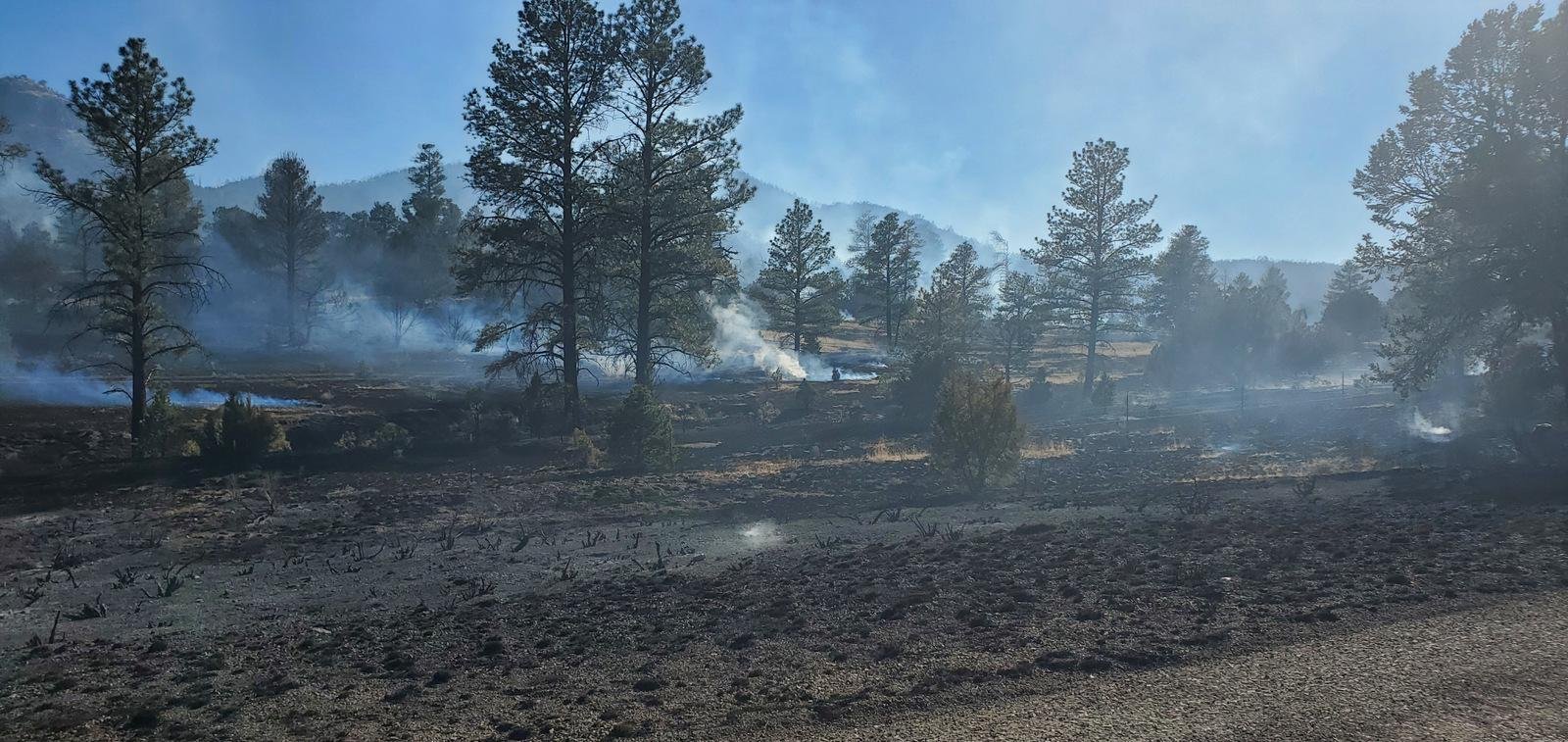
Example of BAe Airtanker that we watched drop its retardant.
Sadly we arrived too late – Pioneer and the nearby cave were both closed. So we continued east towards Socorro. But about half way there we encountered a road block – a small prairie/forest fire was within a half mile of the highway. After a half hour wait, during which we watched a “Fire Bomber drop it’s load of retardant on the fire.
The Drive In
So from Quemado Lake, we retraced our route back to Quemado, then drove east on US 60 through for 7 miles, then turned right onto Catron County Rd A095. From here all navigation was based on indications on the US Topo map of “roads” – parallel dotted lines (see the note below) and a note on GAIA’s map “Quemado North End (CDNST) Trailhead”.
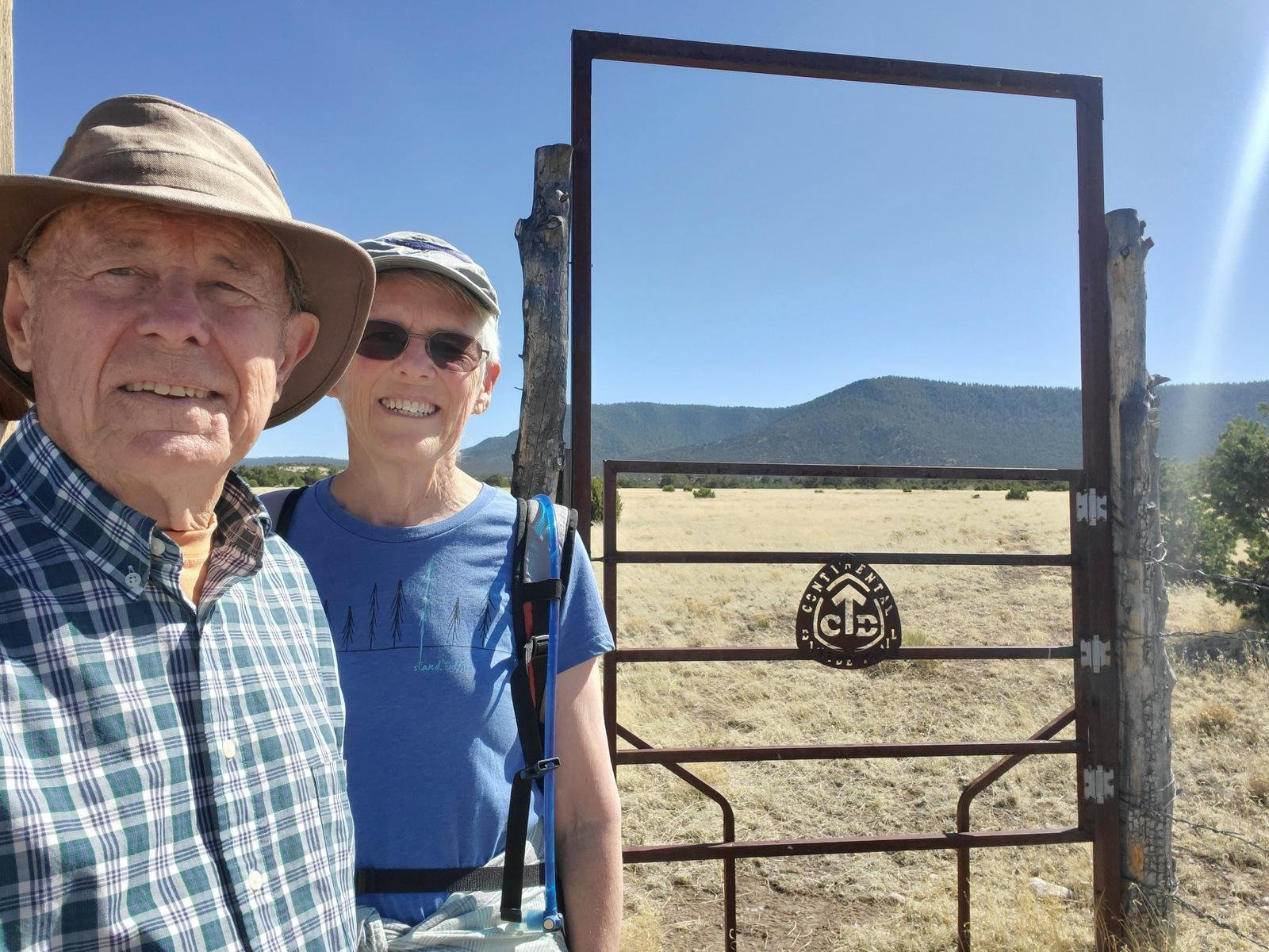
About 4.2 miles down A095 we looked a two-track that went west towards our destination. It didn’t appear to have been used recently, so we continued on hoping to find another road or two-track in better condition. At 5.9 miles from US 60, turned right onto two-track that appeared to get some use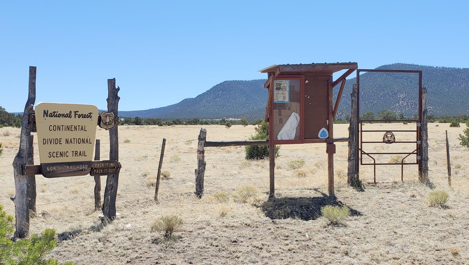 . Tho’ the tracks were deep (requiring high-clearance vehicle) it was “serviceable” for us. Continuing to take cues from the topo map, we continued over sometimes rough and rocky tracks for 1.1 miles, then left for half a mile, again left for another half mile (these are ranch roads – no identifications). And there — we found signs for the CDT
(A note here: Published topo maps don’t reflect the -current conditions- for may “roads” in these parts. Some of them are seldom used two-tracks, which I classify as Class 6. We avoided these, but came upon more recently used Class 5 two-tracks which did lead us to our destination. GAIA’s maps portrays Class 4 and Class 5 “roads” with a solid line, which doesn’t permit distinguishing between the difference.)
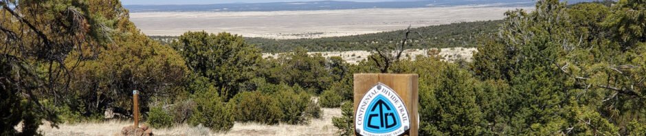
The Hike
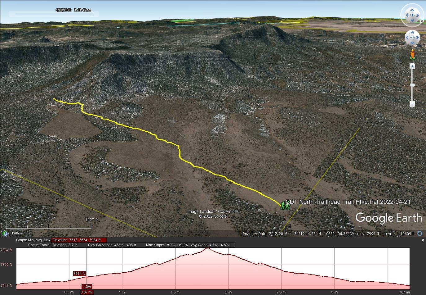
CDT North Trailhead Trail HIke.Pat.2022-04-21
Notes about the Google Earth screenshot: the graph at the bottom shows elevation of the track (pink area) and speed (the blue line).
 Despite the fact that this trail is in the middle of nowhere, with no features of interest in the vicinity, it is well used. That would be a testament to the many hikers who take on the CDT, whether through hiking or doing sections at a time.
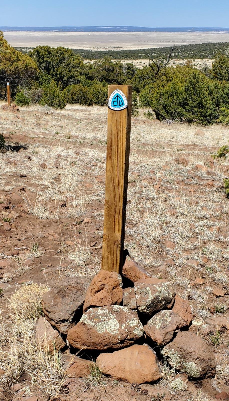 The trail passes through open grassland and in places piñon and juniper forest. The surface is loose soil with a few sections with a rocky surface. In our 3.7 mile hike slope was gentle with crossings of a couple of gentle arroyos; elevation gain was a bit over 400 ft. Along the way we encountered a few CDT blazes on juniper or piñon tree trunks or on stand-alone posts.
Highlight
I suppose the highlight for me was to be hiking on the CDT, even if only part of a section. And to think that No-No may have traversed this section (“No-No” is a young woman that we met on our Mount Taylor hike last year, who we enjoyed very much following her via her BLOG on YouTube, Jennifer Journeys, as she made her through hike on the CDT.)
Statistics
Total Distance: 3.70 miles
Elevation: start 7,533 ft, maximum 7,934 ft, minimum 7,517 ft
Gross gain: 417 ft. Aggregate ascending 483 ft, descending 498 ft
Maximum slope: 18% ascending, 19% descending, 4.6% average
Duration: Approx 2.5 hrs
| GPS Track Files for Download | |
186 Downloads | |
|---|---|
159 Downloads | |
193 Downloads | |
199 Downloads | |
If you haven’t explored these hiking tracks with Google Earth, I urge you to try it. With the virtual 3-dimensional presentation, achieved by panning and tilting the view, you can get a much better idea of the hikes and terrain than you can get from the screenshot above. For some ideas, check out Using Google Earth Track Files.
References and Resources
Wings: BAe 146/AVRO RJ Airtankers Keep Putting out the Flames


