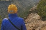
Our first hike on a 2-night camping trip to Bandelier National Monument. By mid-afternoon we had the RPod in the Juniper campground after the drive from Albuquerque. Then, with enough time remaining until supper, we set out from the campground on the Tyuony Overlook Trail.
The Drive In
Just find your way to the entrance gate to Badelier, if asked tell them you are going to the campground, then take the first right turn .. into the campground.
The Hike

Notes about the Google Earth screenshot: the graph at the bottom shows elevation of the track (pink area) and speed (the blue line).
 The trailhead is on the south side of the large parking lot from where the shuttle buses depart when taking visitors into Frijoles Canyon to Visitors Center and the Bandelier ruins. From there it is easy to follow this well used trail. At the fork shortly after getting on the trail, we took the branch to the right. Walking was pleasant over open ground for 2/3rd of a mile. From there the trail proceeds along the rim of Frijoles Canyon for about a 10th of a mile. The views to the left (down canyon) and to the right were impressive – this is quite a canyon, deep and narrow. (There was smoke in the air from a forest fire burning west of Bandelier).
The trail then turned to the left for 300 hundred yards to a junction. Taking our cue from a sign at a junction of trails, we turned right towards Tyuonyi Overlook. A few yards on we encountered a Small Ruin. As a sign told us, “Many small ruins dot the Bandelier Area.” We continued on towards the Overlook. Soon the mesa narrowed, coming to a point with a bird’s eye view of the Tuyonyi Ruins below. We also enjoyed a great view down Frijoles Canyon to the narrow gap through it flows into the Rio Grande.
From the Overlook, we turned back towards the campground, taking the more direct route (as indcated by the aforementioned sign). It made a great afternoon walk, leaving us looking forward to tomorrow’s hike.
Statistics
Total Distance: 3.05 miles
Elevation: start 6,690 ft, maximum 6,699 ft, minimum 6,528 ft
Gross gain: 171 ft. Aggregate ascending 417 ft, descending 414 ft
Maximum slope: 55% ascending, 47% descending, 5.5% average
Duration: 1:45
| GPS Track Files for Download | |
163 Downloads |
|
|---|---|
53 Downloads |
|
If you haven’t explored these hiking tracks with Google Earth, I urge you to try it. With the virtual 3-dimensional presentation, achieved by panning and tilting the view, you can get a much better idea of the hikes and terrain than you can get from the screenshot above. For some ideas, check out Using Google Earth Track Files.
Related Posts
Hikes in Bandelier National Monument
References and Resources
NPS Bandelier: Tyuonyi Overlook Trail
AllTrails: Tyuonyi Overlook Trail
gjhikes: Tyuonyi Overlook – a Very Good Review, w/ photos and map of other trails in the area
Last Updated on August 16, 2022 by George Young


