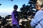
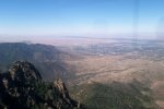
For another activity during Thomas visit, we took an early morning ride on the Sandia Peak Tram and hiked from the upper terminal of the Tram to the Visitor’s Center, located at the top of the Sandia Crest Highway.
The Hike

The hike itself, from the Top of the Tram to the Summit House (top of the Sandia Crest Road) and back to the Tram.
Much like the Survey Trail, this section of the North Crest Trail passes through forested territory, mostly fir with some aspen, ponderosa pine, and other plants. So near the crest itself, there are more rocks than trails lower on the east slope of the Sandias. There are a few overlooks, open areas on the -brink- of the cliff on the upper edge of the mountain.
Statistics
Total Distance: 3.29 miles
Elevation: 10,285 start, 10,656 maximum, 10,270 minimum
Gross gain: 371. Aggregate ascending 791 ft, descending 799 ft
Maximum slope: 48% ascending, 38% descending, 8.2% average
Duration: 2:21
| GPS Track Files for Download | |
141 Downloads |
|
|---|---|
127 Downloads |
|


