
The Hike
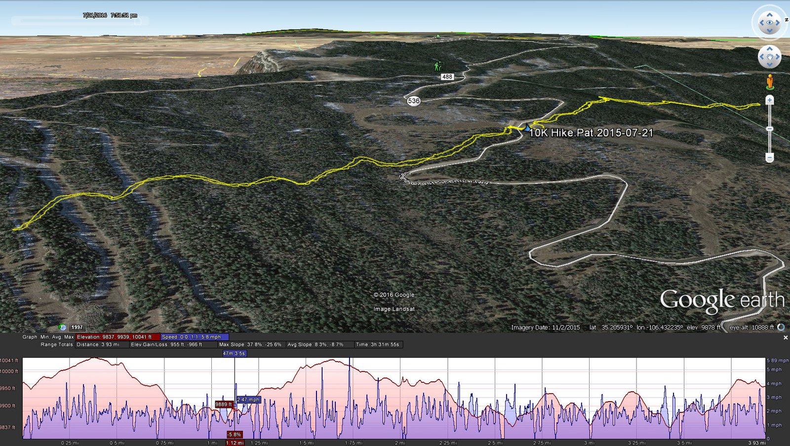
10K Hike.Pat.2016-07-21
Statistics
Total Distance: 3.93 miles
Elevation: start 9,967 ft, maximum 10,041 ft, minimum 9,839 ft
Gross gain: 182 ft. Aggregate ascending 989 ft, descending 1,000 ft
Maximum slope: 29% ascending, 36% descending, 8.5% average
Duration:3:32
| GPS Track Files for Download | |
204 Downloads | |
|---|---|
168 Downloads | |
If you haven’t explored these hiking tracks with Google Earth, I urge you to try it. With the virtual 3-dimensional presentation, achieved by panning and tilting the view, you can get a much better idea of the hikes and terrain than you can get from the screenshot above. For some ideas, check out Using Google Earth Track Files.