We’ve looked “longingly” at the Crest of Montezuma as we’ve driven from Placitas to the east side of the Sandia Mountains, thinking – there must be some hiking there. This winter I came across a report, “Bushwacking up and down the north slope of the Crest of Montezuma” which showed a route we could follow (a site report on Trimble that has disappeared from the Internet). I transcribed the GPS track into files for my GPS tools, and off we went. Oh, boy.
(Refer to the GoogleEarth printout above to track these instructions; our hike is a yellow line, the turquoise line is taken from a report, “Bushwacking ..”.)
The Drive In
To get to our starting point, we drove through the village of Placitas, and where the road takes the 90 degree turn to the south and the back side of the Sandia Mountains, we turned left onto Diamond Tail Road. About 2/3 of a mile down the Road, we parked just off of Diamond Tail Road, close to the entrance gate for Diamond Tail Estates.
The Hike
Note: There are -no trails-, this is entirely bushwhacking through (and around) juniper, cholla, occasional pinon pine, and of course rock outcroppings.
- From parking it was easy hiking over the hill, down into the ravine (1/3 mile), following the ravine to the southeast (.55 miles), then a relatively easy grade on the dogleg generally southwest then southeast.
- Then the going became difficult; the ascent up that ridge to the Crest is very steep. From my GPS record of our track, the GoogleEarth Profile measured a maximum slop of 51.7% (that is about 21 degrees from horizontal). This is by far the steepest grade we have yet hiked.
- Jay climbed well ahead of me, thinking all the time he was just a few steps from the top.
- I lagged behind, carrying our victuals in a 25# pack. That weight on my back challenged my balance, so I was almost ‘hugging’ the ground (sloping up in front of me) and using everything growing (except cholla and prickly pear) to pull myself up and maintain balance.
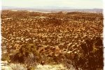
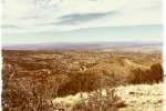
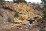
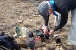
- Once up on top, the hike along the ridge was easy (certainly by comparison). We looked down a -very- steep slope to the southwest into Las Huertas Creek and Canyon, and beyond the east face of the Sandia Mountains. The views to the north were spectacular, as are so many in the Sandias. As is our custom, we set up a ‘micro camp’ at the top to enjoy hot coffee (augmented with a bit of Makers Mark) and trail mix.
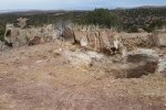
- Again following our predecessor’s track, we headed down a different ridge which was much easier than the ridge we climbed – should we return for another visit, we will go up by this route. Along the way we came across a what appeared to be a vertical mine shaft, maybe 15 feet deep. This raised images of having found the long-rumored Montezuma Mine (read accounts of the story here and here), but so many people have searched for their riches that it is unlikely that we found it.
Statistics
Total Distance: 2.93 miles
Elevation: start ft, maximum ft, minimum ft
Gross gain: 766 ft. Aggregate ascending ft, descending ft
Maximum slope: 52% ascending, 35% descending, % average
Duration: 4:17
| GPS Track Files for Download | |
308 Downloads |
|
|---|---|
168 Downloads |
|
I urge you to explore our hiking tracks with Google Earth. With the virtual 3-dimensional presentation, achieved by panning and tilting the view, you can get a much better idea of the hikes and terrain than you can get from the 2-dimensional screenshot above. For assistance: Using Google Earth Track Files.




I didn’t find this post until after my husband and I did an exploratory hike there yesterday. We had heard that there was a trail but didn’t know anything about it. If you haven’t been there recently you might want to go back. There are now rock cairns and white trail markers and a big switchback that avoids the steepest descent. And, for your information, the link where you found the GPS track is unreachable. Also, your site is an http site, not a https site. When my husband tried to access it from his PC, Norton threw up a warning that your site is “a known dangerous webpage.” I use Mac and didn’t have that problem but thought you might want to know.