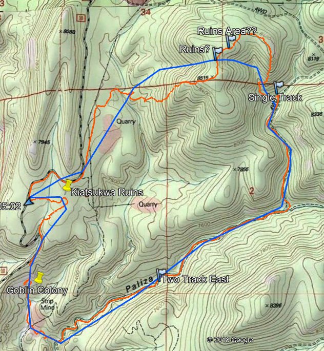
Planning this hike, I turned to GoogleEarth to sketch out a route into new territory. Since I would be introducing Kelly to the area, I chose to begin the hike on FR 10 near the Kiatsukwa Ruins, then down into Goblin Colony. From there into Paliza Canyon, proceeding up-canyon, then climb back up to the mesa top to make a loop back to the truck. Using the normal GoogleEarth presentation, coupled with the USGS Topo overlay (see reference below), I chose a side canyon about 1.5 miles up Paliza Canyon that looked promising for the climb. Once on the mesa top, then down a canyon to more level terrain and an elevation near that of the truck. (See the Sketch .kml file below).
The Hike
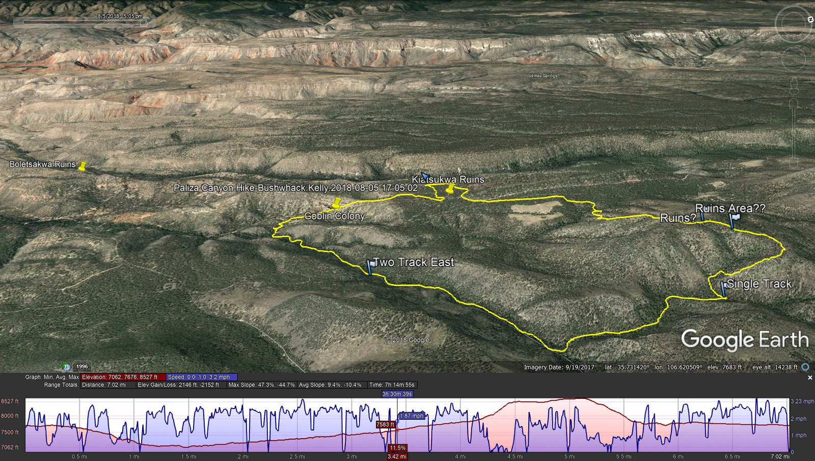
Paliza Canyon Hike_Bushwhack.Kelly.2018-08-05
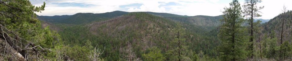
The hike went more or less as planned until we headed out of Paliza Canyon. First, we surveyed the Kiatsukwa Ruins; this is quite large, nearly 200 yards in length and 50 or more yards wide. Mostly consisting of mounds of rock and dirt, the general outline of the pueblo is clearly evident. In a few places one can see the shape of individual rooms. From there it was back onto FR 10, downhill until entering the top of Goblin Colony. We chose a route that descended through the middle of the ‘goblins’; we had a challenge finding a path that we could navigate (the preferred route is to descend on the ridge above the north extent of the ‘colony’ until reaching a lower elevation, then going south for views -up- into the main collection of ‘goblins’).
We then proceeded further down the canyon below Goblin Colony, crossing over into Paliza Canyon and heading up-canyon. ‘Tho there was no noticeable trail ‘on the ground’, the route was relatively easy. Reaching the side canyon that I had identified on the sketch, we turned left (north) to head up to the mesa top. This canyon became narrow, and soon we encountered a very narrow section effectively blocked by fallen trees (and maybe a rock face – we didn’t explore further). We made a tactical decision to tackle the climb up the side of this canyon – a poor choice. Though relatively free of impediments, the slope was -very- steep, so steep that one could barely keep from sliding back down. On the GoogleEarth track it is measured to be
Paliza Canyon Sketch 1 Revised
Statistics
Total Distance: 7.02 miles
Elevation: start 7,714 ft, maximum 8,527 ft, minimum 7,062 ft
Gross gain: 1,465 ft. Aggregate ascending 2,146 ft, descending 2,152 ft
Maximum slope: 47% ascending, 48% descending, 9.4% average
Duration: 7:15
| GPS Track Files for Download | |
342 Downloads | |
|---|---|
174 Downloads | |
260 Downloads | |
174 Downloads | |
I urge you to explore our hiking tracks with Google Earth. With the virtual 3-dimensional presentation, achieved by panning and tilting the view, you can get a much better idea of the hikes and terrain than you can get from the 2-dimensional screenshot above. For assistance: Using Google Earth Track Files.
References
Earth Point Topo Map: Top Maps – USGS Topographic Maps on Google Earth


