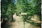
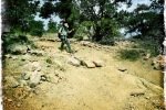
Atalaya Mountain Trail has been on the list for both of us; it is a good hike this time of year (hot in summer, icy and snowy in winter).
The Drive In
The Atalaya – Upper Trailhead is uphill from St John’s College. (There is an Atalaya -Lower Trailhead.) From Old Santa Fe Trail in front of the National Park Service offices, go north on Camino Del Monte Sol, the right (east) on Camino De Cruz Blanca. Just past where it makes a hard right turn onto Wilderness Gate Road, you will find a small parking area on the left; part there. Or, retrace back on Camino De Cruz Blanca; perhaps there will be a parking space at the Dorothy Stewart Trailhead. Otherwise, ????.
The Hike
Notes about the Google Earth screenshot: the graph at the bottom shows elevation of the track (pink area) and speed (the blue line).
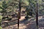
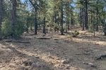
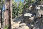
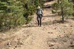
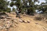
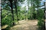
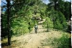
From the parking spaces, walk down Wilderness Gate Road, turn left and pass around a gate into the residential neighborhood. From there .. this hike “gets right to it”.. continue up Camino De Cruze Blanca. A third of a mile on climb the Steep Steps onto the Atalaya Trail #170. The first few hundred yards of the trail is a nice wide sand trail, a steady but easy climb. But further on the trail gets quite steep, often with a very rocky surface – quite challenging.
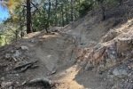
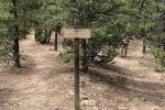
 Just short of a mile from parking, we encountered a sign: STEEPER ROUTE to the left, EASIER ROUTE to the right. Looking at the tracks we chose the shorter route, the STEEPER ROUTE. And was it STEEPER, over rocks and tree roots most of the way to where the EASIER ROUTE rejoined the main trail. We planned to take the latter on the way down.
From there the trail continued to be steep with a rocky surface with only a few respites of not-so-steep-and-rocky surface until the 2 mile point in the hike. Here we attained the ridge; after a sharp turn to the left, the trail led to the peak of Atalaya Mountain (continuing to climb though not so steep).
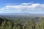
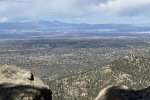
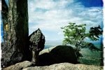
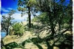
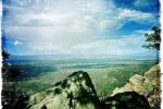
There were great views to the north, south, and west as we climbed up the trail. But the view from near the top was the best, with Santa Fe laid out below and the Jemez Mountains in the distance. After a break for a snack lunch, we headed back down, choosing to take the EASIER ROUTE – although longer by 3/4 mile, it was a much better (EASIER) trail.
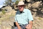
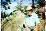
Jay here: The first time I attempted this hike was about 3 years ago. We started down at the St. Johns Campus which is the longer route for this hike. You walk up a wide arroyo before getting to where we started on this most recent hike. Naj and I made it all the way up to where the signs are for Steeper and Easier, but the trail was icy and snow covered, forcing us to turn back. Having now experienced the narrow and rocky switchbacks up near the summit, I’m glad we did not try to do this hike in icy conditions. Just to emphasize, by steeper they mean STEEP. When the hike was completed, George said he did it because he thought I could do it. To which I said, “really? I did it because I thought you could do it.” That’s hiking in New Mexico for you.
Statistics
Total Distance: 5.09 miles
Elevation: start 7,554 ft, maximum 8,992 ft, minimum 7,553 ft
Gross gain: 1,438 ft. Aggregate ascending 1,753 ft, descending 1,753 ft
Maximum slope: 34% ascending, 34% descending, 12.0% average
Duration: 3:55 , Average Speed: 1.3 mph
| GPS Track Files for Download | |
422 Downloads |
|
|---|---|
201 Downloads |
|
If you haven’t explored these hiking tracks with Google Earth, I urge you to try it. With the virtual 3-dimensional presentation, achieved by panning and tilting the view, you can get a much better idea of the hikes and terrain than you can get from the screenshot above. For some ideas, check out Using Google Earth Track Files.
Related Posts
References and Resources
AllTrails: Atalaya Mountain Trail (starts at the Lower Trailhead)
GAIA GPS
Atalaya Mountain Via Atalaya Trail
Atalaya Mountain LoopVia Atalaya Trail And Dale Ball Trails
Hiking Project: Atalaya Mountain Trail (#170)
SummitPost: Atalaya Mountain
Fatmap: Atalaya Mountain Loop
Only in Your State: Atalaya Mountain Trail Is An Easy Hike …


