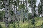
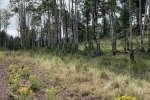
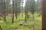
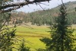
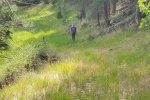
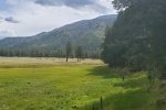
This is our 2nd hike on this camping trip into the Jemez Mountains, camping in the Redondo Campground (see notes from the hike the day before). We ventured again into the southwestern corner of Valles Caldera, with a plan to explore the canyon that goes east out of Redondo Meadow. Without published trails to guide us, we went a-orienteering.
The Hike
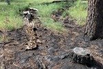
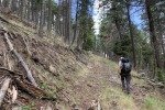
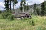
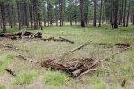
Using our lesson from yesterday about orienteering, we set placemarks on USTopo, ready to read (and follow) bearings. We planned to descend into Redondo Meadow on the same 2-track we used the day before – a bearing of 130° from the campsite. Again with yesterday’s experience regarding the topography, we worked our way around the steeper mounds/ridges (see the featured image above). Soon enough found ourselves on a 2-track that took us to the descent. Along the way we came across the last remains of two log structures, presumably from the days of the Baca Ranch (see the references below for more on the Baca Ranch and the history of Valles Grande).
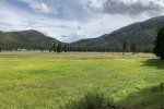
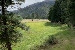
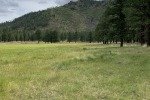
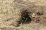
On reaching the Meadow, we skirted its southern boundary where we had some shade, then continued on into the canyon. We looked for the coyote of yesterday, but didn’t see him. However … not far from yesterday’s encounter, we startled a coyote pup; he scampered in front of us up and over a mound. I dashed up to the top of the mound to find a large tunnel and no sign of the pup; it must have gone into its den.
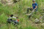
 Entering the canyon we found ourselves near a Class 4 2-track, identified as VC-02. We remained in the open forest for half a mile or so. As the ground started rising and the canyon was narrowing, we hiked on the 2-track itself. We didn’t have a specific destination, only the length of the hike ..and.. a plan to return to the campground before the rain showers that were forecast for the afternoon. Thus, a mile up, where we found the first sign of any running water in this canyon, we stopped for our first mid-hike break.
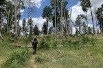
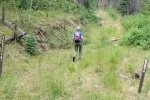
We had kept an eye out as we came from our descent 2-track for any other 2-tracks that would take us back up on Banco Bonito. We had seen one across the canyon, so headed for it. But … just a few yards from our break spot, we spotted a 2-track that traversed the edge back up onto Banco. We took it – a 130′ easy climb. Back on top, we returned to orienteering – bearing and compass. In a quarter of a mile, we found ourselves on a nice Class 4 2-track. As we suspected, it generally followed the edge of Banco, with intersections to other descending 2-tracks. At one point we did take a couple of right turns to keep our course along that edge. After the 2nd turn, we intercepted the 2-track we had taken outbound; from there we generally retracedthat track. And, BTW, no more than a few seconds after we got back in the R-Pod, the rain started and it rained hard for 15-20 minutes.
Our Experience
We learned a lot the day before on our Redondo Meadow Hike. Our navigating (reconnoitering) was much better getting to our chosen destinations, and the increased confidence in finding our down into Redondo Meadow and back up onto Banco Bonito made the day more relaxed. A new focus was figuring out the identifications of the various 2-tracks that we came across. At most of the intersections there were somewhat newer signs identifying roads, and in 2 instances older signs announcing trail names (and for 1 there were turn and straight ahead arrows). It will be for a future update to his post to report on these sighs.
Statistics
Total Distance: 6.39 miles
Elevation: start 8,153 ft, maximum 8,650 ft, minimum 8,054 ft
Gross gain: 596 ft. Aggregate ascending 1,253 ft, descending 1,255 ft
Maximum slope: 34% ascending, 28% descending, 5.8% average
Duration: 5:32
| GPS Track Files for Download |
205 Downloads |
|
|---|---|---|
| GPS Track Files for Download |
155 Downloads |
I urge you to explore our hiking tracks with Google Earth. With the virtual 3-dimensional presentation, achieved by panning and tilting the view, you can get a much better idea of the hikes and terrain than you can get from the 2-dimensional screenshot above. For assistance: Using Google Earth Track Files.
References and Resources
A note: I’ve greatly expanded this list because the history and geology of Valles Caldera is so interesting.
HISTORY & GEOLOGY
Wanderlust: Wanderlusting Banco Bonito An interesting explanation of the geology of Banco Bonito
Bivy: Valles Caldera: Banco Bonito
Jemez Valley History: Valles Caldera A good history of Valles Grande.
CNN: New Mexico’s Baca Ranch soon to be public land (2000)
Washington Post: In New Mexico, Paradise Saved … (1999)
Wikipedia: Valles Caldera
New Mexico Nomad: The Valles Caldera Excellent: geology, history, other information
ENS Newswire: New Mexico Ranch Transformed into National Preserve
Backpacker: Baca Ranch: The Southwest’s Yellowstone
THE CAMPGROUND
ExploreNM: Redondo
USDA Forest Service: Redondo Campground
Campendium: Redondo Campground
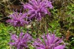
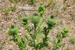
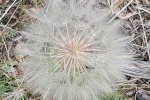
Flowers we didn’t see on the hike the day before.


