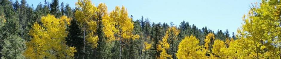
We headed to these favorite canyons in the Jemez, hoping to catch the aspen in their full fall color. And we did. But on the way, the cottonwood trees in San Antonio canyon, all the way from Jemez Pueblo to La Cueva, were the brightest golden color you can imagine.
The Drive In
We hiked Barley Canyon back in May 2017, that time driving in from the bottom of the canyon: past Fenton Lake on NM 126 a short distance past the Fish Hatchery, then up FR 378 (Barley Canyon) a bit over a mile. Then the hike goes from lower to higher in Barley, then back down what I’ve dubbed Barleycito, a side canyon that joins Barley at Barley’s mddle. For this trip we turned onto FR 144, a much shorter drive and hiked down Barleycito then back up Barley.
The Hike
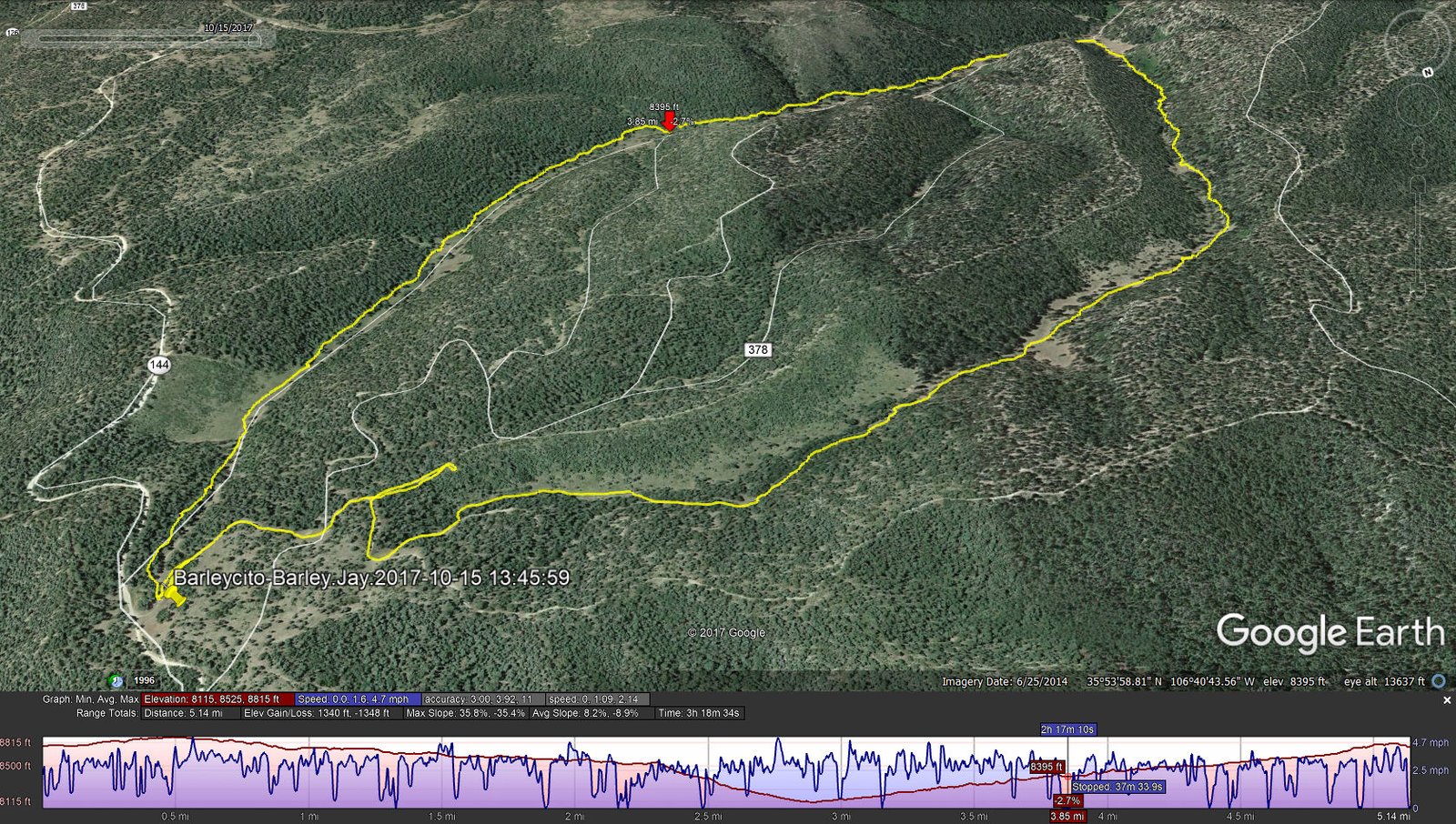
Barleycito-Barley Hike.Jay.2017-10-15
On the drive in on NM 126 and FR 144, we saw sprinklings of golden aspen along with aspen still green and leafless. That was the case in the Canyons as well. This hike was much like the May hike – a very pleasant canyon, easy surfaces and slopes. Although we could stay on the two-tracks (some sections more heavily used) we opted this trip to follow closer to the center/bottom of the canyon where we found we could almost always follow cattle or game trails. Jay here: Finally. The aspen color we’ve been waiting for. And no bushwacking…what a surprise. This was a most pleasant hike primarily for its lack of ascent. So there were no overlooks but plenty of close-up scenery to make up for it.
Statistics
Total Distance: 5.10 miles
Elevation: start 8,715 ft, maximum 8,813 ft, minimum 8,108 ft
Gross gain: 705 ft. Aggregate ascending 1,369 ft, descending 1,370 ft
Maximum slope: 34% ascending, 37% descending, 8% average
Duration: 3:19
| GPS Track Files for Download | |
212 Downloads | |
|---|---|
137 Downloads | |
I urge you to explore our hiking tracks with Google Earth. With the virtual 3-dimensional presentation, achieved by panning and tilting the view, you can get a much better idea of the hikes and terrain than you can get from the 2-dimensional screenshot above. For assistance: Using Google Earth Track Files.


