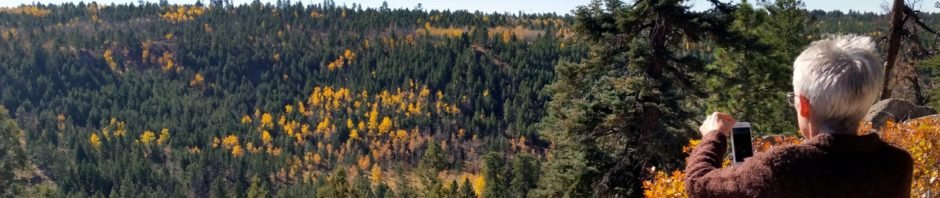
After the drive up San Antonio Canyon through the glowing cottonwoods and hiking among the golden aspen in Barleycito and Barley canyons this past Sunday with Jay, Pat & I returned while the colors were still bright. We were not disappointed.
The Drive In
After breakfast at Hwy 4 Cafe, we headed on up NM 4, then NM 126 to FR 144, the destination being Bear Canyon. We stopped at an overlook at the top of the climb up NM 126 from La Cueva to enjoy the view of the mesas to the south, San Antonio Canyon towards La Cueva, and the Jemez Mountains and Redondo Peak to the east.
The Hike
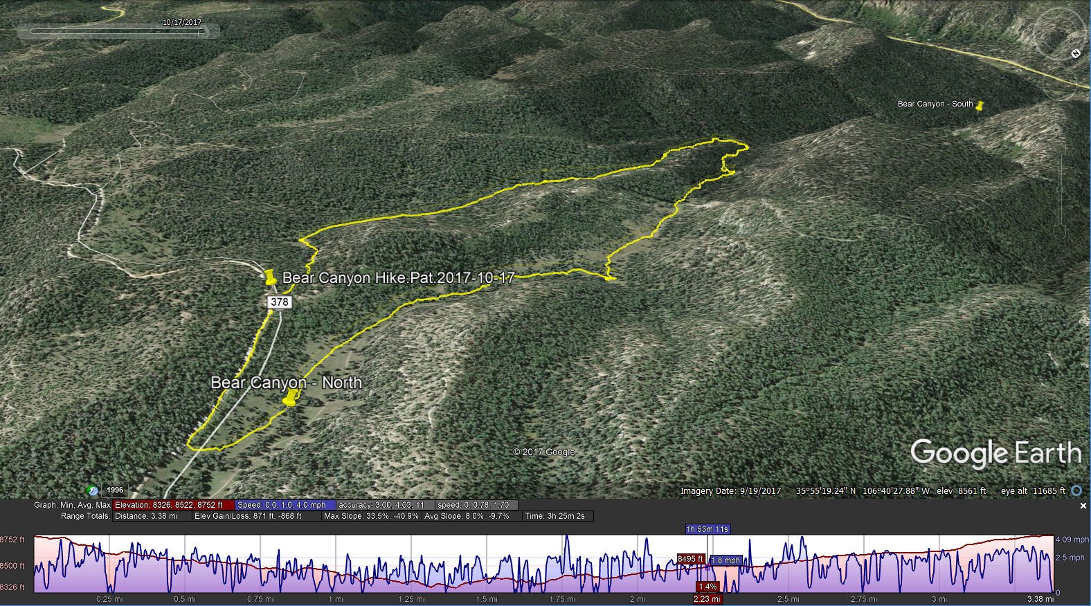
Bear Canyon Hike.Pat.2017-10-17
Jay and I had hiked here back in August; today we would avoid the -steep- ascent onto the ridge above the canyon. Like on that hike, we started by going down “Little Bear” canyon (a side-canyon south of Bear; joins Bear about halfway to Calaveras Canyon). Rather than hiking back down FR 144, today we headed due south from the parking spot – discovered an old two-track that made an easy descent into Little Bear. We followed the canyon for about a mile on a nice two-track or in the bottom of the canyon following cow/game paths. We then made the turn to work our way up Bear Canyon – easy hiking like Little Bear, but with more meadow-like open spaces.
As on the Barleycito-Barley Canyons Hike the week before, some of the aspen were in their full glory, but others had already given up their leaves. Highlight These canyons (Barley, Bear, Oat, Hay, Pony, and some unnamed canyons) make for really great hiking. Barley and Bear are closer to NM 126, on FR 144, than the others which makes them a bit easier to get to. And there is much more that I look forward to: finding a way to get down into San Antonio Canyon, going up further on FR 144 where more canyons beckon, and more ideas from the book “Exploring the Jemez Country”.
Statistics
Total Distance: 3.38 miles
Elevation: start 8,752 ft, maximum 8,752 ft, minimum 8,326 ft
Gross gain: 426 ft. Aggregate ascending 871 ft, descending 868 ft
Maximum slope: 34% ascending, 41% descending, 8% average
Duration: 3:25
| GPS Track Files for Download | |
323 Downloads | |
|---|---|
160 Downloads | |
I urge you to explore our hiking tracks with Google Earth. With the virtual 3-dimensional presentation, achieved by panning and tilting the view, you can get a much better idea of the hikes and terrain than you can get from the 2-dimensional screenshot above. For assistance: Using Google Earth Track Files.
References
ListofJohn Topo: Bear Canyon


