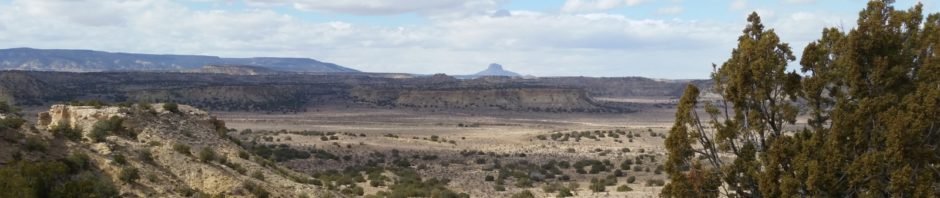
Exploring with Pat – headed for White Mesa Bike Trails and the two-track going north in the Cañada de las Milpas on the west side of Dragon Back. We planned to hike west across the Cañada and up onto the mesa, looking for ruins that are marked on the Topo maps.
The Hike
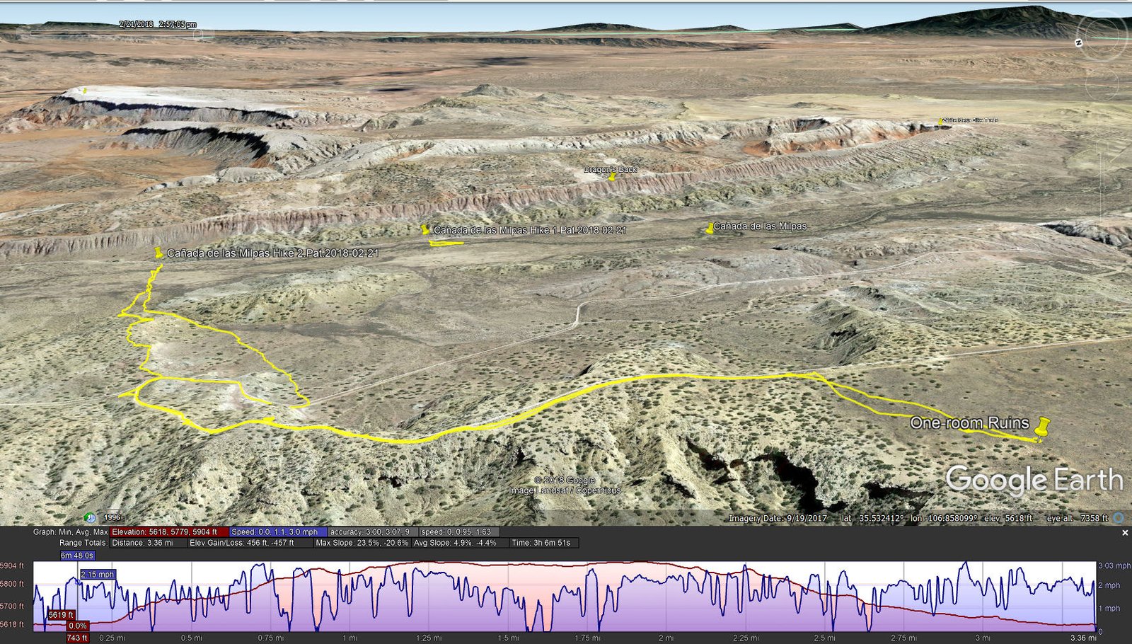
Cañada de las Milpas Hikes.Pat.2018-02-21
Arriving abreast of where we believed the ruins to be, we disembarked and headed across the Cañada only to encounter a deep and wide arroyo with vertical walls at least 10′ high. Clearly we weren’t going to cross the arroyo here – back to the truck. We continued north on the two-track, stopping a couple of times to check the arroyo. About .4 miles from our first try, the arroyo was easily crossed, so we headed west toward the mesa. Using the Topo, Pat chose a route that avoided the steep sides of the mesa – ’twas an easy slope to climb.
As we climbed, the views were amazing. To the north, the Rio Salado and Nacimiento Mountains, to the northeast the Jemez Mountains, to the east Dragon’s Back and the White Mesa Bike Trails, to the south the wider Cañada de las Milpas. At some point, to the west Cabezon came into view, and as we neared the top we began to see across the Rio Puerco. Midway up, we came upon a two-track that made the final climb easier.
We continued on the two-track until reaching a point where, turning right, we should find the ruins. About .2 mile, following the GPS to the location on the Topo, we came upon the tell-tale pile of rocks, the remnants of ruins. (I’ve not been able to find records to further identify this ruins site.) After taking photos, we set up the “kitchen” in the lee of a juniper and had coffee, etc.
The return to the truck was an easy 1.66 miles; we stayed on the two-track as it descended from the mesa top before striking ‘cross country’. The weather had been threatening precipitation with dark clouds forming or arriving out of the southwest, so for a few minutes we were a bit anxious about the prospects of a slippery, muddy road out. The precipitation remained west of the Ojito, at least until we were safely back on US 550.
Statistics
Total Distance: 3.36 miles
Elevation: start 5,618 ft, maximum 5,904 ft, minimum 5,618 ft
Gross gain: 286 ft. Aggregate ascending 456 ft, descending 457 ft
Maximum slope: 24% ascending, 21% descending, 4,9% average
Duration: 3:07
| GPS Track Files for Download | |
326 Downloads | |
|---|---|
152 Downloads | |
452 Downloads | |
259 Downloads | |
I urge you to explore our hiking tracks with Google Earth. With the virtual 3-dimensional presentation, achieved by panning and tilting the view, you can get a much better idea of the hikes and terrain than you can get from the 2-dimensional screenshot above. For assistance: Using Google Earth Track Files.
Related Posts (in the vicinity)


It seems there are old ruins everywhere. So cool that you can find them.