[Three years later]: I had seen references to the Waterfall Hike in various places, but was unable to fine any detailed information, except the location of where it intersected with the Piedra Lisa Trail.
The Hike
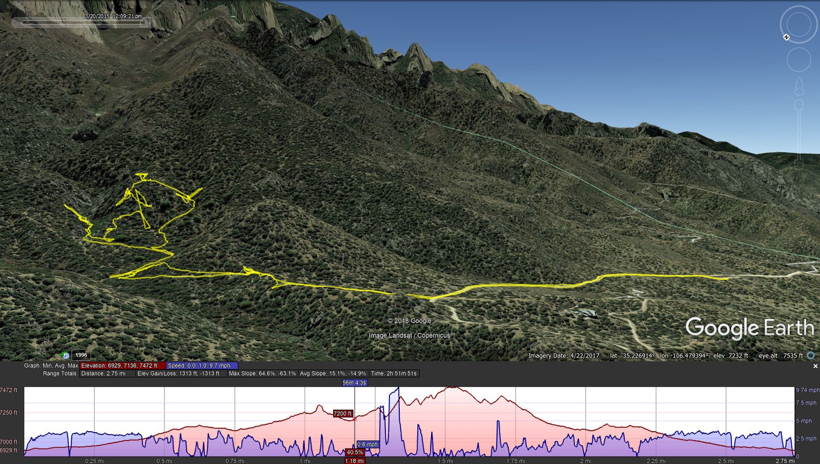
Piedra Lisa South-Waterfall Hike.Marlin.2015-03-20
Undaunted, Marlin and I set out to look at the waterfall. Soon after entering the canyon, about .3 mile, it began to look like there would be rockfall blockages. We retraced our track down the canyon for about .2 mile, then headed up onto the right-hand (south) slope of the canyon. That proved to be -very- difficult – very steep slope and a lot of heavy bushwhacking. After some .3 miles we accepted defeat and headed back down. (On a subsequent hike, Jay and I found our way to the falls; see Piedra Lisa South-Waterfall.)
Statistics
Total Distance: 2.75 miles
Elevation: start 6,929 ft, maximum 7,472 ft, minimum 6,929 ft
Gross gain: 543 ft. Aggregate ascending 1,313 ft, descending 1,313 ft
Maximum slope: 65% ascending, 63% descending, 15% average
Duration: 2:52
| GPS Track Files for Download | |
210 Downloads | |
|---|---|
259 Downloads | |
If you haven’t explored these hiking tracks with Google Earth, I urge you to try it. With the virtual 3-dimensional presentation, achieved by panning and tilting the view, you can get a much better idea of the hikes and terrain than you can get from the screenshot above. For some ideas, check out Using Google Earth Track Files.
References
Sandia Mountain Hiking Guide: Piedra Lisa Trail,Rincon Spur Trail
Sandia Mountain Hiking Guide: Fletcher Trail
SummitPost: Waterfall canyon, Sandia mountains
ondafringe: Off Trail Near Lower South Ridge of Waterfall Canyon
Meetup.com: South Ridge of Waterfall Canyon/Juan Tabo Canyon Loop–Challenging

