
Curiosity drew us to Cerrillos Hills State Park (and with the idea we could have breakfast at Roots Farm Cafe in Tijeras on the way out, and a late lunch at The Hollar in Madrid after the hike). we visited there 4 years ago, but suspected that we didn’t fully take it in.
The Drive In
Cerrillos Hills is on the northern edge of the village of Los Cerrillos. From Albuquerque, travel north on NM 14, past Madrid about 3 miles. Turn west into Los Cerrillos before the railroad overpass. In the village, take the 1st right turn and follow the sand/gravel road to the entrance to the State Park – signs do point the way. There is a $5.00 fee for visiting – ’tis worth the contribution to NM’s state parks.
The Hike
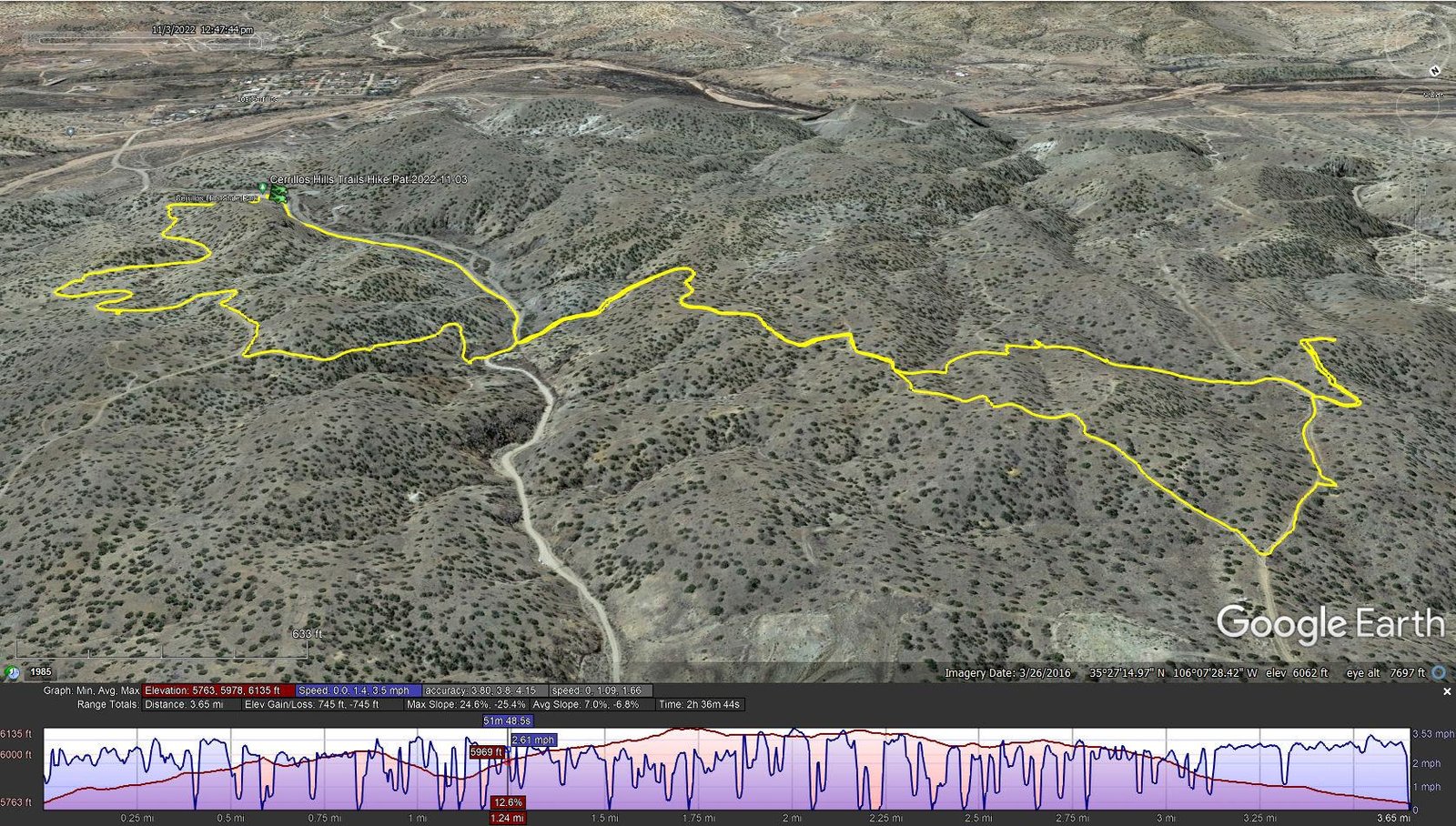
Cerrillos Hills Trails Hike.Pat.2022-11-03
Notes about the Google Earth screenshot: the graph at the bottom shows elevation of the track (pink area) and speed (the blue line).
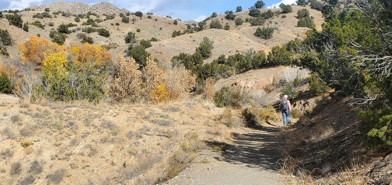
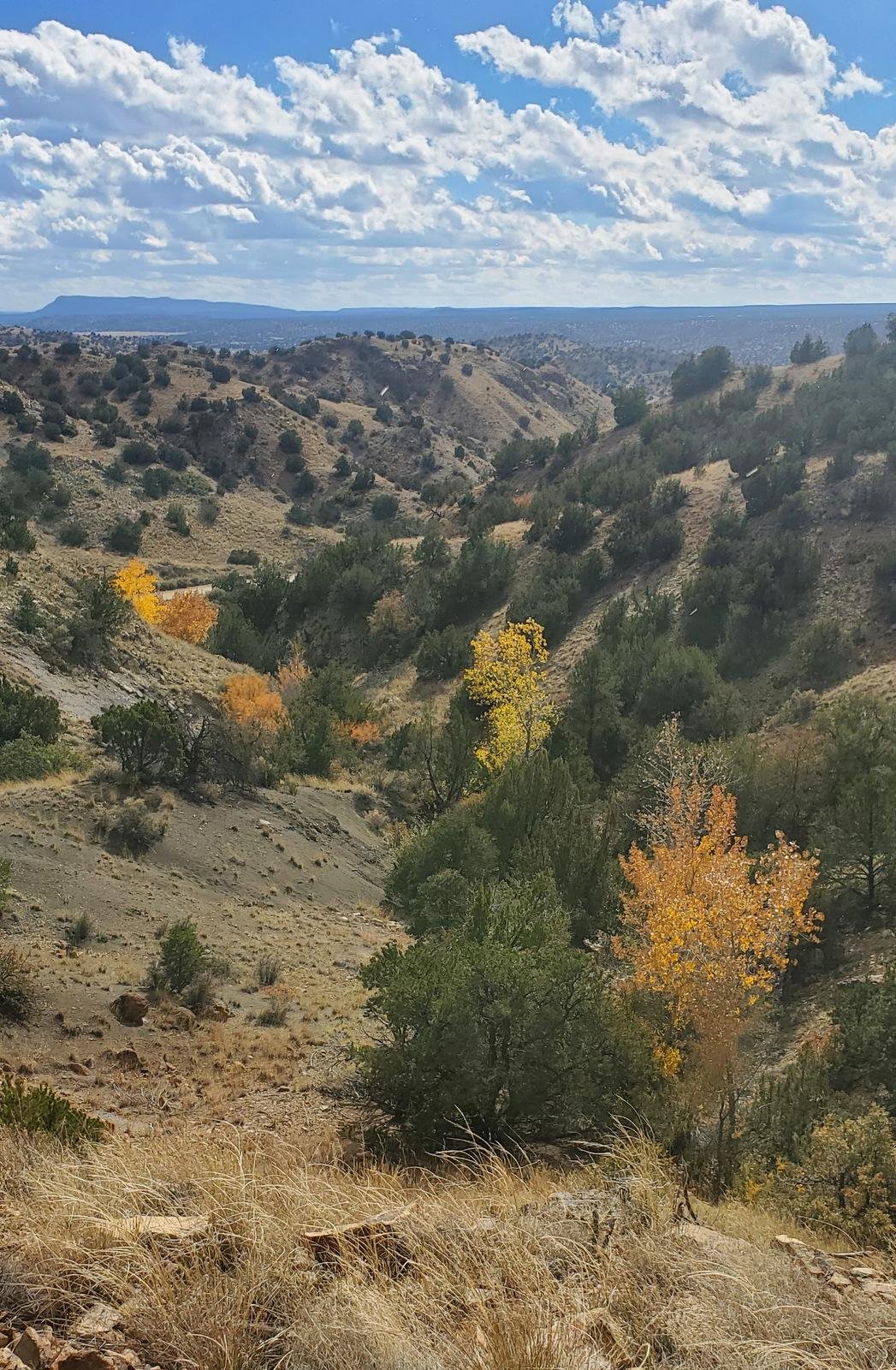 Cerrillos Hills is … well, hilly. There are a number of trails that wend their way through the park. The trails are well groomed ‘tho at times a bit rocky – never the less easy ambulating. Between the hills are valleys some 100 feet deep which creates a moderate amount of elevation gain. When atop the hills, the views are great – to the Sandias to the southwest, Ortiz south, even Nacimientos to the west.
The calling card for Cerrillos Hills is that was a mining boom during the period 1879-1884. Silver, gold, lead, copper, iron, manganese and zinc were extract, tho’ not in quantities to make mining economically productive. There are numerous mine sites scattered throughout the Park. Some are nothing more than a small hole with piles of gravel around it. In other cases, there is a mine shaft going down 20′ or 30′ into the ground (these are cordoned off to prevent access).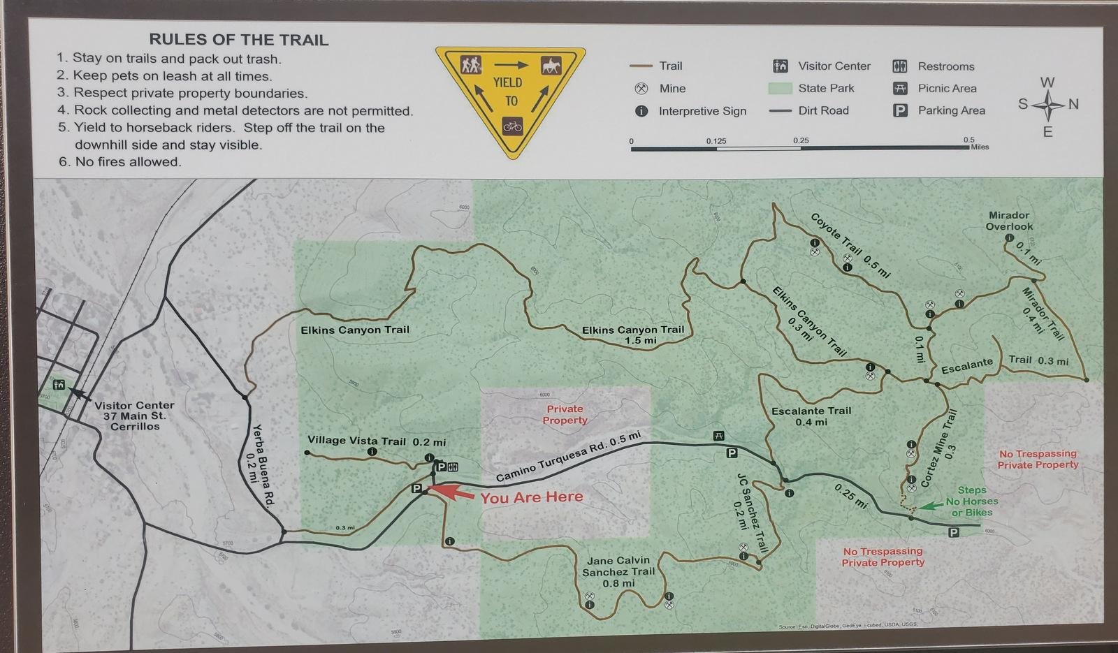 An added note – we did have threatening weather – a storm cell drifted towards from the Sandias, sprinkling just enough for us to don our raincoats. And throughout the hike we faced strong winds when atop the hills. Still, it was a really nice hike in an interesting place..
Cerrillos Hills makes for a nice day trip out of Albuquerque or Santa Fe, in Autumn, Winter, and Spring (it will be hot in Summer, with no shade on the trails, and may be uncomfortably windy in Spring)
Statistics
Total Distance: 3.65 miles
Elevation: start 5,764 ft, maximum 6,135 ft, minimum 5,763 ft
Gross gain: 372 ft. Aggregate ascending 745 ft, descending 745 ft
Maximum slope: 7% ascending, 7% descending, 6.9% average
Duration: 2:37
| GPS Track Files for Download | |
152 Downloads | |
|---|---|
227 Downloads | |
If you haven’t explored these hiking tracks with Google Earth, I urge you to try it. With the virtual 3-dimensional presentation, achieved by panning and tilting the view, you can get a much better idea of the hikes and terrain than you can get from the screenshot above. For some ideas, check out Using Google Earth Track Files.
References and Resources
New Mexico ENMRD: Cerrillos Hills State Park
AllTrails: Cerrillos Hills Historic Park Trail
Amigos de Cerrillos Hills State Park
Explore Aztec: Cerrillos Hills State Park Trails