This was an interesting day, returning to San Lorenzo Canyon. I’ve been there twice, the first time with friend Vince, and again with Pat in 2018. Neither visit left me intrigued (or appreciating the Canyon) like this visit – this is a very interesting place.
The Drive In
On other trips to San Lorenzo Canyon, we drive to Lemitar, then north on the frontage road (west side of I-25) for about 5 miles. For this trip, we exited I-25 at San Acacia, then drove south on the frontage road (east side of I-25) for 2.3 miles. Turned right onto a dirt road, passed under I-25 (a one-lane underpass), then straight ahead on San Lorenzo Canyon road – it winds around for a distance. Just over 2 miles on this dirt road, turned right across a cattle guard; there is a BLM sign there welcoming you to San Lorenzo Canyon Recreation Area. Then drove into the wash of the Canyon (the wash is solid, driven on by many even big vehicles). Continued as far as we could go – that is until we faced with a 25′ tall rock blocking further travel in the Canyon. … By then you have seen amazing Canyon walls, side canyons, and geologic formations, among them hoodoos.
The Hike
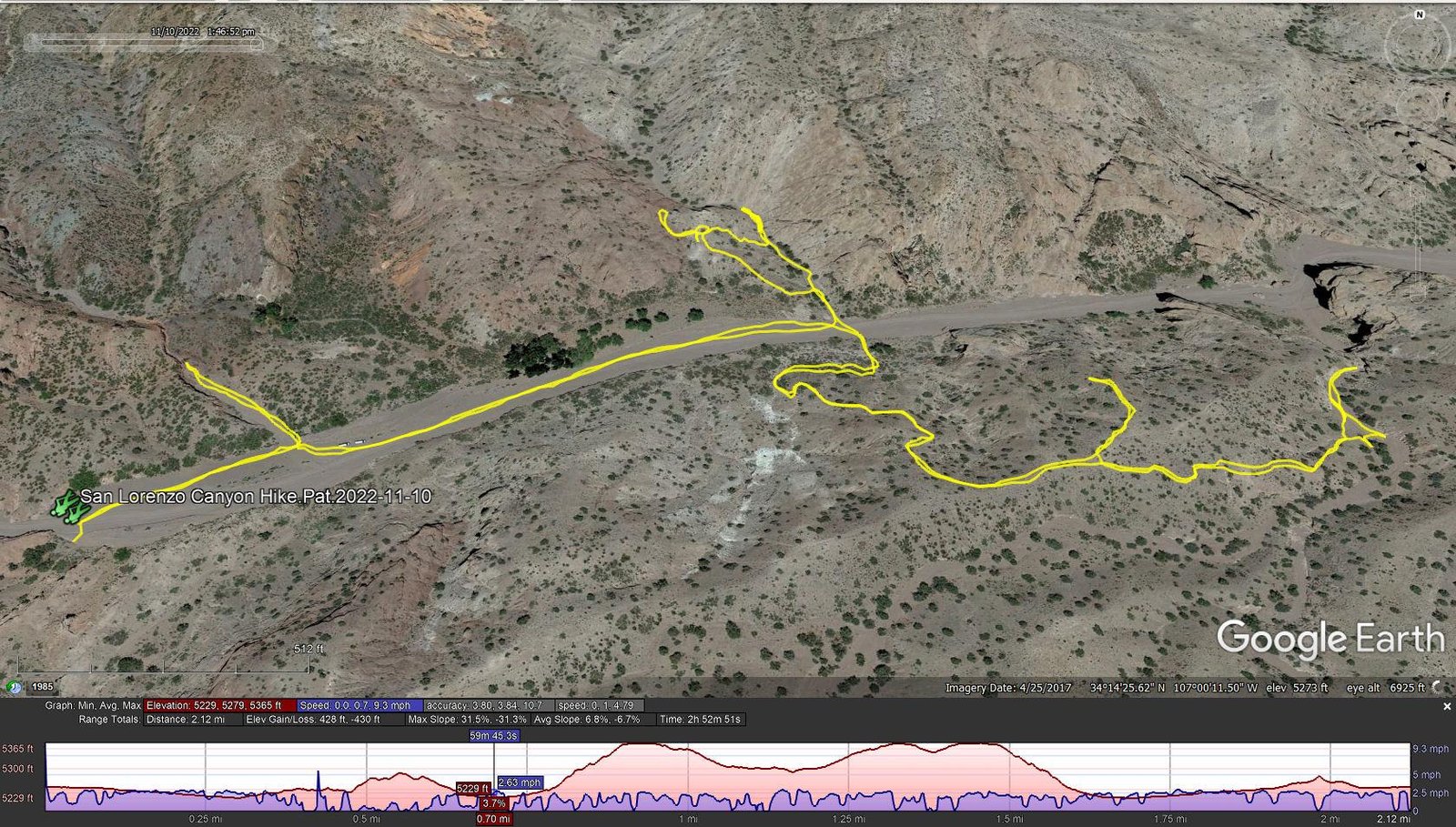
San Lorenzo Canyon Hike.Pat.2022-11-10
Notes about the Google Earth screenshot: the graph at the bottom shows elevation of the track (pink area) and speed (the blue line).
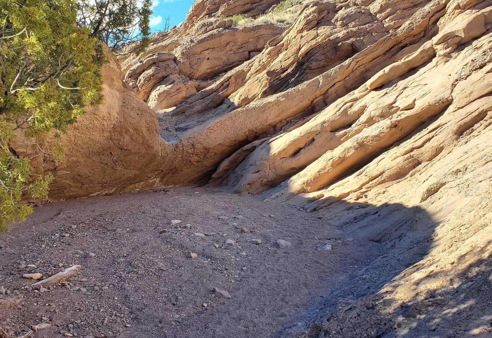
Overhang, 5′ off the floor, blocking our way further into this side canyon.
As in the past, we parked a few yards from the big rock. Seeking a way to get up on the north rim of the canyon, we checked GAIA – there seemed to be a trail going north in one of the side canyons. We walked down-canyon and into that side canyon, only to be met by a 5′ overhanging ledge blocking our way. We explored various routes to get around it (including bringing a short stepladder on our next visit). The rock slope to the right looked promising – Pat checked it out but we weren’t comfortable. (Later, from above the south rim, we watched another couple use that route to continue up-canyon.)
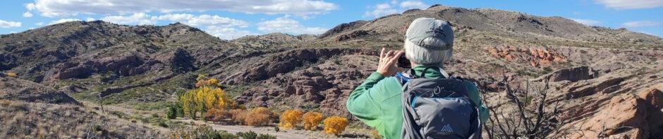
Pat, having climbed up wicked rock faces, exulting in the achievement (and view).
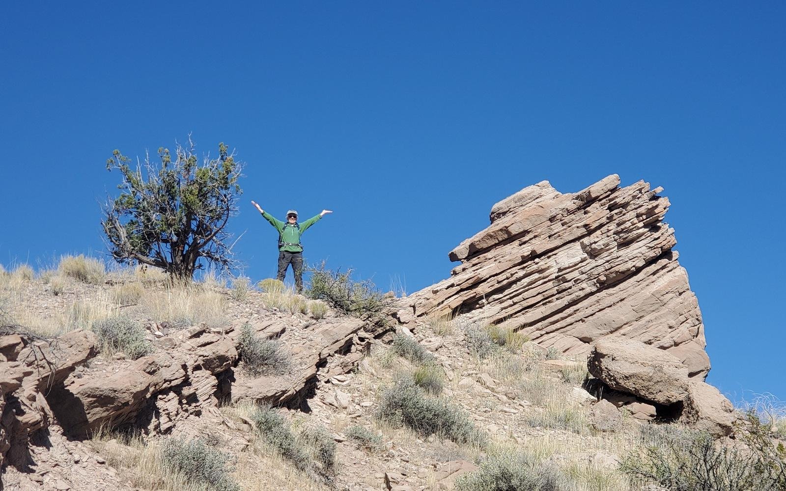
We did discover a trail from the main Canyon floor that ascended the ridge to the west of this side canyon. Again, Pat climbed up more steep rock slopes to the top of the ridge, but further progress seemed too risky for us (I was especially wary, in part because I was carrying our usual 25# supply pack).
From there we returned to the Canyon floor, and with the help of GAIA, we headed directly across the Canyon to the (unmarked) trailhead for the San Lorenzo Canyon Trail. This is a relatively well-used trail that makes a gentle climb up onto the south rim. GAIA (and the BLM maps) show the trail as traversing this south rim for the length of the Canyon. Our initial plan was to proceed a half mile or so and descend back into the main Canyon, enough for the day. We hiked that half mile, to a ravine that might allow us back into the Canyon. No go – we encountered a 15′ drop, with another similar drop below.
Here we stopped for our mid-hike break (ramen this chilly day), then headed back to our entry point on this trail. We did take one side trip over to the edge of the rim to take advantage of the view (and were we saw the other hikers get around the ledge that blocked our path). From there, it was back to our entry trailhead and the Tacoma.
Before heading out, we checked the map, identified 2 other trailheads for the San Lorenzo Canyon Trail (at the other end of the Trail); we paused to take photos of them for future reference. (Review the Photo Gallery below).
Highlight
This place is amazing, with its colorful canyon walls, many layers of rock in those walls, layers at many different angles, side canyons begging to be explored, a fascinating place. And the Canyon is open to dispersed camping to boot, with many places to set up a RV or tent..
Statistics
Total Distance: 2.12 miles
Elevation: start 5,259 ft, maximum 5,365 ft, minimum 5,229 ft
Gross gain: 136 ft. Aggregate ascending 428 ft, descending 428 ft
Maximum slope: 32% ascending, 31% descending, 6.8% average
Duration: 2:53
| GPS Track Files for Download | |
220 Downloads | |
|---|---|
316 Downloads | |
165 Downloads | |
255 Downloads | |
If you haven’t explored these hiking tracks with Google Earth, I urge you to try it. With the virtual 3-dimensional presentation, achieved by panning and tilting the view, you can get a much better idea of the hikes and terrain than you can get from the screenshot above. For some ideas, check out Using Google Earth Track Files.
Related Posts
Hikes to San Lorenzo
Hikes in the Socorro area
References and Resources
BLM: San Lorenzo Canyon
San Lorenzo Canyon Trail (pdf)
Summit Post: San Lorenzo Canyon
ExploreNM: San Lorenzo Canyon Recreation Area
Visit Socorro: San Lorenzo Canyon – watch the video
AllTrails: San Lorenzo Canyon
SightDoing: Hiking the San Lorenzo Canyon in 24 Pictures (Great Photo Site)
New Mexico Meanders: 2020-05-27 San Lorenzo Canyon (desert feature)


