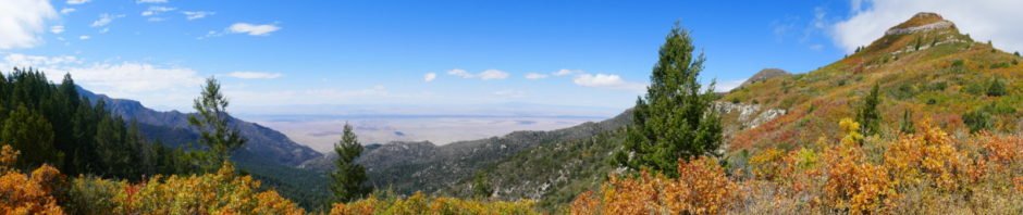
Fourth of July Campground and the Trail are a favorite place to visit in autumn. The maple trees burst forth in autumn with colors that rival that of the flowers during spring and summer in New Mexico.
The Drive In
The road in to Fourth of July is the Torreon-Tajique Loop Road; turn at the sign to the Inlow Baptist Camp next to the church. The road is well maintained, gravel with some rocky spots and one or two bare-earth sections. It narrows after passing the Camp, but is suitable for family sedans. There is ample parking just short of the Campground; we visited on a weekday, found no campers, parked in the Campground.
The Hike
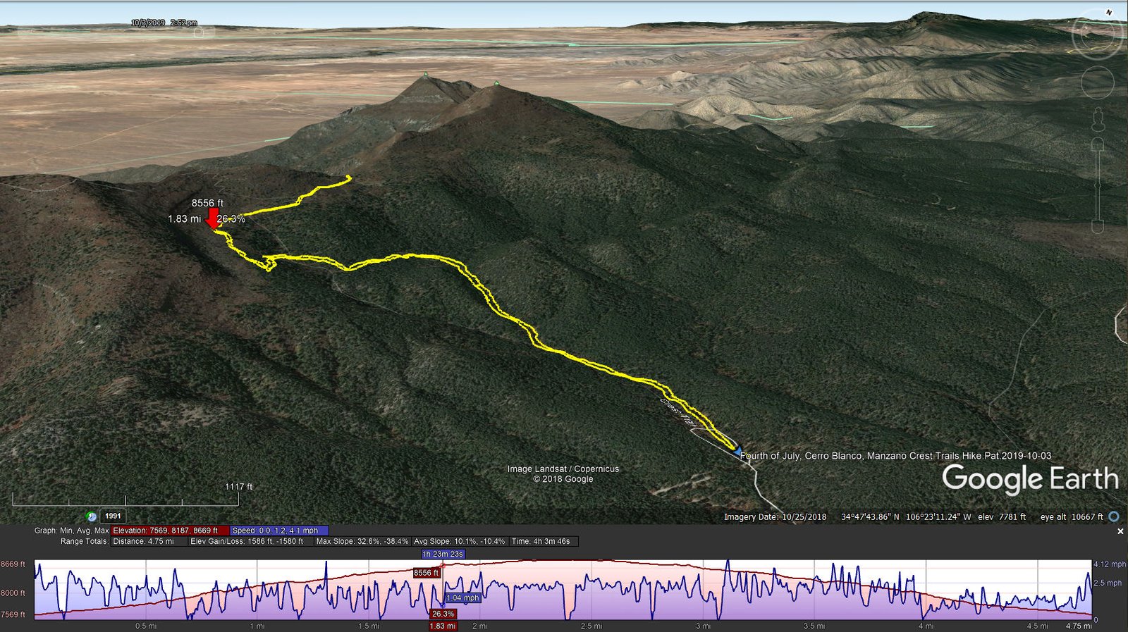
Fourth of July, Cerro Blanco, Manzano Crest Trails Hike.Pat.2019-10-03
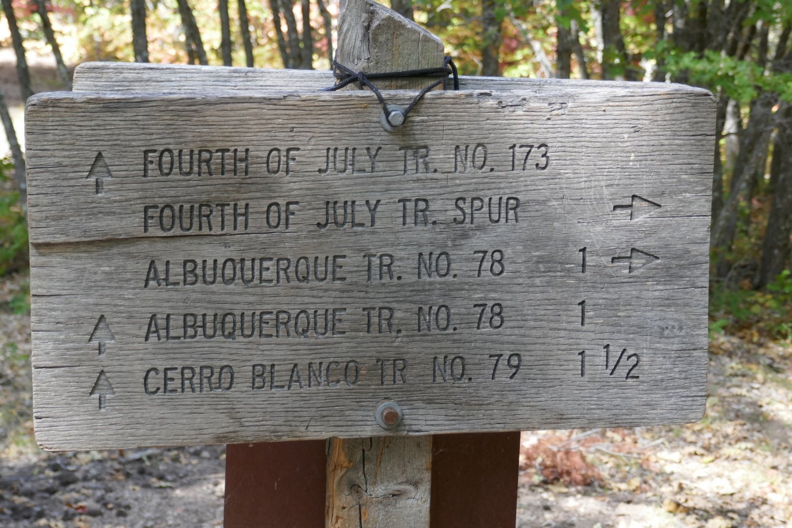 The Fourth of July trailhead, at the far (west) end of the campground, is clearly marked and starts out as a ‘thoroughfare’ trail (see the photos in the Gallery below). Signs, and the Welcome Board, leave no doubt which direction to proceed at each intersection going up the trail. The area is replete with maple trees, and this first week on October is perfect to enjoy their colors.
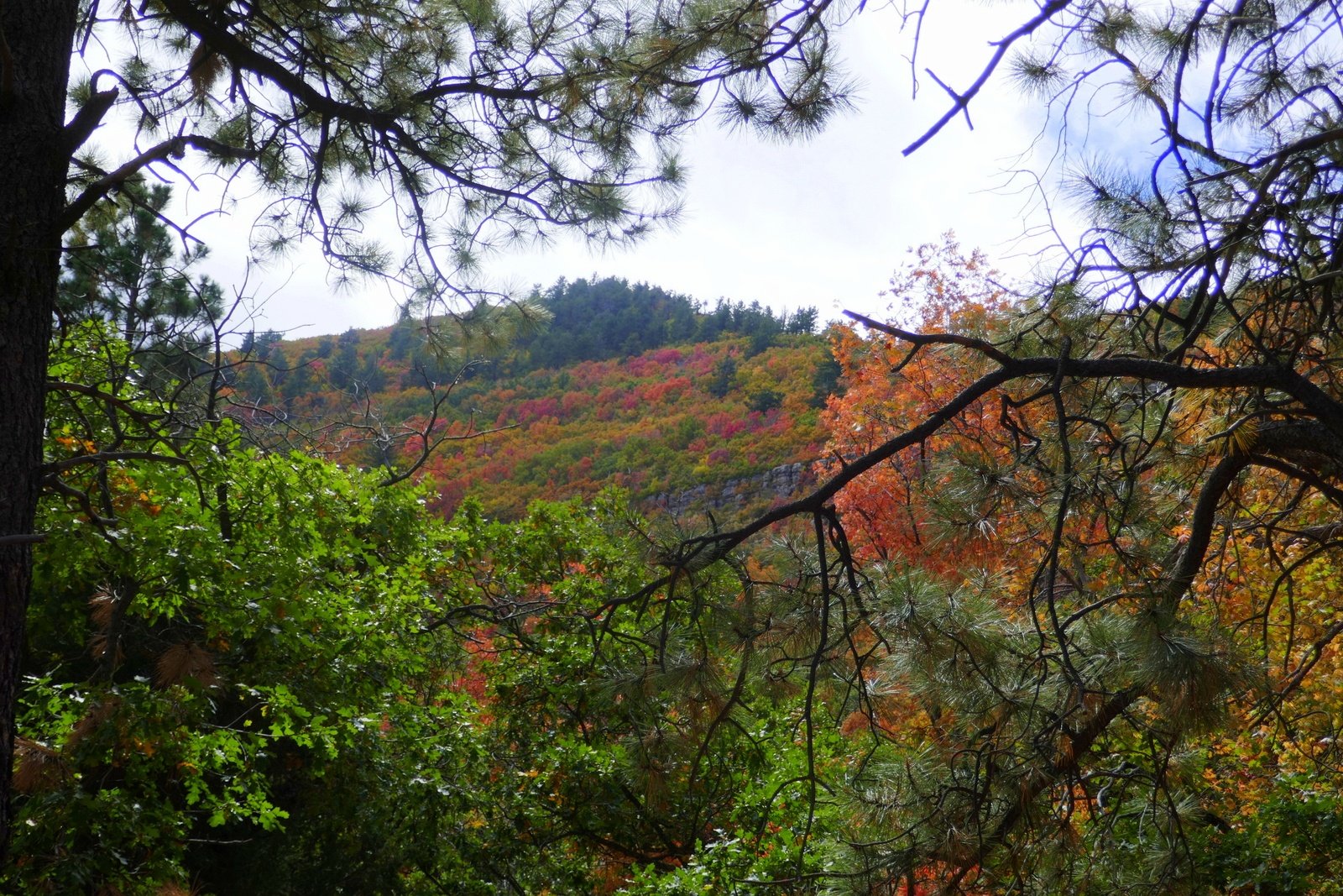
After passing the Lower Fourth of July Spring, the trail becomes a bit more challenging with more rocky surface in spots and a gentle but constant climb (after all, 1,100 feet in some 2 miles). Midway up the trail, after passing the Upper Fourth of July Spring, sections of the trail level out, are smooth and covered with pine needles – very easy hiking. Past the half way point, we had a view of higher elevations and the amazing colors in the mixed forest.
Reaching the intersection with the Manzano Crest Trail, Mosca Peak came into view to the north. From there it was a short distance to the saddle between Mosca and Bosque Peaks. From there we could see to the west, across the Rio Grande valley, to Albuquerque, Belen, and the Rio Grande’s Bosque (forest in Spanish). We paused here for our mid hike break, then retraced our route back to the truck.
The colors of the leaves of maple trees were intense.


Statistics
Total Distance: 4.75 miles
Elevation: start 7,569 ft, maximum 8,669 ft, minimum 7,569 ft
Gross gain: 1,100 ft. Aggregate ascending 1,586 ft, descending 1,580 ft
Maximum slope: 33% ascending, 38% descending, 10.1% average
Duration: 4:04
| GPS Track Files for Download | |
187 Downloads | |
|---|---|
407 Downloads | |
298 Downloads | |
310 Downloads | |
I urge you to explore our hiking tracks with Google Earth. With the virtual 3-dimensional presentation, achieved by panning and tilting the view, you can get a much better idea of the hikes and terrain than you can get from the 2-dimensional screenshot above. For assistance: Using Google Earth Track Files.


