Back to the Pecos River Valley in the Sangre de Cristo, to explore the road to Iron Gate Campground. From the topo map and our assessment when visiting there last week, we wanted to assess our comfort level with driving up such a steep incline on such a steep hillside with no guard rails. So we made a hike of it.
The Hike
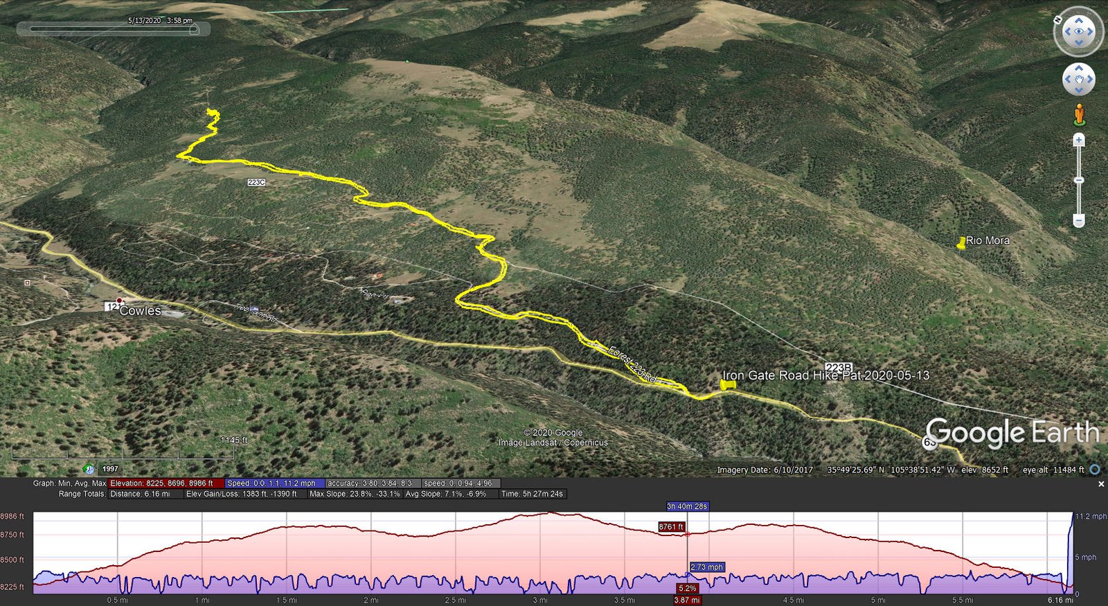
Iron Gate Road Hike.Pat.2020-05-13
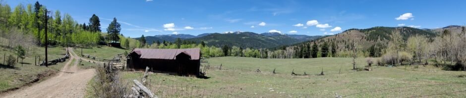
The hike proceeds -up- quickly, with the view down to the bottom of the canyon becoming further and further -down- a very steep slope. The climb is about 1.5 miles from whence elevation gains are minimal. Along the way the road passes through private land designated as Cowles and Geronimo communities, and a “Summer Home Area” both with cabins/houses scattered about. Geronimo appears to be made up of a lovely ranch which appears to have been possibly the original settlement hereabouts – it is quite a nice spread.
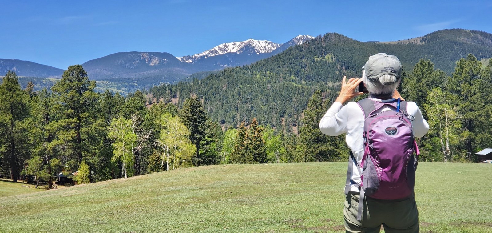
Santa Fe Baldy from a meadow along Iron Gate Road.
At about 1.5 miles the road skirts a large meadow, cleared of trees. From there we could take in the full scale of the southern end of the Sangre de Cristo, with Santa Fe Baldy in full view, still with lots of snow on top. Again at the 3 mile point, in another open space we enjoyed the great beauty of these mountains. We took our first break here (pre-lunch), then our full lunch half way back to the Tacoma.
Yes, the road is steep and the terrain falls away steeply on the downhill side. But it is wide enough for meeting cars to pass. Next trip we will drive up to the 3 mile point and hike the remaining distance to the Iron Gate Campground.
Statistics
Total Distance: 6.16 miles
Elevation: start 8,259 ft, maximum 8,986 ft, minimum 8,225 ft
Gross gain: 761 ft. Aggregate ascending 1,383 ft, descending 1,390 ft
Maximum slope: 24% ascending, 33% descending, 7.1% average
Duration: 5:27
| GPS Track Files for Download | |
176 Downloads | |
|---|---|
191 Downloads | |
I urge you to explore our hiking tracks with Google Earth. With the virtual 3-dimensional presentation, achieved by panning and tilting the view, you can get a much better idea of the hikes and terrain than you can get from the 2-dimensional screenshot above. For assistance: Using Google Earth Track Files.


