We embarked on a short trip into southeastern Utah, to explore that territory and to eat at a special restaurant we’d heard about. We did not make this a camping/hiking trip, but stayed in commercial lodging enroute and at a BnB in Boulder, UT. See more in the BLOG post about the trip at Utah Trip – 10/19/2022-10/24/2022.
The Drive In
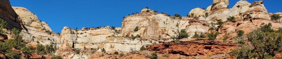
From Boulder, UT the trailhead is 12.7 miles south on UT 12, then turn right onto Calf Creek Road; a half mile to the trailhead. As we drove towards the trailhead, we stopped to take in the view of Calf Creek Canyon.
The Hike
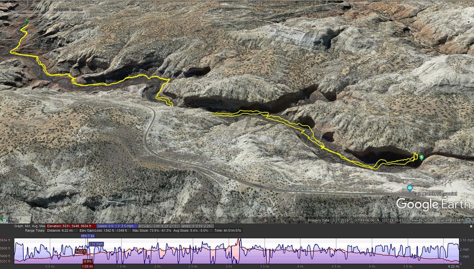
Lower Calf Creek Canyon Waterfall Trail Hike.Pat.2022-10-21
Notes about the Google Earth screenshot: the graph at the bottom shows elevation of the track (pink area) and speed (the blue line).
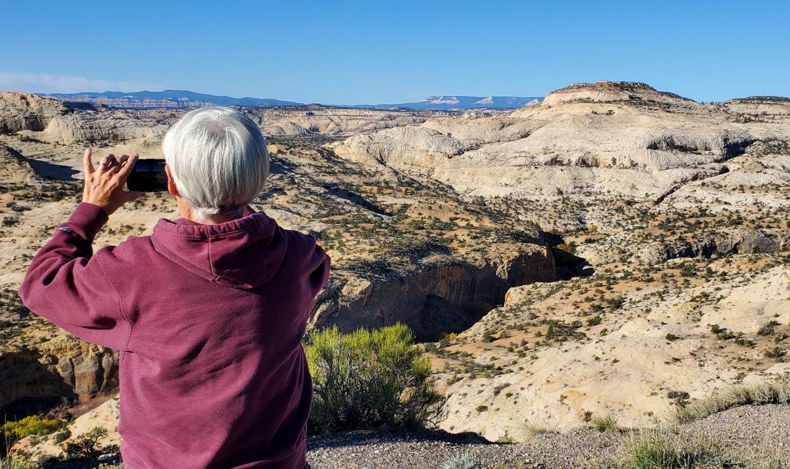
 ‘Tis a popular trail – the parking lot had few spaces open in this narrow canyon when we arrived. After signing in, we started out on a well-used trail, to be greeted by the colorful c
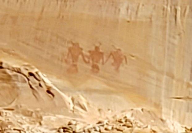 anyon walls. About a half mile from the trailhead, we spotted the petroglyphs on the far wall that we had heard about.
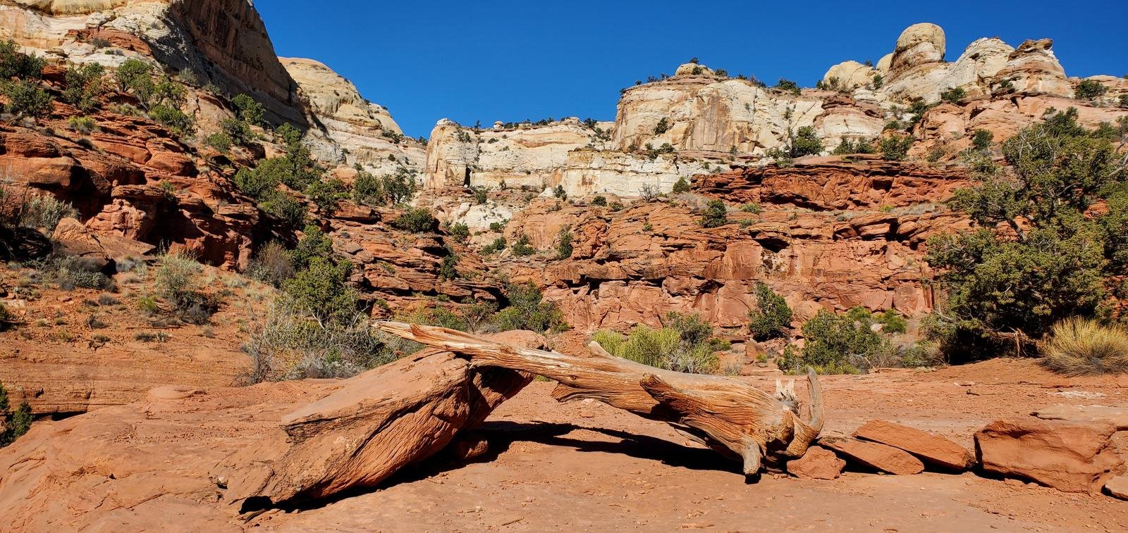
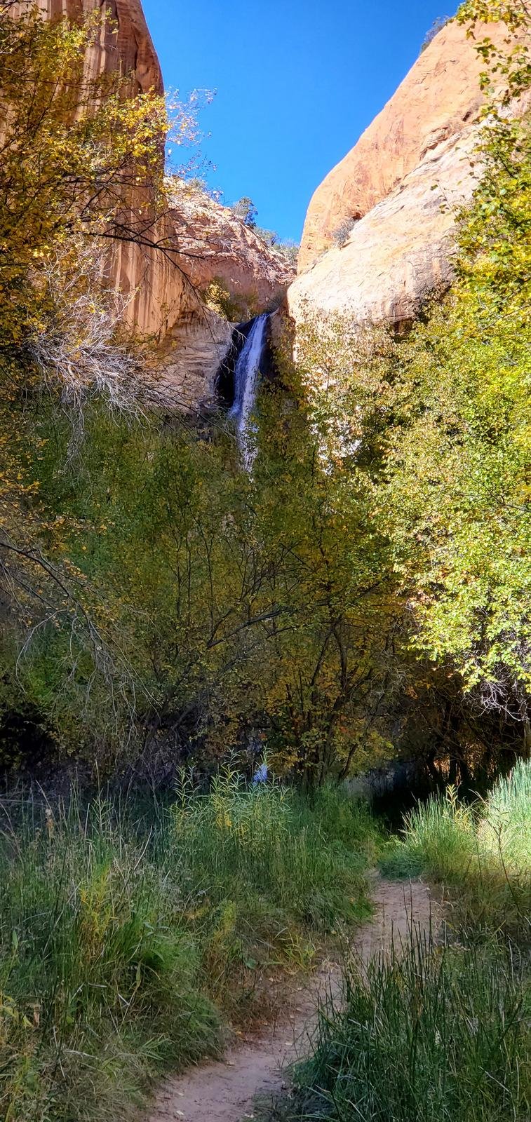
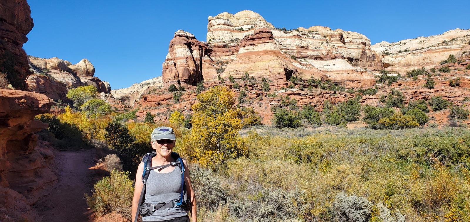 Along the trail the canyon walls tower above us, with the spectacular colors of the various layers. And along Calf Creek, willow and other plants remind one that there is water in the Creek.
 Of course, the attraction for this trail is Lower Calf Creek Falls. This is our first view of this 130 foot high waterfall. ‘Tho the day had been warm (we shed all but our last layer of clothing), the gallery around the falls was cool enough that we put a layer back on.
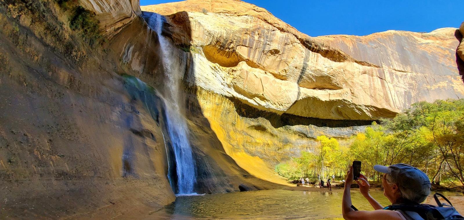
Statistics
Total Distance: 6.22 miles
Elevation: start 5,341 ft, maximum 5,634 ft, minimum 5,331 ft
Gross gain: 303 ft. Aggregate ascending 1342 ft, descending 1342 ft
Maximum slope: 74% ascending, 61% descending, 5.2% average
Duration: 4:52
| GPS Track Files for Download | |
185 Downloads | |
|---|---|
137 Downloads | |
If you haven’t explored these hiking tracks with Google Earth, I urge you to try it. With the virtual 3-dimensional presentation, achieved by panning and tilting the view, you can get a much better idea of the hikes and terrain than you can get from the screenshot above. For some ideas, check out Using Google Earth Track Files.
Related Posts
Utah Trip – 10/19/2022-10/24/2022
References and Resources
BLM National Conservation Lands: Lower Calf Creek Falls Trail
Utah.com: Calf Creek Falls – Lower Gallery
VisitUtah: Lower Calf Creek Falls
AllTrails: Lower Calf Creek Falls
Road Trip Ryan: Hiking Lower Calf Creek Falls


