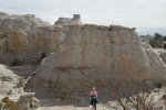
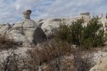
An after-the-fact post of this hike that Pat and I made before I started the BLOG.
The Hike
Statistics
Total Distance: 1.39 miles
Elevation: start 5,845 ft, maximum 5,906 ft, minimum 5,906 ft
Gross gain: 61 ft. Aggregate ascending 251 ft, descending: 251 ft
Maximum slope: 32% ascending, 37% descending, 7% average
Duration: 1:24
| GPS Track Files for Download | |
340 Downloads |
|
|---|---|
197 Downloads |
|


