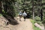
To escape  the really hot summer temperatures in Albuquerque (and Santa Fe) we headed to higher elevations, to Red River and camping in the Elephant Rock Campground. The plan – hike up the Middle Fork of the Red River to … Middle Fork Lake. Pat & I did this hike back in 2020 and in 2019 with grandson Thomas. We’ve enjoyed it and welcomed the chance to share it and two nights of camping with our friends Jay, Nancy, and Bo from Santa Fe.
The Drive In
 To get to the trailhead, drive through Red River on NM 578 and continue south to the end of the pavement. Continue on the first road to the right, Forest Road 58, a Class 4 tw0-track. Because of recent rains we drove through two fairly large, ‘tho not deep, pools of water. Then for the next 4oo yards or so this very rocky road had a rivulet of water running down it. We continued for a bit more than a mile to a large parking area. A high clearance vehicle is preferable, but there were “street” autos in the parking lot. The trail proceeds from there.
Jay here: Someone drove in with a Subaru Crosstrek which is not very high clearance. Must have driven VERY slowly.
The Hike
Notes about the Google Earth screenshot: the graph at the bottom shows elevation of the track (pink area) and speed (the blue line).
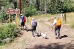
 From the parking lot, the trail proceeds for on a continuation of the two track. Some 500 yards on we encountered a gate labeled Private Property. But to the left was a sign directing us to the left and across a bridge over this Middle Fork of the Red River and to the “Middle Fork TR No. 91”.
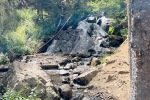
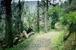
The first half mile is very rocky and in full sun; the the next half mile is less rocky with some shade. A nice smooth trail follows for few hundred yards, then the trail continues with sections that are rocky and with sun interspersed with shaded areas.
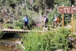
 At 1.3 miles into the hike, the trail crosses the Middle Fork, this time with no bridge. One can choose to cross on tree trunks laying across the shallow stream, hop across on rocks, or … just wade. We chose one of the first two, ‘tho Nancy with Bo opted to wade across.
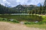
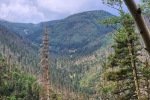
 The trail makes a steady climb all the way to the lake with 3 sections of switchbacks, the last one 1.9 miles into the hike. Topping out, the trail enters an open area that leads to the lake. We took in the scenery and cool temperature lakeside – with the wind it even became a bit chilly.
 We enjoyed our lunches and headed back down. Clouds had been building while we had lunch and before long it took to raining — on with the ponchos and raincoats. We continued down, again making the stream crossings and back to the parking area – by that time we were out of the rain. (This was Bo’s 3rd hike with us, and he is getting his hiking legs.)
Jay here: Each switchback was an opportunity to stop in the shade before tackling the next leg. Not a bad way to hike unless you’ve got something to prove — we’re done with that. When the wind amped up it was like a classic science experiment. Warm air blows across cold water and voila, air conditioning! We’ve hiked in rain and snow before, but tiny hail pellets were a first. Bo is definitely gaining real hiking experience but his fur was mighty soggy at hike’s end. He may need his own poncho.
Statistics
Total Distance: 5.03 miles
Elevation: start 9,637 ft, maximum 10,862 ft, minimum 9,633 ft
Gross gain: 1,193 ft. Aggregate ascending 1,745 ft, descending 1,745 ft
Maximum slope: 42% ascending, 43% descending, 10.5% average
Duration: 4:23 , Average Speed: 1.15 mph
| GPS Track Files for Download | |
106 Downloads |
|
|---|---|
105 Downloads |
|
If you haven’t explored these hiking tracks with Google Earth, I urge you to try it. With the virtual 3-dimensional presentation, achieved by panning and tilting the view, you can get a much better idea of the hikes and terrain than you can get from the screenshot above. For some ideas, check out Using Google Earth Track Files.
Related Posts
Reference
The Campground:
Recreation.gov: Elephant Rock Campground
USDA Forest Service: Elephant Rock Campground
Only in Your State: Elephant Rock Campground Might Be The Most Beautiful …
The Trail:
USDA Forest Service: Middle Fork/West Fork Road Trail 487
AllTrails: Middle Fork Lake Trail
Hiking Project: Middle Fork Lake Trail
Only in Your State: This Increduble Hike Leads To A Lake So Hidden …


