
Another hike without a preconceived plan – we felt a need to get out for a few hours.
The Drive In
Oak Flats is close to our home in downtown Albuquerque, close for everyone living in Albuquerque. Go eastbound on I-40 to Tijeras, then south, up the hill on NM 337, to the turn to Oak Flat Road, continue for a mile to the Oak Flats Picnic Area.
The Walkabout
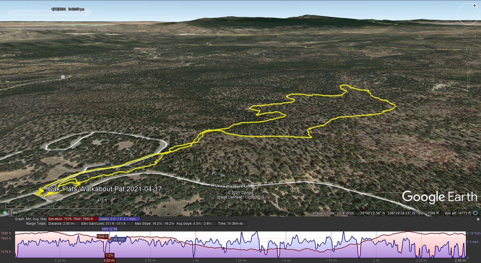
Oak Flats Walkabout.Pat.2021-04-17
There are a myriad of trails in the area around the Oak Flats Picnic Area. (check CalTopo’s map). Ample parking is available at the entrance to the Picnic Area. The trails have been given names (and numbers) and there are signs at junctions. Leaving the parking area haded north, we found ourselves at a junction of the Caida del Piño and Easy Pickin’ trails. We turn right onto the latter, a 10th of a mile on we turned left onto Mahogany (which is also a two-track). We stayed on Mahogany until Gamble Oak – turned left until turning left on Caida del Piño, heading back to parking.
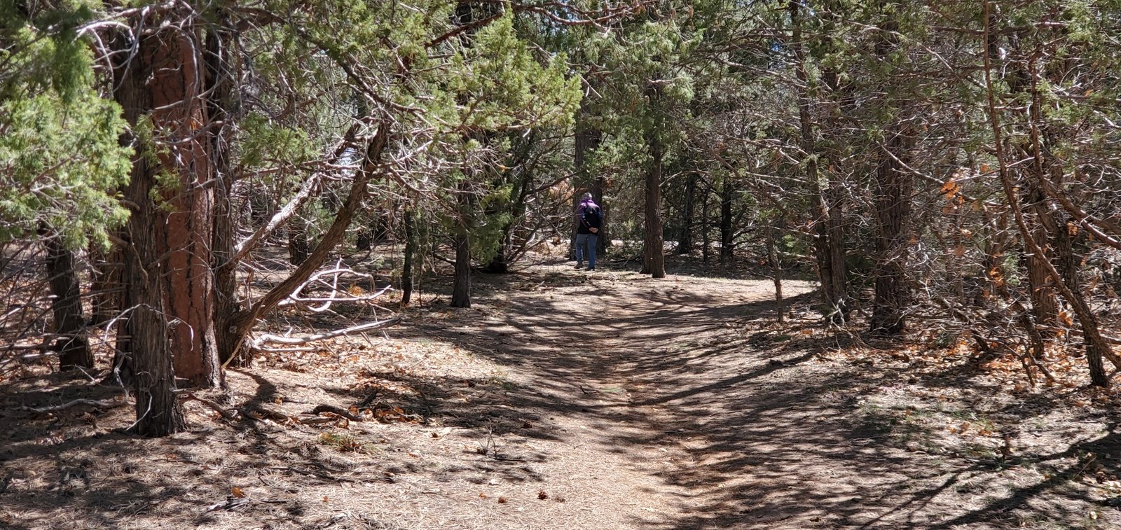
Typical of the condition of the trails.
These trails are among the most pleasant and easy hiking in the area. The surface is dirt, often covered with pine needles, with occasional gravel and small rocks. The forest is quite open but the trails are mostly shaded.
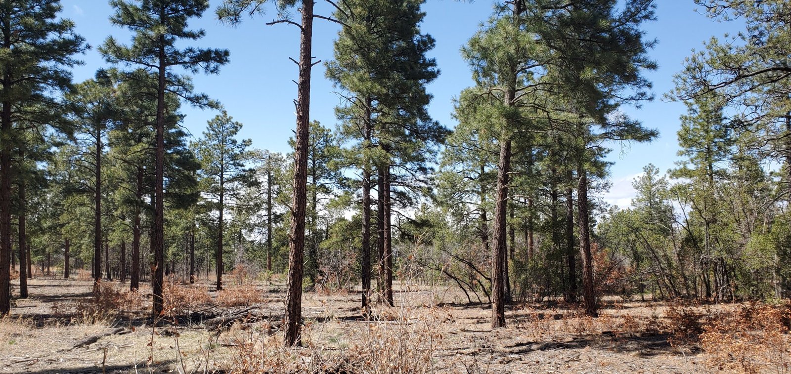
The forest has generally been cleared of undergrowth.
This area is very popular for folks on mountain bikes. The -do- contribute to maintaining the trails in good condition. We encountered only one bike on this weekday; more bikers may use the area on weekends.
Highlight
Our timing for this ‘escape’ was excellent – we finished in time to have a fine lunch at Roots Farm Cafe, a favorite stop for us anytime we’re heading out that way.
Statistics
Total Distance: 2.50 miles
Elevation: start 7,670 ft, maximum 7,690 ft, minimum 7,576 ft
Gross gain: 134 ft. Aggregate ascending 311 ft, descending 311 ft
Maximum slope: 16% ascending, 16% descending, 3.9% average
Duration: 1:36
| GPS Track Files for Download | |
172 Downloads | |
|---|---|
170 Downloads | |
If you haven’t explored these hiking tracks with Google Earth, I urge you to try it. With the virtual 3-dimensional presentation, achieved by panning and tilting the view, you can get a much better idea of the hikes and terrain than you can get from the screenshot above. For some ideas, check out Using Google Earth Track Files.
Related Posts
Ponderosa in Oak Flats Hike – 11/03/2016
Oak Flats-Ponderosa Trails HIke – o5/09/2019
References and Resources
USDA Forest Service: Oak Flats Picnic Site
Oak Flat Trailhead & Connector Trail 05637 (check the map)
AllTrails: Oak Flat Loop
MTB Project: Manzanita Mountains Trail System
(explore all the trails along south NM 337)
CalTopo: Oak Flats Trails