Taking a bit more time this morning for our customary morning walk, we drove out to Tijeras Canyon, then up NM 337 to Cedro and Albuquerque’s Oak Flats Open Spaces. In addition to this change of venue from our walks in the Bosque along the Rio Grande, we were on the lookout for oak acorns, fodder for Pat’s dyeing explorations.
The Drive In
‘Tis an easy drive – east on I-40 through Tijeras Canyon, exit on NM 337 for Tijeras, then up to the top of the hill. Turn left on Oak Flat Rd, proceed for 1 mile, turn into the Oak Flats Open Spaces. Take the drive to the left, follow it around to the trailhead. (Depending on the time of day, consider stopping by Roots Farm Cafe on the way in for breakfast or coffee, or on the way out for lunch.)
The Hike

Oak Flats Walkabout.Pat.2022-09-03
Notes about the Google Earth screenshot: the graph at the bottom shows elevation of the track (pink area) and speed (the blue line).
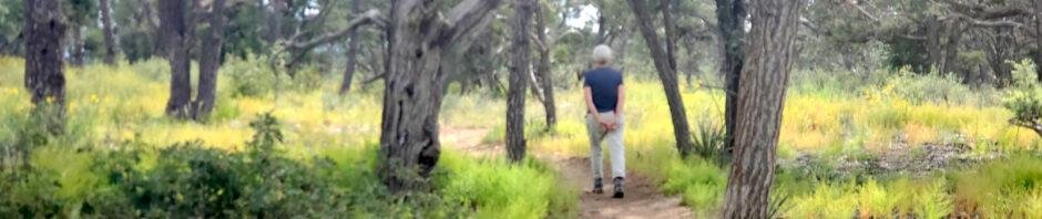
 The trails here in Oak Flats are well used – by hikers and bicyclists. Most of the trail’s surface is smooth-easy walking; there are a few rocky places. The Area is mostly open juniper and piñon pine, with small groves of oak (hence the name). As you can see from the elevation profile above (isn’t GoogleEarth great?), there isn’t much elevation change in Oak Flats.
Trails do criss-cross the area; we had a general idea how we wanted to go, but as usual we kept a GPS track for reference (and to publish on these BLOG posts). And the GPS show the trails on their maps (USTopo and especially GAIA).
On hikes here in New Mexico, I find flowers enhance the experience of nearly every hike. This holds true for this hike, even so far into autumn, and in an area that otherwise seems to be very dry.


Statistics
Total Distance: 2.59 miles
Elevation: start 7,684 ft, maximum 7,703 ft, minimum 7,640 ft
Gross gain: 63 ft. Aggregate ascending 338 ft, descending 338 ft
Maximum slope: 14% ascending, 16% descending, 4.1% average
Duration: 1:29
| GPS Track Files for Download | |
165 Downloads | |
|---|---|
162 Downloads | |
If you haven’t explored these hiking tracks with Google Earth, I urge you to try it. With the virtual 3-dimensional presentation, achieved by panning and tilting the view, you can get a much better idea of the hikes and terrain than you can get from the screenshot above. For some ideas, check out Using Google Earth Track Files.
Related Posts
Other Oak Flats hikes
Hikes in Tijeras Canyon