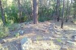
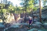
This is an easy hike up a Forest Road that follows Paliza Canyon from the Paliza Campground north into the Jemez Mountains. It passes 2 or 3 old mining sites on the way to a Y – take the one to the left towards Goblin Colony. The Goblins are a large collection of amazing rock formations on a steep hillside. One sees many of them coming up from the valley, but continue climbing to see many, many more. Check out the references to see more photos.
The Hike
Statistics
Total Distance: 3.10 miles
Elevation: 6,838 start, 7,208 maximum, 6,838 minimum
Gross gain: 370 ft. Aggregate ascending 580 ft, descending: 590 ft
Maximum slope: 27% ascending, 30% descending, 7% average
Duration: 2:29
| GPS Track Files for Download | |
164 Downloads |
|
|---|---|
125 Downloads |
|
I urge you to explore our hiking tracks with Google Earth. With the virtual 3-dimensional presentation, achieved by panning and tilting the view, you can get a much better idea of the hikes and terrain than you can get from the 2-dimensional screenshot above. For assistance: Using Google Earth Track Files.
References
ASCHG: Paliza Canyon – Goblin Colony Hike
ASCHG: Goblin Rocks Loop
The Gentle Art of Wandering: The Goblin Colony
Judith Bauman: Paliza Canyon Goblin Colony
The Kruse Chronicles: Paliza Canyon Goblin Colony


