Jay and I hiked Palomas Peak back in 2016, once in snow and three weeks later in nicer weather. This was a nice return to this trail (also identified by a couple of signs as Faulty Trail, but the Faulty we know is some distance from here, in middle-south on the eastern slopes of the Sandias and out of Tijeras Canyon).
The Hike

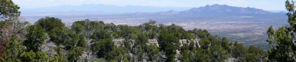
Palomas Peak-Faulty Hike.Jay.2019-04-28
On this hike we were reintroduced to trails in the Sandias – they give us a good climb, more elevation gain than other places we hike. So .. it was a good workout, and a day of very nice weather. Visit pages for the other hikes for more description, etc.
Jay here: It’s hard to believe, but George neglected to mention that we once again went off the trail on a wild and whooly (or whiplashy) bushwhack that accounted for dozens of places on hands, arms and legs where blood was drawn. I can understand how George might fail to mention this part of the hike, since he thinks bushwhacking is so much fun. On the other hand, I could do without the drama and running so low on bandaids.
Statistics
Total Distance: 4.77 miles
Elevation: start 7,061 ft, maximum 7,053 ft, minimum 8,075 ft
Gross gain: 1,022 ft. Aggregate ascending 1,513 ft, descending 1,518 ft
Maximum slope: 43% ascending, 38% descending, 10.1% average
Duration: 4:09
| GPS Track Files for Download | |
234 Downloads | |
|---|---|
240 Downloads | |
I urge you to explore our hiking tracks with Google Earth. With the virtual 3-dimensional presentation, achieved by panning and tilting the view, you can get a much better idea of the hikes and terrain than you can get from the 2-dimensional screenshot above. For assistance: Using Google Earth Track Files.
References
Hiking in New Mexico:
Palomas Peak Hike – 05/01/2016
Palomas Peak Hike – 05/22/2016
AllTrails: Palomas Peak Via Faulty Trail


