We haven’t hiked the Piedra Lisa trail in a long time; I last hiked it back in 2015. Pat & I thought it would be a good one today: close by, in the shade, not to long or strenuous. Oops, wrong on that last count.
The Drive In
The trailhead is on Forest Service 333 Rd, about a third of a mile beyond where the pavement ends.
The Hike

Piedra Lisa South Hike.Pat.2019-05-02
Introduction
When I first hiked here, the initial “trail” was on the road for about half a mile, then headed off into the woods. Now there is a “bypass” trail that is much nicer, running parallel to the road and in the shade of woods and presents a small elevation gain (~100 ft) for that half mile. But … the trail then heads uphill, gaining about 100 ft for each .1 mile ( or 17% slope) ‘tho offering a nice, easy hiking surface. The trail continues that way to the top with only a couple of somewhat level stretches.
The Hike
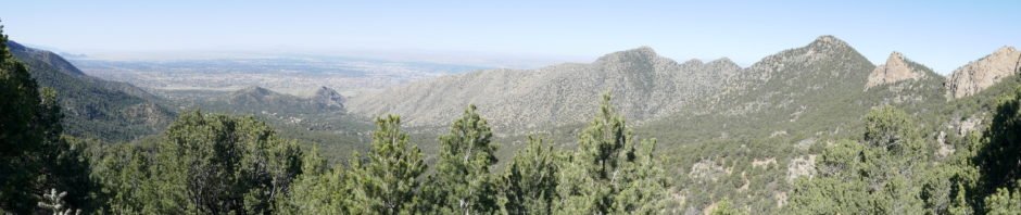
We hadn’t planned on such a hike but were pleased to have conquered Piedra Lisa. All along the trail the views were great: to the southwest down La Cueva Canyon and beyond to a broad vista of Albuquerque and to the east the cliffs of this west side of the Sandia Mountains. Unfortunately this was a hazy day so the photos below don’t convey the views very well. At the “top”, a saddle atop Rincon Ridge, we stopped for our mid-hike break where we had a nice view north into Placitas. (From here, one can continue north on the Del Agua trail that ends on the Loop Road that comes off NM165 in Placitas; Jay and I did a p0int-to-point on these trails back in 2013, not long after we started hiking regularly.)
Hiking up Piedra Lisa is strenuous; likewise hiking back down the trail is strenuous in a different way. Because it is quite smooth but in many places with a layer of sand, careful management of downhill speed/energy is required. This can be as wearing on muscles as the climb up, ‘tho different muscles. It is, however, contributing to our conditioning to do more and sometimes strenuous in the coming months.
Statistics
Total Distance: 4.3 miles
Elevation: start 6,929 ft, maximum 8,166 ft, minimum 6,929 ft
Gross gain: 1,237 ft. Aggregate ascending 1,642 ft, descending 1,643 ft
Maximum slope: 37% ascending, 39% descending, 12.4% average
Duration: 4:16
| GPS Track Files for Download | |
266 Downloads | |
|---|---|
203 Downloads | |
If you haven’t explored these hiking tracks with Google Earth, I urge you to try it. With the virtual 3-dimensional presentation, achieved by panning and tilting the view, you can get a much better idea of the hikes and terrain than you can get from the screenshot above. For some ideas, check out Using Google Earth Track Files.
References and Resources
USDA Forest Service: Piedra Lisa South Trailhead-Piedra Lisa Trail 135
ASCHG: Piedra Lisa South Hike
Piedra Lisa South To North Hike
AllTrails: South Piedra Lisa Trail
SummitPost: Piedra Lisa Trail No. 135 (South Trail)
ondafringe: Day Hike: South Piedra Lisa Trail
Enchanting Wildflowers: 10 Enchanting Wildflowers Native to New Mexico


