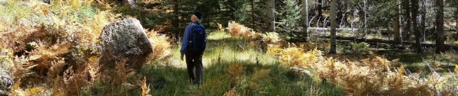
The Hike
We returned to Pony Canyon, having hiked it back in May 2017. We were hoping to catch the aspen in their full fall color – we were early for the ‘show’, but found other plants showing their colors. Although we parked at a different turnout, we followed close to the same track as before.
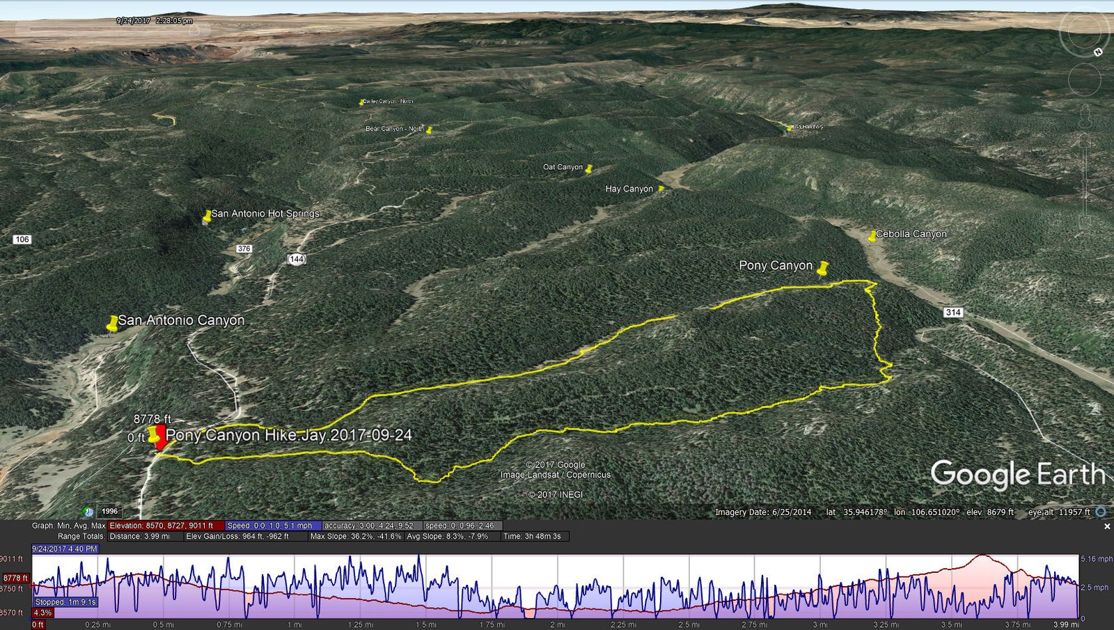
Pony Canyon Hike.Jay.2017-09-24
Statistics
Total Distance: 3.99 miles
Elevation: start 8,778 ft, maximum 9,011 ft, minimum 8,570 ft
Gross gain: 441 ft. Aggregate ascending 964 ft, descending 962 ft
Maximum slope: 36% ascending, 42% descending, 8% average
Duration: 3:48
| GPS Track Files for Download | |
209 Downloads | |
|---|---|
136 Downloads | |
If you haven’t explored these hiking tracks with Google Earth, I urge you to try it. With the virtual 3-dimensional presentation, achieved by panning and tilting the view, you can get a much better idea of the hikes and terrain than you can get from the screenshot above. For some ideas, check out Using Google Earth Track Files.
References
Hiking in New Mexico: Pony Canyon Hike (See that hike for more references.)


