We went looking for new territory in the Ojito Wilderness. I’d planned to park on US 550 across from the north end of Dragon’s Back and explore the valley below the Back and the mesas and such to the east. (Thanks to a Land Ownership overlay for Google Earth, I knew that we would be on state-owned or BLM land.) However, as we drove away from San Ysidro, I looked over at the Rio Salado and, behold, there was water running in it. That meant that we’d have to ford the Rio to get to the area of interest, so … we went to Plan B.
The Driveabout
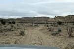
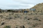
I’d often noticed a gate on the left further along on US 550; we found it to be only chained shut (not locked) and a sign “Ojito Wilderness” beckoned us to enter. Driving past some well-built corrals, we found ourselves on a reasonable well used two-track. Upon reaching the Rio Salado we found water running, only a few feet in width against the near shore. The bottom appeared to be hard as did the sand beyond, so putting the Tacoma in 4-wheel drive we drove through – easily.
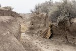
From there we proceeded into an exploration of the northern extents of the Ojito Wilderness. The two-track was generally good, until that is we encountered a more challenging stretch – steep and somewhat washed out (I think one would need a high clearance vehicle for this stretch). Just past this stretch was a gate. Our first thought was to hike from here, but after a quarter of a mile on foot, the wind and cold caused us to reconsider – back to the gate (again only chained) and make this a DriveAbout.
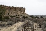
Continuing on what would be a ‘nice’ two-track, we headed southeast in the Querencia Arroyo with Cucho Mesa on our right and unnamed mesas ahead. Encountering a ‘Y’ in the two-track, we headed more westerly into a large basin; we continued until the two-track ended at the base of the mesa. Still curious about the area, particularly if we might get near territory familiar from other hikes, we returned to the ‘Y’ and went up the other leg (labeled on the topo map as a “jeep trail”). We proceeded until encountering a ravine crossing that was more than we wanted to challenge.
The Walkabout
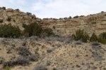
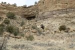
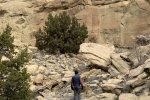
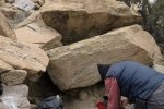
We chose to do a WalkAbout (just wandering, not a great distance), exploring galleries protruding into the ‘unnamed’ mesa. (We were also curious about the condition of the two-track beyond our stopping point; as far as we explored, it was in good condition. On further inspection via GoogleEarth, it appears to be very challenging further along as the canyon becomes more narrow before topping out still some distance from Pipeline Road. It would seem to make a great route for something more nimble than the Tacoma, like an ATV or such.) After the WalkAbout, we enjoyed our traditional mid-hike snack, then headed back to US 550.
Jay here: When the wind was at our backs it did not seem that cold. Then we turned back into the wind and realized that the combination of wind and temperature was making it a bone chiller. Happy to get back in the Tacoma out of the wind. All of this area is worth exploring again under better weather conditions, but before the blistering summer heat. Sometime in May might be about the right time…unless the aforementioned Rio crossing is still running strong with snowpack runoff.
Through all this, we were curious about our position in this excursion relative to the many other hikes we’ve made in the Ojito Wilderness. Using that wonderful tool, GoogleEarth, I plotted those hikes. As you can see (click on the screenshot above for a bigger view), we were still some distance from any previous hike. But .. I see that this entrance into the Ojito (red line near top of screenshot) offers potential for more hiking, to explore this amazing geology. And … what else might we find (like the petrified wood pile we found on a hike back in 2017).
Statistics
Total Distance: 1.15 miles
Elevation: start 5,660 ft, maximum 5,717 ft, minimum 5,660 ft
Gross gain: 57 ft. Aggregate ascending 216 ft, descending 205 ft
Maximum slope: 43% ascending, 49% descending, 5.8% average
Duration: 0:54
| GPS Track Files for Download | |
161 Downloads |
|
|---|---|
115 Downloads |
|
158 Downloads |
|
181 Downloads |
|
736 Downloads |
|
204 Downloads |
|
I urge you to explore our hiking tracks with Google Earth. With the virtual 3-dimensional presentation, achieved by panning and tilting the view, you can get a much better idea of the hikes and terrain than you can get from the 2-dimensional screenshot above. For assistance: Using Google Earth Track Files.
References
Hiking in New Mexico: Our hikes in the Ojito Wilderness
Descriptions, tracks, references, and photos


