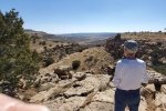
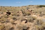
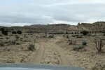
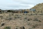
Category Archives: Driveabout

Activity: trips that include a driveabout (driving tour).

Valle Vidal DriveThru – 03/29/2025

It’s been many months since we have been able to get out and about – we needed to begin a recovery from “cabin fever”.  Friday evening, with a weekend of nice weather in the offing, spontaneously (no advance planning) we embarked Saturday on a Driveabout, choosing to explore a part of New Mexico that has long been on our bucket list: Valle Vidal.

The Drive In

From Albuquerque, Valle Vidal is a long drive:

  • Via Cimarron –
    • By way of I-25 to north of Springer, then west on NM 58 – 215 miles, 3 hours
    • Or by way of Santa Fe (I-25), Española (US 94/285), Taos (NM 68), and Eagle Nest (US 64) – 186 miles, 3.5 hours
    • Then 7 miles north on US 64, turn west on FR 1950, 43 miles to Valle Vidal on a very well maintained gravel road
  • Or via Costilla, 2 miles from the border with Colorado –
    • By way Santa Fe (I-25), Española (US 84/285), and Taos (NM 68) to Costilla (NM 522) – 178 miles, 3.2 hours
    • Then drive east on FR 1950, ten miles on a paved road followed by for 13 miles on gravel, both not-so-well maintained
  • And the drive to the Valle is still many miles from the highway.

We weren’t certain that the road through Valle Vidal, FR 1950, would be open for a DriveThru. Passing through Taos, a decision point, we called the Forest Service district office. We did not get a clear answer, ranging from “it is closed” (leaving us to guess if “it” was the road itself) or if there were only restrictions from leaving the road.  We decided to go for it, but stay a night in Cimarron, putting the decision about a DriveThru until the next day.

We obtained a reservation for the night at the St James Hotel, a very good choice. We stayed in the Jesse James room, enjoyed a very nice supper in their dining room/bar, and … we weren’t bothered by ghosts (for which the Hotel has quite a reputation).


The next morning we decided to try the DriveThru, risking 1) not able to get into the National Forest at all, or .. 2) finding a gate closed before exiting the other end of FR 1950 dictating that we return to Cimarron. The conclusion – the road was open .. all the way.

The DriveThru

Valle Vidal Drivethru.Pat.2025-03-29

Notes: the graph at the bottom shows elevation of the track (pink area) and speed (the blue line). Press <back> on your browser to return to the post.

From Cimarron we entered from the East, turning off of US 65 onto FR 1950 about 7 miles north of the town. The route starts out in open plains bounded by hills on both sides – a valley passing through a portion of Ted Turner’s Vermijo Ranch. At about 21 miles we entered into the National Forest.We find the openness of this scenery to be a favorite – grass across the valley, juniper and piñon trees on the hills. There are many side canyons that drew our curiosity (but one is not allowed to leave the road’s right-of-way).
Elevation increases gradually for some 25 miles as this valley becomes narrower. And as we drove west, snow capped mountains beyond began to appear, adding greatly to the scenery.The terrain was becoming more varied – taller hills, narrower canyons interspersed with large open areas, each one drawing an exclamation of Wow – open space. About 30 miles in the road began a serious climb from 8,000 feet  to Windy Pass (10,000 feet elevation), with a couple of sections with sharp switchbacks. Along the way we checked out the two campgrounds: McCrystal and Cimarron (both closed until May).

Descending from Windy Pass, we entered into the north end of Valle Vidal. We didn’t have the time (or energy) to explore roads going south into the Valle itself. But looking over our shoulder … we would like to come back; given the distances, to make the most of the visit it would best be done as part of a camping trip.

Continuing the drive west was all downhill, through the narrow canyon of the Rio Costilla. Meandering from one side of the Rio to the other, we passed under some amazing rock formations, tall cliffs 100′ to 200′ above the road. And the rocks were in many colors, patterns, shapes – not a vista but interesting scenery themselves. (This got us thinking of getting a GoPro to better document these Driveabouts, and to share some of the scenery.)

Hindsight

So the DriveThru is 67 miles. Although the road is good (for a gravel road) it makes for a very long day. Especially true as we were constantly being ‘bombarded’ by new views of the scenery – grass valleys, hills, glimpses of snow-capped mountains, and amazing rock formations (particularly on the way out from Valle Vidal itself). We also came upon a pair of Elk and a .. turkey. 

After that long day of driving, we opted to stay a second night on the road, booking a night at the Hacienda del Sol in Taos. This is a quite nice BnB with much history, the buildings dating back to 1804. In the 20th century, it was the home of Mabel Dodge Luhan and her husband who entertained many notable guests such as Georgia O’Keefe, Ansel Adams, and others. Our room was most comfortable, and … guests enjoy a quite nice breakfast.

The Forest Service restricts access to much of the Valle during various times of the year, particularly during the rutting season for Elk. There are also limitations on camping outside of the Campgrounds. Be advised to check their web site or call ahead for guidance

GPS Track Files for Download
10 Downloads
0 Downloads
If you haven’t explored these hiking tracks with Google Earth, I urge you to try it. With the virtual 3-dimensional presentation, achieved by panning and tilting the view, you can get a much better idea of the hikes and terrain than you can get from the screenshot above. For some ideas, check out  Using Google Earth Track Files.

References and Resources

US Forest Service: Valle Vidal Unit
Sante Fe New Mexican: Valle Vidal: Discovering the wonders of the ‘Valley of Life’
National Geographic: Valle Vidal Unit – Carson National Forest
St James Hotel & on FaceBook
Hacienda del Sol

Tierra Grande Driveabout and Monte Largo Trail Walk – 03/07/2025

It has been many months since I was last able to get out on a trail. Today we went only a short distance on the trail so I’m labeling this a Walk. But … it was .. a trail .., with a name – Monte Largo Trail. On the way, we went wandering about Tierra Grande, a very large, totally open, nearly absolutely flat expanse west of the Manzano Mountains and south of Albuquerque. A developer years ago laid out roads and plots of land for habitation – a few sites have houses, in most case miles from the next one.

The DriveAbout

Tierra Grande Driveabout and Monte Largo Trail Walk.Pat.2025-03-07

Our DriveAbout began about 14 miles southeast from Belen on NM 47. There we turned northeast onto Tierra Grande Loop, then left onto Military Highway, both well maintained sand-and-gravel roads.We used GAIA maps as a guide to explore this vast open expanse of …. almost nothing. The roads were mostly well maintained – graded sand/small gravel and many with ditches.  Wishing to explore closer to the Manzanos, we turned right on Stable Drive, then left on Tango Road. We ignored a Dead End sign, but …. we had to turn around when we encountered a deep ravine across the road – not for the Tacoma.

Backtracking to Military Highway, we headed north setting our sights on the Monte Largo Trailhead. A turn right on Commerce Blvd, then a right onto Celaya Blvd took us to the trailhead, a large gravel parking lot with a break in the fence for the Monte Largo Trail.

The route out was to take Celaya around to a turn right onto Commerce Blvd, then left onto Progress Blvd. About a mile on, we turned right on an unnamed road, continued to Commerce Blvd, where we turned left to Military Highway. Then it was a right turn onto Military Hwy. About .6 mile from Commerce Blvd we encountered the largest drifts of tumbleweed ever seen; they blocked the road dictating that we skirt them to the right of the roadway – amazing. Than a bit further along Military Hwy ended, but on the left was a cattle guard that allowed us to get onto Trigo Springs Road. From there we turned left at the next intersection onto N Navajo Loop and a straight shot to Belen, arriving in time to have lunch at the Whistle Stop Cafe in the Belen Harvey House Museum (a great lunch and interesting museum).

Now that route is in some places quite convoluted. One could find more direct routes, with some better planning than we did, or with better mapping on-the-go. But we were exploring/wandering. And we’ll do some more in coming weeks.

The Walk

Notes about the Google Earth screenshot: the graph at the bottom shows elevation of the track (pink area) and speed (the blue line).

Having not hiked for 10 months, this for me was an exploratory excursion. For a month I’ve been walking up to 3 miles on the level, smooth Bosque Trails along the Rio Grande. But to be on a real trail with uneven surfaces, rocks, even ups-and-downs, would be “breaking new ground” and testing my endurance.

For the distance we walked, the trail was well used and easy to follow. The first quarter mile was a gentle slope among junipers above the bottom of the canyon on the south side. The trail then descended into the bottom and continued, again with gentle slope. We chose to stop this day at .6 mile; at that point the trail joined a two-track that shows on the GAIA map. So only 1.85 miles, but I felt quite comfortable being back on the trail, and looking forward to more hikes and miles in coming weeks/months; I plan to return here to go further on the Monte Largo Trail.

Highlight

We’ve seen nowhere else the variety of rocks in this canyon. It must be a special place for student geologists. Some had the appearance of lava, others petrified wood (‘tho not). There would be changes in colors – within one rock. We found small pieces of quartz, and a couple of -large- pieces. Some had swirls like they were kneaded during their formation, other striations.  All another work of Mother Nature’s art.

Statistics

Total Distance:   1.85 miles
Elevation: start 6,251 ft, maximum 6,402 ft,  minimum 6,251 ft
Gross gain: 151 ft.  Aggregate ascending 246 ft, descending 246 ft
Maximum slope: 19% ascending, % 22descending, 7.1% average
Duration: , Average Speed: mph

GPS Track Files for Download
16 Downloads
14 Downloads
0 Downloads
16 Downloads
If you haven’t explored these hiking tracks with Google Earth, I urge you to try it. With the virtual 3-dimensional presentation, achieved by panning and tilting the view, you can get a much better idea of the hikes and terrain than you can get from the screenshot above. For some ideas, check out  Using Google Earth Track Files.


References and Resources

AllTrails: Monte Largo Trail
                 Monte Largo Canyon
ondafringe: Day Hike: Monte Largo Canyon
Living Wonderously: Monte Largo Canyon
ASCHG: Monte Largo Canyon Hike
Birding Hotspots: Cibola NF-Cañon Monte Largo
Hiker: Monte Largo Trail

Photos

Bisti Badlands Driveabout – 05/27/2017

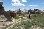
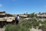
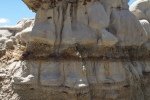
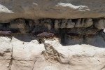
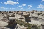
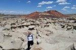
This is a retro-post of a driveabout through western New Mexico. It included a stop at the edge of the Bisti Badlands. I don’t have a GPS track, nor much memory of our visit. But here are photos of our ‘brush’ with the Badlands.

To’hajillee Driveabout – 10/23/2020

A friend has been describing some amazing geophysical features in the Rio Puerco valley, north from I-40 and the To’hajillee Indian Reservation. For this trip, we took our shot at finding the area.

The Drive About

Tohajiilee Driveabout.Pat.2020-10-23

To’hajiilee is a reservation of the Cañoncito Band of Navajos that occupies a large area of the Rio Puerco valley north of I-40. Westbound on I-40 from Albuquerque, we took the exit for the Route 66 Casino, and at the traffic circle turned north on Rio Puerco Road.

We continued on Rio Puerco road (also identified on our topo map as Trail 57) for 3.77 miles, then turned left onto Trail 57. This took us to Cañoncito (7.75 miles) where we turned right (north) on Trail 56 for a half mile to an intersection where we opted to bear to the left (Trail 7041) and towards what appeared to be more interesting terrain. A couple of miles further, we bore to the right onto Route 7041, turning left in 3.4 miles onto Rte 7076, climbing up onto La Mesa Quebrada. We continued for another 6.7 miles where the road became a 2-track (at a home site); we opted to turn back at this point, not having found the formations we were looking for. 

We returned via the same route to Cañoncito, then chose to continue on the paved Trail 56 (Cañoncito School Road) to I-40 and home.

Highlight

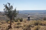
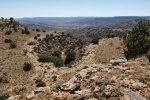
As always, we enjoy so much getting out into New Mexico’s outback. Trips like this provide the opportunity explore the geography and see the topography in its various shapes and forms. In so many places the views across valleys and canyons, even arroyos, are magnificent. We realized that we had not found the geologic formations. We will return with plans for another route, possibly staying of Rio Puerco Road instead of turning right onto Trail 57.

Statistics (driveabout)

Total Distance:  42 miles (from exit off of I-40)
Elevation: start  5,286 ft, maximum  6,482 ft,  minimum 5,286 ft
Duration: 3:15

GPS Tracks

GPS Track Files for Download
87 Downloads
135 Downloads
I urge you to explore our hiking tracks with Google Earth. With the virtual 3-dimensional presentation, achieved by panning and tilting the view, you can get a much better idea of the hikes and terrain than you can get from the 2-dimensional screenshot above. For assistance: Using Google Earth Track Files.

References and Resources

Wikipedia: Tohajiilee Indian Reservation

Piedra Tenate Driveabout & Hike – 01/21/2020

P1040497.JPGThis was our second hike on a two day adventure in San Miguel del Valle in the Tlacolula Valley in Oaxaca. We spent the night in an Ecotourism cabin in the pueblo, then met our guide Memo for another trip into the Sierra Norte
.

The Drive In

P1040502.JPG The drive took us up a narrow dirt and gravel road that clung to the steep side of the mountains, like yesterday climbing from 5,000 feet to over 10,000. It appeared one section of the road had only recently been carved out, corroborated by the absence of that portion of the road on my topo map and on the current GoogleEarth image. A road like this carved out of the mountain gave us some spectacular views across the large canyon and down towards the open plain of Tlacolula Valley.

The Hike

P1040505.JPGParking a short distance from the highway, we hit the trail, at first a two-track with easy walking through the high altitude forest of these Sierra Norte mountains. Near the edge of a large relatively flat area, we had a superb view down into a valley leading to San Miguel. A half mile on, we left the forest for an open hillside and views into the valley in the other direction. Turning back to make a loop, we came across developments from past agrigulctural activities, including a circular enclosure of rocks that was used in time past for threshing grains.

Highlight

Highlights of this trip with Memo were the many flora that we found and admired along the way.

Statistics

Total Distance: 2.34 miles
Elevation: start 8,793 ft, maximum 8,793 ft, minimum 8,423 ft
Gross gain: 370 ft. Aggregate ascending 493 ft, descending 492 ft
Maximum slope: 33% ascending, 44% descending, 7.4% average
Duration: 2:42

GPS Track Files for Download
85 Downloads
213 Downloads
73 Downloads
78 Downloads
161 Downloads
87 Downloads
If you haven’t explored these hiking tracks with Google Earth, I urge you to try it. With the virtual 3-dimensional presentation, achieved by panning and tilting the view, you can get a much better idea of the hikes and terrain than you can get from the screenshot above. For some ideas, check out  Using Google Earth Track Files.

Cueva de Bandidos Driveabout and Hike – 01/20/2020

For this post, in addition to describing a Hike in the territory of the village of San Miguel del Valle in the Sierra Norte, this entry in my journal is also about the Story leading up to this adventure and the Driveabout Inbound getting to the hiking trail, and the Driveabout Outbound returning to San Miguel del Valle .

The Story

This adventure actually began two days earlier when Pat and I forayed from Oaxaca City to the Zapotec village of San Miguel del Valle to arrange an overnight trip, with hikes scheduled for both days. Our past 3 years of experience, almost always with a guide of some form, had given us sufficient confidence that, with our meager Spanish, we could 1) take public buses to San Miguel, and 2) arrange with the staff at their Ecotourism office for a cabin and hiking guide.

  • From the Baseball Stadium in Oaxaca City where one can catch transportation going east, we caught the bus to Tlacolula planning to then get a bus or a colectivo to San Miguel.
    • Colectivos provide transportation to nearly all of the villages within many miles of Oaxaca City. They are much less expensive than taxis, but collect riders until all 5 seats are filled. This can make for a less than comfortable ride; buses are generally more comfortable.
  • We got off the bus in Tlacolula and easily found the station for buses to San Miguel. After 15 or 20 minutes waiting we were on our way. In San Miguel we easily found the Ecotourism office where we hoped to make arrangements for our visit.
    • San Miguel, like all the Zapotec villages in those parts, is a cooperative community in which citizens take their turn at various jobs, much like the Pueblos in New Mexico. The two people in the Ecotourism office received us warmly but spoke no English. Even with our meager Spanish we were able to communicate our desires (a cabaña for one night and a guide for hiking on each of the two days) and we believed we had successfully completed the arrangements.
    • As our final step, we asked if we could get a guide who spoke English. They made a phone call and we were speaking with a gentlemen with excellent English. We reviewed with him what we believed we had arranged, he confirmed it all with the office members, and we scheduled to meet him two days later.

Having enjoyed such good fortune in getting to San Miguel for planning, we were ready to repeat the travel from Oaxaca City for our adventure.

  • As before, now with our packs and overnight bag, we caught a bus from the Baseball Stadium headed for Tlacolula.
  • The bus didn’t stop at the bus station as it had the other day. We realized this as it started to leave Tlacolula on its way to another nearby town; we got off the bus at the outskirts of the village to wait for a bus or colectivo going to San Miguel.
  • After waiting 20 minutes or so, we walked the half mile back to the center of town and the transportation hub, ultimately getting a ride in a colectivo.
    • We later learned that the citizens of San Miguel were in a town meeting at which everyone is expected to attend, including drivers for buses and colectivos. Thus, none were running while were waiting.
  • The colectivo deposited us in the parking lot for the Ecotourism. Our guide wasn’t waiting there for us as expected – he was in the town meeting along with everyone else. He joined us shortly, introduced us to our cabaña, and we headed out for the day’s tip into the mountains.
  • Throughout all this, everyone we encountered was friendly and helpful which we’ve found to be a universal trait of Oaxaceños.

I relate all this because it brings back memories for us (now and when we read it in the future), and also in hopes that others can use our experience as a jumping off point for your own adventures.

The Driveabout Inbound

Having met up with Memo, we first stopped by a cafe in San Miguel for lunch where we had about the best chicken soup ever. Then we headed up into the Sierra Norte in Memo’s car. After a few miles on a paved road passing through dry scrubland, we started ascending into the mountains. We soon found ourselves 1) into the forest, 2) on a road climbing steeply with a steep drop off on one side or the other, and 3) winding through sharp switchbacks.
Reaching the pueblo of Cuajimoloyas, at 10,000 feet elevation, we stopped briefly where Memo pointed out the extent of the San Miguel Parque. Each of the pueblos in these Sierra Norte mountains has jurisdiction over a defined territory which they manage for the benefit of the community. Memo had pointed out on the drive up that the road is generally the boundary between the San Miguel’s territory and the adjoining pueblo’s. The pueblos hereabouts are recognized as ecotourism destinations and have developed trails and other amenities; Memo showed us on the billboard map the trails for the San Miguel Parque.

Back in the car, we continued a bit further on paved road before turning off onto a good though seldom-used two-track,  driving through an open forest of pine, oak, and other trees. In some 2 miles we stopped for the hike for this day.


The HikeP1040484The weather up here high in the mountains was foggy (this is sometimes referred to as a Cloud Forest) and quite chilly and we missed the blue skies so typical this time of year. The hike began by going through some open forest, but we soon found ourselves descending into a deep, narrow, even dark canyon, winding our way between rock walls. Then we came upon a small cave, then a very large cave – the Caves of the Bandits? The trail showed regular use, even with stair steps where necessary, to climb up or down rock ledges. Further along we passed by a pool of water and more large crevices, all pointing to the advantage of this area for bandits to hide out. The climb out of the canyon was on a long stairway constructed with local materials – sections of the small diameter trunks of pine trees prevalent in the area, or steps carved in the rock.

The return trail was again through the tropical forest so prevalent in the area. Along the way we admired the many plants new to us – the huge agave plants (not suitable for making mezcal), bromeliads, a few flowers (I wonder what it is like during and after the rainy season). We finished by climbing up on a large bed of rock to look across the canyon, and as far as the fog permitted, the mountains beyond.

The Driveabout Outbound

P1040486The drive out followed a different route. Still on what appeared to be seldom used two-track in good condition, we enjoyed the scenery of this high mountain forest. We stopped at a large meadow with a lake and a few cabins constructed on the hillside above the lake; Memo told this was a favorite getaway for people from San Miguel, to come high in the mountains in summer to escape the heat in the valley. (I was late in starting the GPS track, so the the .kml file misses the first mile or so of the driveout.) The two-track brought us to the pueblo of Llano Grande where we stopped for a break before heading back down to San Miguel. This included a visit to the cafe where we enjoyed chocolate con agua and herbia te while standing around the wood-fired stove in the kitchen for the warmth. It was then back down to San Miguel for a night in their cabana.

Statistics

Total Distance: 1.06 miles
Elevation: start 9,994 ft, maximum 10,092 ft, minimum 9,933 ft
Gross gain: 99 ft. Aggregate ascending 232 ft, descending 231 ft
Maximum slope: 28% ascending, 18% descending, 7.6% average
Duration: 2:00

GPS Track Files for Download
81 Downloads
251 Downloads
79 Downloads
78 Downloads
139 Downloads
74 Downloads

I urge you to explore our hiking tracks with Google Earth. With the virtual 3-dimensional presentation, achieved by panning and tilting the view, you can get a much better idea of the hikes and terrain than you can get from the 2-dimensional screenshot above. For assistance: Using Google Earth Track Files.

References and Resources

ZapoTrek: Cueva Iglesia Trip Advisor: Zapotrek Hike and Bike – Cueva Iglesia Hike

Valles Caldera DriveAbout – 07/14/2019

My brother, Garth, came to visit us for a week.  After a few days of working together on the cabin (the usual excuse for him to come to New Mexico), on Sunday with Pat we headed to the Jemez Mountains and Valles Caldera for some cooler temperatures and the scenery. Checking in at the Visitors Center of the Valles Caldera National Preserve, we learned that the culvert that was washed out this past winter had been repaired and we could drive further into the Caldera – just what we were hoping for.

The Drive from Albuquerque to Valles Caldera

For those who haven’t visited this territory, here is a screenshot of the drive from home in Albuquerque to the entrance to the Valles Caldera National Preserve. It is an 81 mile drive, via I-25 northbound to Bernalillo (19 miles), then US 550 northwest bound to San Ysidro (23 miles). From there north on NM 4, through Jemez Pueblo, Jemez Springs, and La Cueva (26 miles), then to the entrance to Valles Caldera National Preserve (13 miles). To explore it further, download the GoogleEarth .KML file from the link below. [A note: don’t exceed the 30 mph speed limit in the Jemez Pueblo; their police are serious and enforce the limit.]

Valles Caldera Driveabout.PatGarth.2019-07-14

This drive itself is worth a day trip. After Bernalillo, the scenery is interesting ‘tho distant – White Mesa ahead, the red and rugged Mesa Cuchilla a bit to the right, and the Jemez Mountains off to the north. A few miles up NM 4 you will pass through the Jemez Pueblo (keep your speed below 30 mph), then a few more miles through Walatowa where the red cliffs dominate the view; the Walatowa Visitors Center is worth a visit. Along the way NM 4 follows the Jemez River with numerous parking areas for fishing (and a Forest Service campground – Vista Linda).

Leaving Walatowa and passing the Jemez Valley High School you will enter the narrow Cañon de San Diego with  Mesa de Guadelupe and then Virgin Mesa on your left,  and Mesa de las Casas and then Cat Mesa on your right, rising vertically from the Jemez River. NM 4 winds its way up the cañon to Jemez Springs, an interesting small village with restaurants, a truly old-time bar (Los Ojos), and a new tap room (Second Alarm Brewhouse, a “new-time” bar?). Continuing on NM 4 you will be climbing to higher elevations (and cooler temperatures), passing Soda Dam, more fishing spots, Battle Ship Rock, and … then on your right the tallest cliffs so far. Shortly you will reach La Cueva, really just a crossroad with a general store, and .. Nomad Mountain Pizza, where you will find a really great pizza (check online for their days and hours of business).

From La Cueva the climb continues – the road is ascending the southwest rim of Valles Caldera (La Cueva 7,800 ft, . About 5.5 miles from La Cueva you will make the first crossing of the East Fork Jemez River (in Cajete Cañon), and a half mile further trailheads for the East Fork Trail; the trail goes west towards McCauley Warm Springs, and east to the Jemez River Box – both make great hikes. From there the road takes you along the southern section of the rim and then down into into the Caldera. As you break out into the open, you will enjoy a grand view of Valle Grande – it is awesome. (Beware: the space of Valle Grande is so open and vast that it thoroughly confounds one’s sense of distances.)

(A note: I overheard a Forest Service Ranger at the Visitors Center point out that this Valle Grande -is only a small part the the Caldera. From NM 4 the distance to the far side of the Valle is only 4.3 miles to the north, 5.5 miles to the northeast. The diameter of the Caldera is more that 12 miles.)

The DriveAbout in Valles Caldera

As noted above, on our previous visits we weren’t able to drive past a washed-out culvert. Since then, repairs had been completed so we could drive into Valle San Antonio, the northern portion of the Caldera (screenshot below). Driving beyond the Visitors Center requires a pass and .. a promise to be back at the Center 30 minutes before closing (5:30 during regular summer hours). The road, VC01 from the Center then VC02 heading north, is well maintained (for a graded gravel road in New Mexico). It is certainly suitable for ‘street vehicles’ (high-clearance not required – just take it slow on the rocky and washboard sections). Again – distances are hard to judge – the drive from the Visitors Center to the junction with  VC09 in Valle San Antonio will require 45 minutes or longer (important for planning, to as to be sure to return to the Center by 5:30).

Valles Caldera Driveabout.CalderaDriveAbout.PatGarth.2019-07-14

The drive from NM4 is downhill all the way, but the view across the Valle is stunning. From here one can often see herds of elk out in the Valle – they appear so small because they are so far away. As you approach the Visitors Center, slow down for the Prairie Dogs.

Driving west from the Visitors Center (again, drive slow, watch for the prairie dogs) you will enter the Cabin District, a collection of ranch buildings from the days when this was a working ranch. The Caldera has been the set for many movies and TV series, notable among them The Lone Ranger (2013) and Longmire (2012-2017). Garth is standing in front of the cabin that was the centerpiece for Longmire.

Proceeding north on VC02, the road gains elevation and the full extent of Valles Grande becomes apparent. The Visitors Center shrinks in the distance. Some 2 miles from the Cabin District, you will pass a road down to the Horse Corral. Then around a curve into Valle Jaramillo and across the Creek (same name); this was the washed out culvert.

Continuing on VC02 north in Valle Jaramillo between smaller mountains in the reserve, the view opens up again to the west. Jaramill Creek is bounded by lush grasses (and we have seen people fishing for trout in the creek. Some 6 miles further on you will enter into Valle San Antonio, much larger than Valle Jaramillo. Another mile or so you will come to a T in the road, with VC09 going east and west from this junction. We opted to go east, for just a short distance – time was approaching when we needed to head back to the Visitors Center before 5:30.  

GPS Track Files for Download
94 Downloads
102 Downloads
103 Downloads
114 Downloads
I urge you to explore our hiking tracks with Google Earth. With the virtual 3-dimensional presentation, achieved by panning and tilting the view, you can get a much better idea of the hikes and terrain than you can get from the 2-dimensional screenshot above. For assistance: Using Google Earth Track Files.

References

National Park Service:
    Valles Caldera National Preserve    
    Maps
National Parks Traveler: Exploring The Parks: Valles Caldera National Preserve
Wikipedia: Valles Caldera
NM Museum of Natural History and Science: Valles Caldera, Jemez Volcanic Field
GeoTimes: A Secret Garden: New Mexico’s Valles Caldera
Facebook: Valles Caldera National Preserve
National Parks Traveler: Exploring the Parks: Valles Caldera National Preserve
BikePacking: Valles Caldera Supervolcano Explorer, New Mexico
     (a superb photo gallery)
And check other posts for Valles Caldera

FR 289 St Peter’s Dome Driveabout – 06/26/2019

With only a half day before heading home from this 4-day camping trip to the Jemez Mountains, we chose to make a DriveAbout rather than a hike. We had explored FR 289 on a previous visit, and developed a curiosity about driving further.  After scrutinizing  Forest Service and Topographic maps, and having gone most of the way, our interest was to go further, to discover if we could get to St Peter’s Dome.

The Drive About

FR 289-St Peter’s Dome Driveabout.Pat.2019-06-26

We’ve developed a classification system for roads:

  • Class 1 – paved in good condition
  • Class 2 – paved but breaking up
  • Class 3 – “New Mexico Paved”, graded sand or gravel in good condition
  • Class 4 – ungraded, in good condition, typically a two-track (don’t go if not dry)
  • Class 5 – a two-track but -not- in good condition (high clearance vehicle required, don’t go if  not dry)
  • Class 6 – good for hiking!

FR 289 is clearly a Class 3 – great condition even for a New Mexico Paved road (it had even been graded since our previous visit). There was one rocky, steep section with sharp drop off that gave us pause – to take it slowly and carefully. In the past, one could take FR 289 all the way to Cochiti Highway, down by Cochiti Reservoir. These days a gate at the boundary to the Cochiti Reservation prevents through traffic; when we were there “unofficial” signs so warned us.

Seven miles from NM 4 we turned left onto FR 142; this would be a Class 5 road – high clearance vehicle advised. FR 142 ends 3.5 miles from FR 289, ending with an immediate dropoff but a spot wide enough to turn around. From here a Class 6 two-track continues beyond a closed gate to the summit of St Peter’s Dome. On Google Earth I measure it to be 1 mile to the summit, from 8,118 to 8,460 feet elevation (342 ft gain); it is there waiting for us to return.

The view approaching St Peter’s Dome from FR 289; the dome has the two ‘bumps’ on its summit, the one to the right being a rock building lookout tower. Just visible as a line in the left center of the photo is FR 142 as it climbs up to the left on the northern slope of the Dome.
At the end of FR 142: To the left, Boundary Peak. To the right, the two track beyond the gate leading to the summit. In the center, across the Pajarito Plateau towards Bandelier in Frijoles Canyon, across the Rio Grande Canyon below White Rock, and the Sangre De Cristo on the horizon beyond Boundary Peak.
At the end of FR 142: Looking west across the deep canyons that slice through the San Miguel Mountains: Sanchez, Cochiti, Bland – very rugged terrain. And on the horizon to the right, the mountains of Valles Caldera.

As the photos show, the mesas and cañons are denuded by fires, the Dome Fire in 1996 and the Las Conchas fire in 2011. Jay and I had visited the southern area of the Dome Wilderness back in 2016 (“Dome Wilderness, Sanchez Water Fall Hike – 9/25/2016“); the area was nearly devoid of plants. This year, at least in this northern portion of the Wilderness, plants are returning (especially this year with the snow and rain we’ve enjoyed).

As mentioned in our recent Alamo Spring hike, the absence of forest affords great views. The topo map depicts three trails that emanate from the parking place, the St Peter’s Dome trail going south, the Boundary Peak trail going east, and a third trail going north. Each connects with other trails in the Dome Wilderness or Bandelier National Monument. The canyons hereabouts are steep and deep, making such hikes daunting, but they must be quite scenic. Spending some time with Google Earth (including the EarthPoint Topo Map overlay), I can see some out-and-back hikes, and in one instance maybe even a loop of 5 or 6 miles going east of St peter’s Dome.

We look forward to returning, going to the summit of St. Peter’s Dome, and exploring these other trails. The track files below show our complete drive, from the Jemez Falls campground east on NM 4, then right on FR 289, St Peters Dome Road for 7 miles, then left on FR 142 (also St Peters Dome Road).

GPS Track Files for Download
141 Downloads
101 Downloads
If you haven’t explored these hiking tracks with Google Earth, I urge you to try it. With the virtual 3-dimensional presentation, achieved by panning and tilting the view, you can get a much better idea of the hikes and terrain than you can get from the screenshot above. For some ideas, check out  Using Google Earth Track Files.

References

(I’m including a wide range of references related to the Dome Wilderness; there is so much to explore. Other resources may be found for hikes starting from the Visitor’s Center of Bandelier National Monument.)
Forest Service:
    St. Peter’s Dome Trail (just a brief description)
    Wilderness Areas in the Santa Fe National Forest
AllTrails:
    Saint Peters Dome Trail
    Canada-Capulin Trail
Los Alamos NM: 50 Hikes in the Los Alamos Area (PDF)
Sangres.com: Dome Wilderness
SummitPost:
    Dome Wilderness (an excellent overview, including list of features)
    Saint Peters Dome WanderLust: Wanderlusting St. Peter’s Dome NM
Volunteers for the Outdoors: St. peter’s Dome Trail
Mountain Project: Capulin Canyon Rock Climbing

Querencia Arroyo Driveabout & Walkabout – 04/01/2019

We went looking for new territory in the Ojito Wilderness. I’d planned to park on US 550 across from the north end of Dragon’s Back and explore the valley below the Back and the mesas and such to the east.  (Thanks to a Land Ownership overlay for Google Earth, I knew that we would be on state-owned or BLM land.)  However, as we drove away from San Ysidro, I looked over at the Rio Salado and, behold, there was water running in it.  That meant that we’d have to ford the Rio to get to the area of interest, so … we went to Plan B.

The Driveabout

Querencia-Arroyo-Driveabout.Jay_.2019-03-31

I’d often noticed a gate on the left further along on US 550; we found it to be only chained shut (not locked) and a sign “Ojito Wilderness” beckoned us to enter. Driving past some well-built corrals, we found ourselves on a reasonable well used two-track. Upon reaching the Rio Salado we found water running, only a few feet in width against the near shore.  The bottom appeared to be hard as did the sand beyond, so putting the Tacoma in 4-wheel drive we drove through – easily.

From there we proceeded into an exploration of the northern extents of the Ojito Wilderness. The two-track was generally good, until that is we encountered a more challenging stretch – steep and somewhat washed out (I think one would need a high clearance vehicle for this stretch). Just past this stretch was a gate. Our first thought was to hike from here, but after a quarter of a mile on foot, the wind and cold caused us to reconsider – back to the gate (again only chained) and make this a DriveAbout.

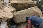
Jay, rock surfing again. He’s getting good at it.

Continuing on what would be a ‘nice’ two-track, we headed southeast in the Querencia Arroyo with Cucho Mesa on our right and unnamed mesas ahead. Encountering a ‘Y’ in the two-track, we headed more westerly into a large basin; we continued until the two-track ended at the base of the mesa.  Still curious about the area, particularly if we might get near territory familiar from other hikes, we returned to the ‘Y’ and went up the other leg (labeled on the topo map as a “jeep trail”). We proceeded until encountering a ravine crossing that was more than we wanted to challenge.

The Walkabout

Querencia Arroyo Walkabout.Jay.2019-03-31

We chose to do a WalkAbout (just wandering, not a great distance), exploring galleries protruding into the ‘unnamed’ mesa.  (We were also curious about the condition of the two-track beyond our stopping point; as far as we explored, it was in good condition. On further inspection via GoogleEarth, it appears to be very challenging further along as the canyon becomes more narrow before topping out still some distance from Pipeline Road. It would seem to make a great route for something more nimble than the Tacoma, like an ATV or such.)  After the WalkAbout, we enjoyed our traditional mid-hike snack, then headed back to US 550. 

Jay here: When the wind was at our backs it did not seem that cold. Then we turned back into the wind and realized that the combination of wind and temperature was making it a bone chiller. Happy to get back in the Tacoma out of the wind. All of this area is worth exploring again under better weather conditions, but before the blistering summer heat. Sometime in May might be about the right time…unless the aforementioned Rio crossing is still running strong with snowpack runoff.

Compilation of our Hikes in the Ojito Wilderness (link to KML file below)

Through all this, we were curious about our position in this excursion relative to the many other hikes we’ve made in the Ojito Wilderness. Using that wonderful tool, GoogleEarth, I plotted those hikes.  As you can see (click on the screenshot above for a bigger view), we were still some distance from any previous hike. But .. I see that this entrance into the Ojito (red line near top of screenshot) offers potential for more hiking, to explore this amazing geology. And … what else might we find (like the petrified wood pile we found on a hike back in 2017).

Statistics

Total Distance:  1.15 miles
Elevation: start  5,660 ft, maximum  5,717 ft,  minimum  5,660 ft
Gross gain:  57 ft.  Aggregate ascending  216 ft, descending  205 ft
Maximum slope: 43% ascending, 49% descending, 5.8% average
Duration: 0:54  

GPS Track Files for Download
110 Downloads
63 Downloads
107 Downloads
129 Downloads
607 Downloads
148 Downloads
I urge you to explore our hiking tracks with Google Earth. With the virtual 3-dimensional presentation, achieved by panning and tilting the view, you can get a much better idea of the hikes and terrain than you can get from the 2-dimensional screenshot above. For assistance: Using Google Earth Track Files.

References

Hiking in New Mexico: Our hikes in the Ojito Wilderness
    Descriptions, tracks, references, and photos

NW New Mexico RoadTrip – 04/25/2018

To extend our travels in New Mexico, we set out for a two-day road trip to the northwest part of the state.  Our goal was to explore back country, spending a night in Farmington.  A bit of research in advance brought to light some interesting places to visit (see the References below).

The Trip

NW New Mexico Road Trip.Pat.2018-04-25

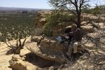
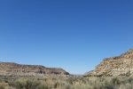
So, it was on US 550 going west, passing through Cuba to Counselor (barely a wide spot in the road), and turning north on NM 403, a 50+ mile unpaved road that runs the length of Largo Canyon.  ‘Tis a two lane, well graded road most of the time, thanks to it’s use by the oil and gas industry (this is ‘their’ territory).  Flanked on both sides with mesas 50′ up to maybe 150′ in height, with many side canyons going off to the left and right.  ‘Twas our plan to visit at least one of the Pueblitos (see reference to GoogleEarth file below); it soon became apparent that most of the Pueblitos are located on the top of the mesas.  We identified one for which it appeared a road ascended to the mesa top not far off or NM 403: Kin-Yazhi Pueblito.  We were able to crest the mesa, but the road towards the Pueblito was blocked, leaving us with a 1.7 mile hike.  Uncertain about details of our plan for the remainder of the trip, we passed on the hike – next time.

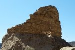
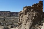
Continuing north on NM 403 we found a Pueblito that was at the base of one of the mesas: Foothold Pueblito.  Taking a 3 mile diversion up Palluche Wash, we then turned onto a two-track that would take us to the Pueblito.  There was a moment of surprise when we looked down the two-track as it descended a -steep- embankment, then crossed 150 yards of sand in the bottom of the Wash.  It was -dry- however, so with 4-wheel drive engaged, we crossed easily.  And found our way to the Foothold Pueblito – quite interesting, as it sits atop a very large, rectangular rock at the base of Superior Mesa. It was then on to Farmington for the night at Casa Blanca Inn & Suites.

The next morning after breakfast at the Inn, we headed to Aztec to visit the Aztec Ruins National Monument to tour this 900 year old Pueblo. From there we went to check out Navajo Dam and Reservoir.  We will remember mostly that the road crosses the dam; the two lanes are minimal width, no shoulder or guardrail, and it is a very long way down the steep slope of the face of the dam if one should leave the road.  We’ll avoid doing that in the future.

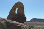
From there we started out for home, but taking a short side trip to check out the miniature Natural Arches that have been located throughout the area (see the link below).  We chose a side road off of NM 173 that led to 3 or 4 arches (according to the map).  Parking at the perimeter of a gas well pad, we wandered around looking up at the rock face, and found them, small bridges over an opening to the sky beyond.  After a small lunch, we hit the road, choosing to go ‘cross country’ on NM 537 through the Jicarilla Apache Indian Reservation.  This road makes for a pleasant drive through forested hills, a change from the desert environment of Largo Canyon.  Then home via US 550 – we’ll return for more exploring, particularly in Largo Canyon.

Statistics

GPS Track Files for Download
145 Downloads
56 Downloads
423 Downloads
302 Downloads
148 Downloads
60 Downloads
I urge you to explore our hiking tracks with Google Earth. With the virtual 3-dimensional presentation, achieved by panning and tilting the view, you can get a much better idea of the hikes and terrain than you can get from the 2-dimensional screenshot above. For assistance: Using Google Earth Track Files.

References

Aztec, New Mexico
   Dinetah Pueblitos & Historic Homesteads in Largo Canyon
   Natural Arches
  Aztec Ruins National Monument
Farmington, NM: Dinetah Rock Art & Pueblitos
National Park Service: Aztec Ruins National Monument