 This was our second hike on a two day adventure in San Miguel del Valle in the Tlacolula Valley in Oaxaca. We spent the night in an Ecotourism cabin in the pueblo, then met our guide Memo for another trip into the Sierra Norte
.
The Drive In
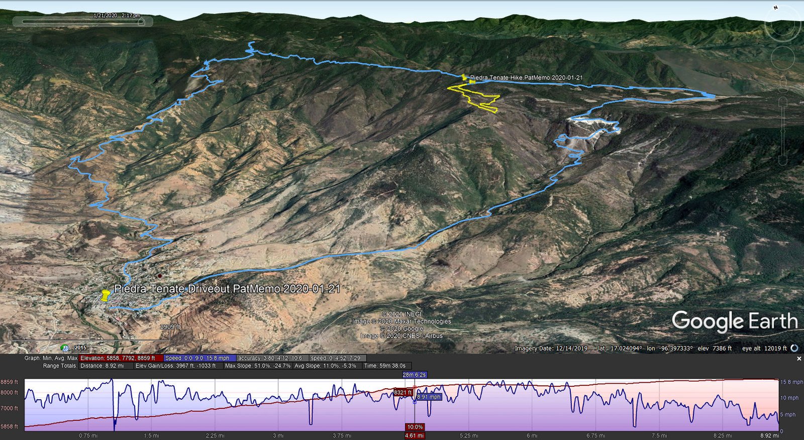
 The drive took us up a narrow dirt and gravel road that clung to the steep side of the mountains, like yesterday climbing from 5,000 feet to over 10,000. It appeared one section of the road had only recently been carved out, corroborated by the absence of that portion of the road on my topo map and on the current GoogleEarth image. A road like this carved out of the mountain gave us some spectacular views across the large canyon and down towards the open plain of Tlacolula Valley.
The Hike
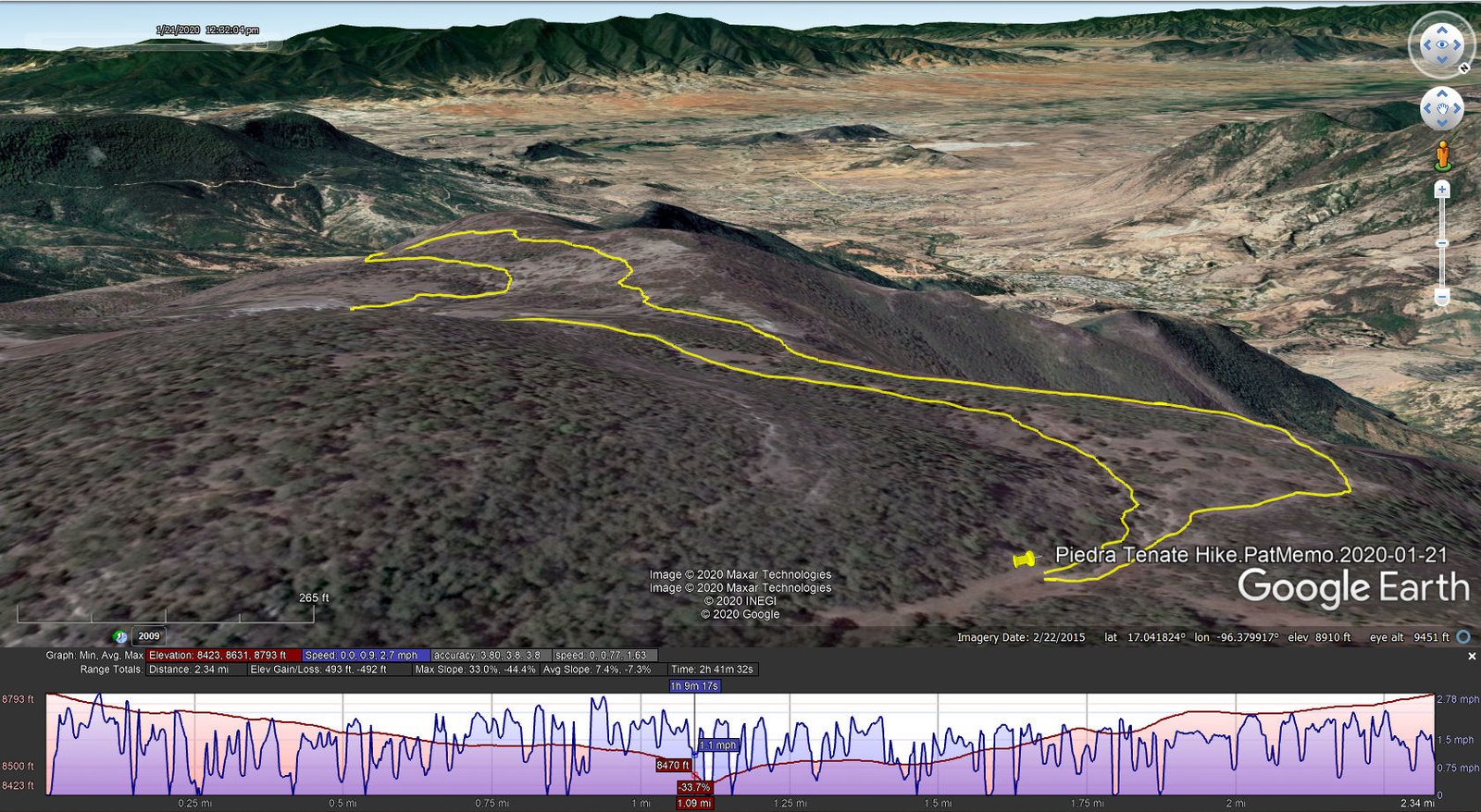
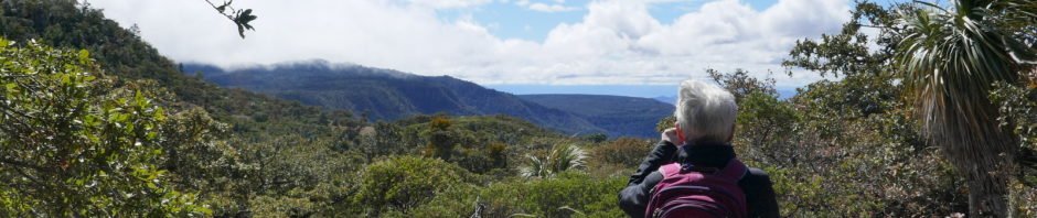
 Parking a short distance from the highway, we hit the trail, at first a two-track with easy walking through the high altitude forest of these Sierra Norte mountains. Near the edge of a large relatively flat area, we had a superb view down into a valley leading to San Miguel. A half mile on, we left the forest for an open hillside and views into the valley in the other direction. Turning back to make a loop, we came across developments from past agrigulctural activities, including a circular enclosure of rocks that was used in time past for threshing grains.
Highlight
Highlights of this trip with Memo were the many flora that we found and admired along the way.
Statistics
Total Distance: 2.34 miles
Elevation: start 8,793 ft, maximum 8,793 ft, minimum 8,423 ft
Gross gain: 370 ft. Aggregate ascending 493 ft, descending 492 ft
Maximum slope: 33% ascending, 44% descending, 7.4% average
Duration: 2:42
| GPS Track Files for Download | |
200 Downloads | |
|---|---|
324 Downloads | |
186 Downloads | |
188 Downloads | |
276 Downloads | |
207 Downloads | |
If you haven’t explored these hiking tracks with Google Earth, I urge you to try it. With the virtual 3-dimensional presentation, achieved by panning and tilting the view, you can get a much better idea of the hikes and terrain than you can get from the screenshot above. For some ideas, check out Using Google Earth Track Files.


