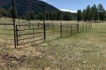
This is our first hike during four days of camping in the Redondo Campground near the Valles Caldera. There aren’t any published trails in this area (that I can find), so this hike is based on planning using topo maps (primarily the US Topo Maps app on my Android smartphone).
Camping
First, some comments about the Redondo Campground. In the previous years Redondo was closed, so we were pleasantly surprised to find that it has been reopened. That was especially welcome information since there were no campsites available in the nearby Jemez Falls Campground. All campsites in Redondo are FF (First come-First serve), 62 of them. We are fortunate to be able to go camping during the week, and as hoped when we arrived there were many campsites available. In fact, during our three nights, only 3 other campsites occupied in the south loop were occupied.
The Hike
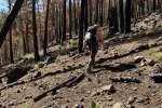
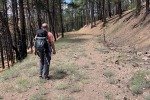
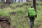
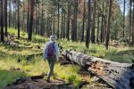
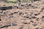
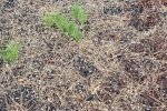
 This hike was an experience in orienteering since there are no published trails and few reports of hiking in the Valles Caldera, especially in this southwest corner of the Preserve. We set out to visit Redondo Meadow, starting from the Redondo Campground. The topography of Banco Bonito is interesting – 20′-50′ mounds and ridges with small valleys (vales?) between, with no discernible drainage pattern. That left us with hiking over the ridges and mounds or around them. The ground is even, often covered with pine needles or with wood chips from recent forest thinning – nice.
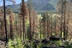
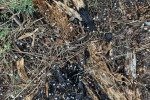
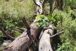
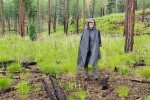
All across Banco there was evidence of fire, some areas from long ago, other instances more recent. Indications of recent burns coupled with large areas of wood chips led us to suspect this was from a recent thinning project. Some trees were cut down, chipped, and chips were spread about particularly on 2-tracks. In other examples, the trees and their stumps must have been selectively burned; there was no evidence of fire beyond a few feet from the stump or trunk. For many of the burned cases, there were tunnels where roots must have completely burned out. This all seemed strange.
The greatest challenge, from looking at the topo maps, appeared to be getting down from Banco Bonito to the floor of Redondo Meadow. We identified a place where the topo lines were further apart and set that for our first waypoint. Approaching it, we came across a 2-track going down the slope giving us an easy descent.
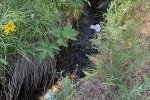
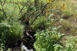
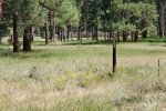
We avoided going directly across the Meadow – it appeared to be a marshy area. Taking a bit of a detour, we crossed in deep but dry grass and headed up Redondo Creek on level and flat ground through open forest. ‘Tho we crossed a 2-track going in our direction, we kept our course, crossing Redondo Creek 2 or 3 times, then hiked along the stream until scrub oak and other bush-type plants made further progress difficult. We stopped for our mid-hike break, then “whacked” our way to the 2-track and started back towards the campground.
We proceeded on the 2-track, including a portion that was elevated above the Meadow – shaded and offered a great view down into the Meadow. From that vantage point we spotted an interesting feature, a circular area of burned grass, in the center a burned tree trunk. Looked to us like a lightning strike.
We remained on the 2-track into Redondo Creek canyon below the Meadow. As earlier, from the topo map we had identified a place where ascent back onto Banco Bonito would be easier; it proved to be a good choice. Back on the Banco, it was the same sort of hiking, mounds and ridges interspersed among small valleys, to return to the campsite.
Our Experience
What We Planned
For our first hike during this camping trip, we were attracted to the open space of Redondo Meadow and the upper reach of Redondo Creek. Looking at the topography, it appeared we would need to find a way to descend from Banco Bonito (where the campground is located) to the meadow floor; that became an “anchor point” for our track. From our campground site, we plotted a track that would take us ESE to a hook in the steep edge of Banco where it appeared the slope would be less than other places. Then our track would proceed across the meadow and up the creek as far as a Geothermal Well identified on the map. For the return, we planned to hike downstream anticipating we would find a way back up onto Banco.
What We Did
This was truthfully our first attempt at “orienteering” and we learned a lot – particularly how important it is to use compass headings. We began by setting a course based on the topography, believing that between the topographic lines on USTopo and what we could see around us. We anticipated that we could follow the ridges and valleys of Banco Bonito and be going the right direction. Ooops .. as you see from our GoogleEarth track, we went northeast for nearly half a mile before realizing we weren’t going in the right direction. We then got out our compasses, set a waypoint for our destination, got it’s bearing from USTopo, and proceeded with compass in hand. Things went smoothly after that.
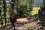
Following the bearing towards our intended descent, working our way around steep climbs onto mounds or ridges in the topography of Banco Bonito, we soon came across a 2-track (Class 5), likely an old logging road. We followed it for some distance, but when it turned away from the bearing to our waypoint, we were again bushwhacking. (Note: Bushwhacking is not an accurate description for transiting this forest; the forest is open, likely thinned in recent years with virtually no undergrowth – very easy hiking.)
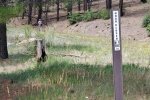
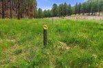
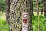
Nearing our waypoint, we came upon another 2-track leading towards the edge of Banco Bonito. Upon investigation, we found that descended to the floor of Redondo Meadow; very nice. At the base of the descent we found trail signs, a couple of yellow-topped posts with arrows and on a tree, “Duke Trail”, and information that this is an equestrian and bike trail going up the 2-track.
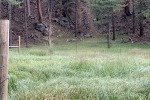
Looking to cross the Meadow, we saw tall, very green grass, an indication that it might be marshy. To avoid a wet crossing, we worked our way to the right where the apparent marshy area was narrower. That proved to be dry and easy to cross. (As we started across the Meadow, we spotted a coyote near a pair of ponderosa pines. As we approached, it moved off 100 yards or so and began barking. Concerned that it was protecting something nearby, we skirted away from it and went about our business. More on this in the post for the next day’s hike.)
On the far side of the Meadow we hiked through more open forest, level ground, easy walking, generally following Redondo Creek. We crossed the Creek 2 or 3 times, working our way upstream until we found ourselves in -real- bushwhacking – thick growth of scrub oak and other plants, including one with thorns that seemed to reach out to grab us. With this, plus having been out for 3 miles, we chose to stop for our first mid-hike break, then start back to make this it our usual 6 mile hike.
After our break, we out ourselves onto the 2-track (Class 4) headed back towards the Meadow. Encountering a Y, we chose the ‘high road’ to the right which was parallel to the ‘low road’ and which gave us a great view of the Meadow below. Returning to the ‘low road’ at the western end of the Meadow, we continued on the Class 4 2-track towards a section of the edge of the Banco that appeared to be less steep slope and not so high. It proved to be a good choice – 100 feet of elevation gain, 17% average slope, easy.
Once back on Banco Bonito, using our newly learned orienteering approach we had successful return to the campground. But .. not before that day’s afternoon shower showed up. We were pelted by pea-sized hail with very few raindrops, which meant we didn’t get so wet; the hail shower subsided by the time we arrived at the camper.
Flowers
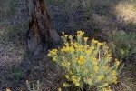
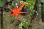
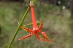
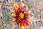
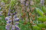
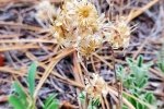
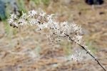
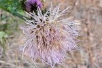
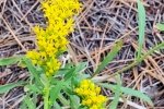
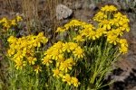
 Many descriptions of hiking in New Mexico advertise the many flowers that can be encountered on the trails, particularly in the mountains. As you may have already discerned from other posts in the BLOG, I am entranced by them. And so, again during this trip, I captured photos of some beauties. You will find a collection in the gallery below.
Statistics
Total Distance: 6.18 miles
Elevation: start 8,145 ft, maximum 8,338 ft, minimum 7,933 ft
Gross gain: 405 ft. Aggregate ascending 1,098 ft, descending 1,099 ft
Maximum slope: 38% ascending, 30% descending, 5.3% average
Duration: 5:15
| GPS Track Files for Download | |
226 Downloads |
|
|---|---|
130 Downloads |
|
I urge you to explore our hiking tracks with Google Earth. With the virtual 3-dimensional presentation, achieved by panning and tilting the view, you can get a much better idea of the hikes and terrain than you can get from the 2-dimensional screenshot above. For assistance: Using Google Earth Track Files.
References and Resources
Wanderlust: Wanderlusting Banco Bonito
A very interesting explanation of the geology of the area, including Banco Bonito
USDA Forest Service: Redondo Campground
Bivy: Valles Caldera: Banco Bonito
ExploreNM: Redondo
Campendium: Redondo Campground


