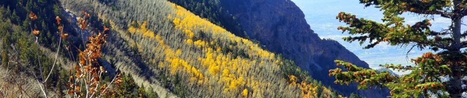
‘Tis autumn when the aspen forests “bloom” in bright yellow. The northwest slopes of North Sandia Peak have a large forest of aspen. Back in 2017 we hiked the North Crest Trail hoping to catch them in full glory – we were late. This year, we again attempted to see the spectacle – but again we were just a bit late. Next year .. ??
The Drive In
From downtown Albuquerque: east on I-40 to the Tijeras turnoff, then north on NM 14 through Cedar Crest to Antonito and the turnoff for NM 536, Sandia Crest Road (also known as the Sandia Scenic Highway). The Crest Road has many twists and turns, many at 20 mph to change direction by 180° or more. But that’s the way to get to 10,000 feet in 17 miles. There is ample parking at the Sandia Crest House (‘tho a $3 “Amenity Fee” or an America the Beautiful Pass is required; our Senior Pass was sufficient).
The Hike
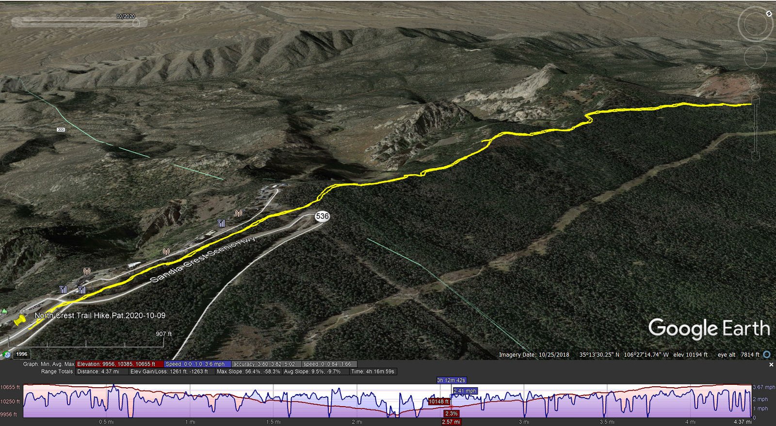
North Crest Trail Hike.Pat.2020-10-09
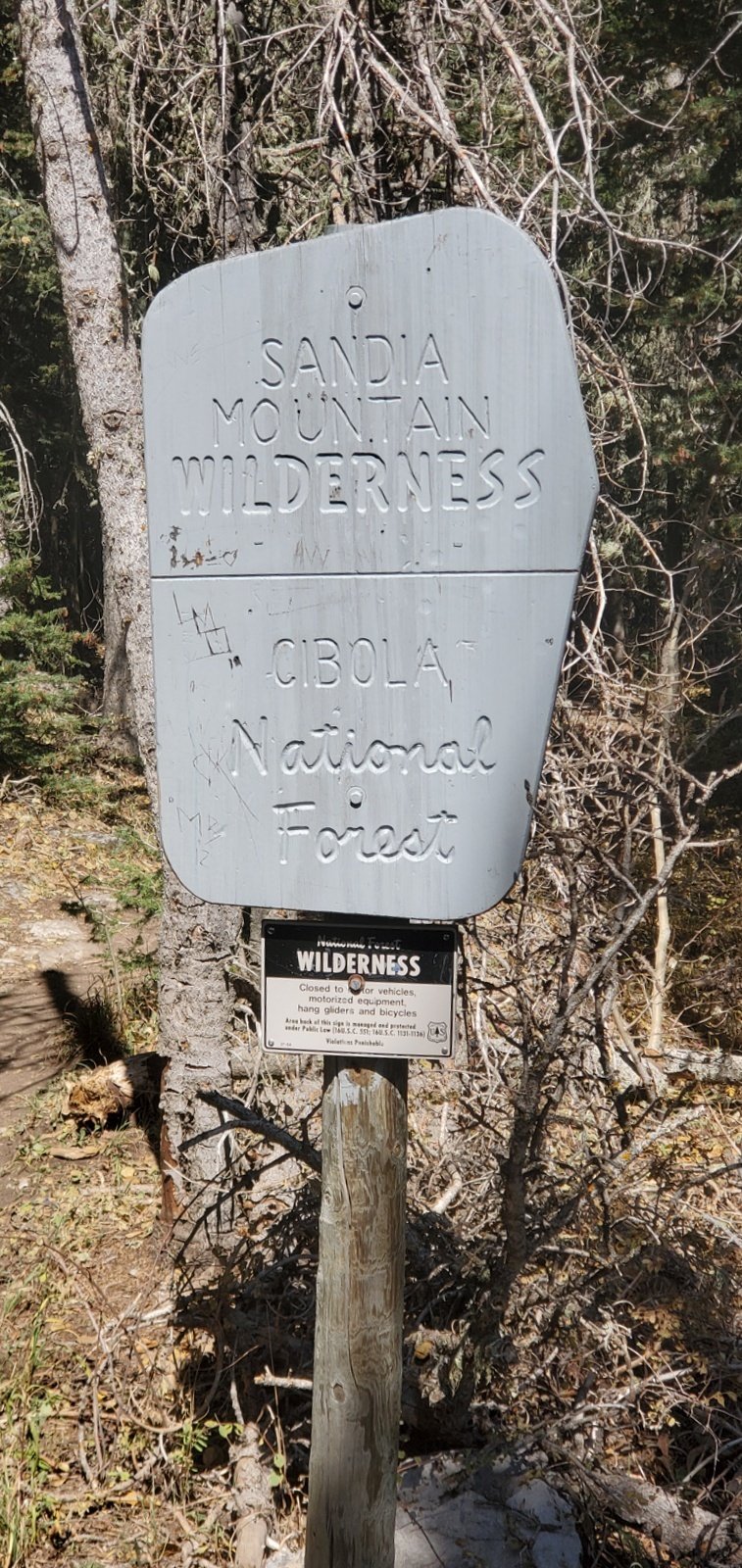 The trail begins at the north end of the parking lot by skirting the downhill (east) side of the radio antenna compound. A half mile along it follows along the edge of the Crest. We passed by the Ys in the trail (referred to in our hike earlier this year), intent on getting to the Del Agua Overlook and
 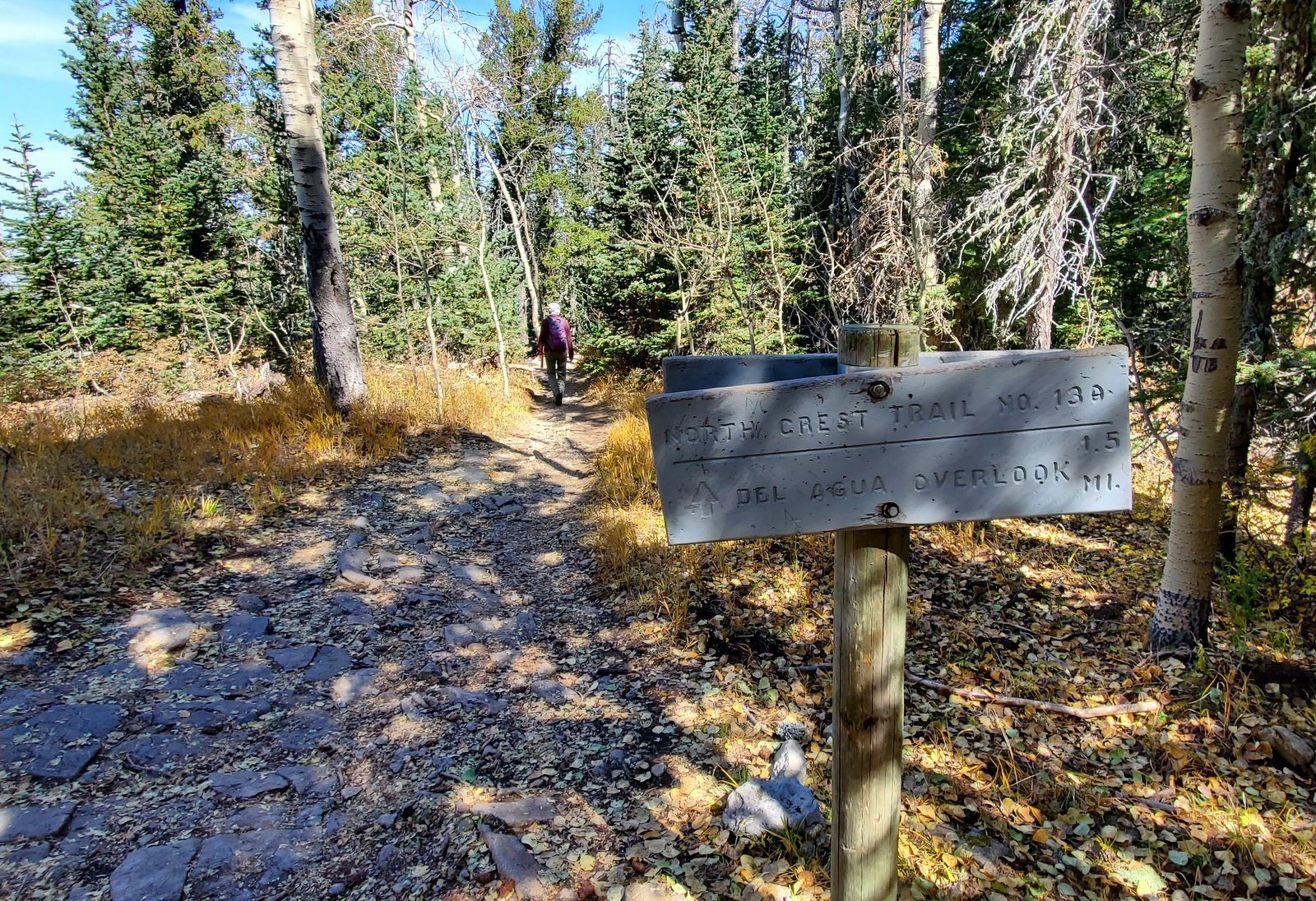 a view of aspen in full color. The trail descends almost all the way, from 10,645 ft to 9,950 ft at the Overlook. The surface is in places rocky (solid, not loose) and in other sections a dirt trail surface, often covered by aspen leaves that had fallen.
 Along the way we could see aspen along the trail, some in bright color but many already turning “dirty yellow” or the leaves had a
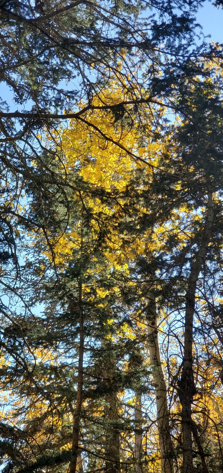 lready fallen. This did not bode well for the destination view. And … sure enough, most of the slope of North Sandia Peak was bare aspen, except of one section in the middle that still had some color.
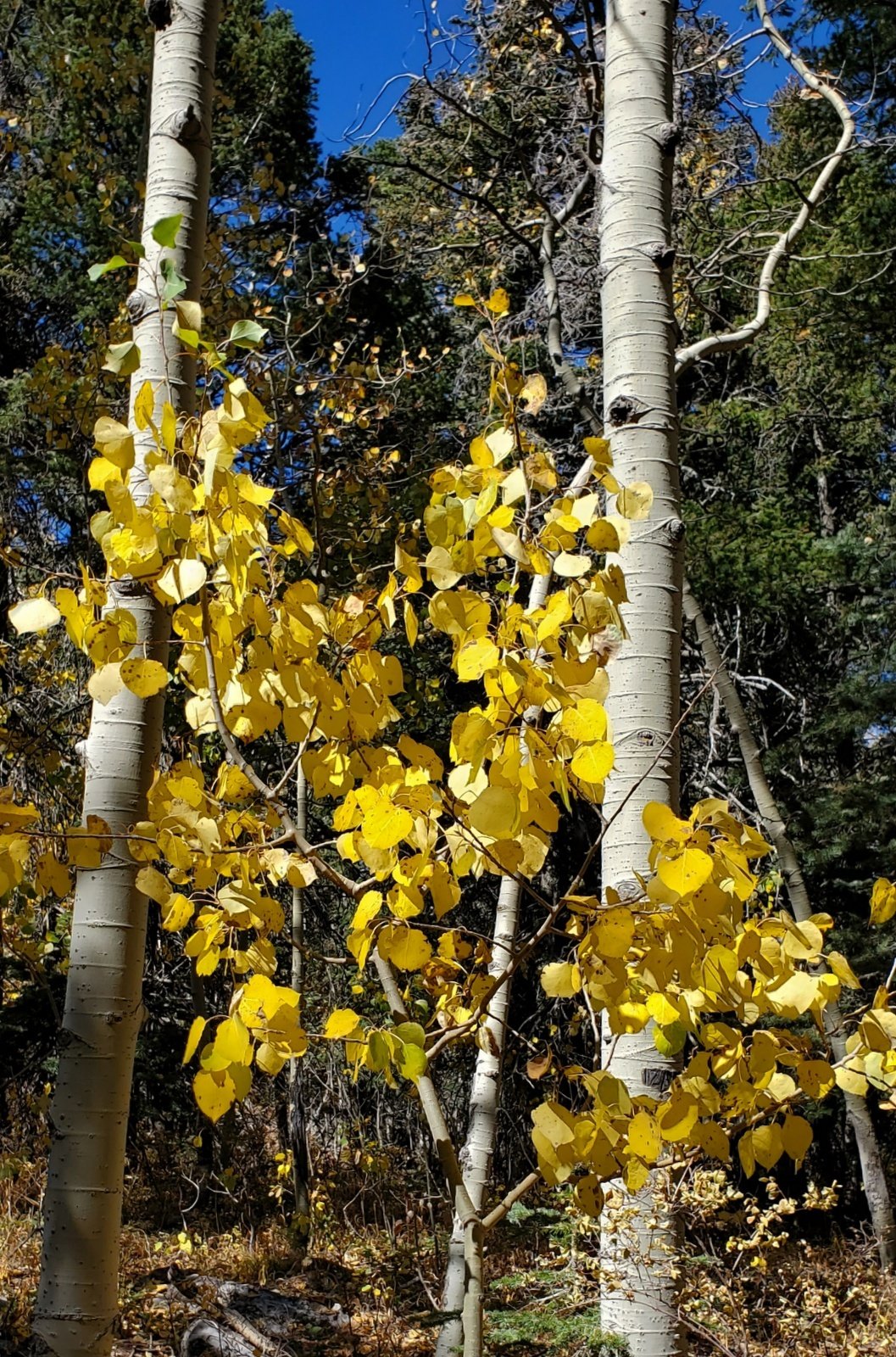
After having lunch at the Overlook, we headed back in a mid-late afternoon sun. We took advantage of that light to enjoy some of the aspen along the trail that still had their leaves. They were so very bright against the clear blue New Mexico sky, almost like they were being lit from within. So we got a taste of aspen in the autumn.
Statistics
Total Distance: 4.37 miles
Elevation: start 10,642 ft, maximum 10,655 ft, minimum 9,956 ft
Gross gain: 699 ft. Aggregate ascending 1,261 ft, descending 1,263 ft
Maximum slope: 56% ascending, 58% descending, 9.6% average
Duration: 4:17
| GPS Track Files for Download | |
192 Downloads | |
|---|---|
186 Downloads | |
I urge you to explore our hiking tracks with Google Earth. With the virtual 3-dimensional presentation, achieved by panning and tilting the view, you can get a much better idea of the hikes and terrain than you can get from the 2-dimensional screenshot above. For assistance: Using Google Earth Track Files.
Previous Posts
North Crest Trail-North Sandia Peak Hike – 06/18/2020
North Crest Hike – 10/12/2017
References and Resources
USDA Forest Service:
Crest Trail 130 – North & South
Sandia Mountain Trails (PDF)
Sandia Peak.com:
Sandia Crest Trails and Trailheads (PDF – brochure and great map)
AllTrails: North Crest Trail
Dog of the Desert: North Crest Trail, North Sandia Peak, and Survey Trail
ASCHG:
Sandia Crest Trail North Hike
Sandia Crest to del Agua Hike


