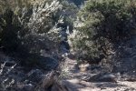
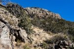
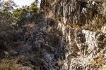
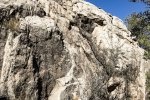
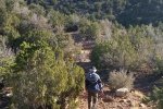
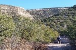
Wishing to have a short day, we chose to stay close to home. Looking for territory on the north end of the Sandia Mountains that we haven’t already hiked (near Placitas), I used Google Earth to identify a canyon that looked attractive.
The Drive In
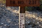
GE showed a road leading to a spot near the mouth of this canyon, and I had sketched out a path to guide us with the GPS. But we discovered my starting point was from a road that is private; we decided to not park there. Instead, we headed to the Agua Sarca trailhead near Tunnel Springs.
The Hike
We proceeded up the Agua Sarca trail for a ways, then headed west towards the canyon of interest. Using the GPS on the Android phone, and the topo maps in the US Topo app, we bushwhacked our way over ridges and across 2 arroyos, when we came across a trail (with many cairns, so I’ve dubbed it Cairn Trail). We followed Cairn Trail until it headed north, not the direction we needed to go. So, back to bushwhacking, across another 2 or 3 arroyos, and discovery of a very old two-track (which made things easier). When the two-track petered out, we had just a few steps into canyon.
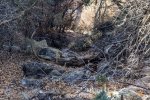
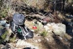
After that bushwhacking, it was a relief to have a smooth sandy bottom in this canyon with only occasional rock outcroppings that we had to traverse; and there were very little downfall to impede our way. The slope was steady and easy going. We were in and out of sunlight; in the shade of the sides of the canyon it was quite cool and there was a dusting of snow on the ground from squalls last week. We continued up the canyon until it became narrower and there were obstructions ahead, and we wished to preserve energy for bushwhacking we expected to face on the return. So we had our mid-hike break 2.5 miles into the hike.
The return down the canyon went smoothly. We set our sights on using more of the two-tracks and trails we had discovered on the way out. That worked – we had only a short bushwhack from the two-track to the Cairn Trail, which in turn met up with the Agua Sarca Trail. Whew, that was a lot easier than the outbound portion of this hike. I’ve been unable to find any name for this canyon, so we’ve dubbed it Sandy Bottom Canyon. That aptly describes it, especially in contrast to NoName, Del Agua, and others in the area which have long sections of rocky surface and some have rock faces that are a challenge to climb up (or down).
Jay here: Just when you are convinced you’ve seen it all when it comes to the hiking opportunities in the Sandias, you realize there’s lots more out there…and some trails/canyons do not even have names. BTW, it was days later when I realized that I went to school with a girl named Sandy Bottom. What a coincidence.
Statistics
Total Distance: 4.69 miles
Elevation: start 6,355 ft, maximum 7,128 ft, minimum 6,610 ft
Gross gain: 518 ft. Aggregate ascending 1,534 ft, descending 1,531 ft
Maximum slope: 29% ascending, 32% descending, 11% average
Duration: 4:13
| GPS Track Files for Download | |
142 Downloads |
|
|---|---|
114 Downloads |
|
I urge you to explore our hiking tracks with Google Earth. With the virtual 3-dimensional presentation, achieved by panning and tilting the view, you can get a much better idea of the hikes and terrain than you can get from the 2-dimensional screenshot above. For assistance: Using Google Earth Track Files.


