This time of year in New Mexico we repair to higher elevations and cooler temperatures for our outdoor activities. We’re so fortunate to have options – mountains all around, choices of destinations for each, all within an hour or two drive. Staying closer to home on this day, we chose to become better acquainted with the Sandia Mountains, in particular the forested east slopes and .. shade from the high-elevation sunlight at 10,000 feet.
The Drive In
From downtown Albuquerque: east on I-40 to the Tijeras turnoff, then north on NM 14 through Cedar Crest to Antonito and the turnoff for NM 536, Sandia Crest Road (also known as the Sandia Scenic Highway). By this point we’re at 6,900 feet elevation and already noticing a drop in air temperature. The Crest Road has many twists and turns, many at 20 mph to change direction by 180° or more. But that’s the way to get to 10,000 feet in 17 miles. And on The Crest – the temperature will stay below 80 all day. There is ample parking at the Sandia Crest (‘tho a $3 “Amenity Fee” or an America the Beautiful Pass is required; our Senior Pass was sufficient).
The Hike
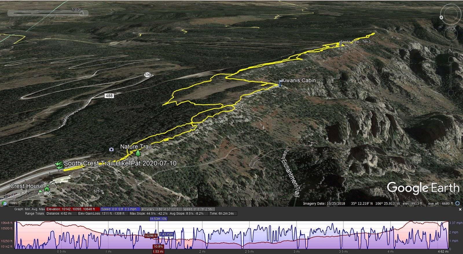
South Crest Trail Hike.Pat.2020-07-10
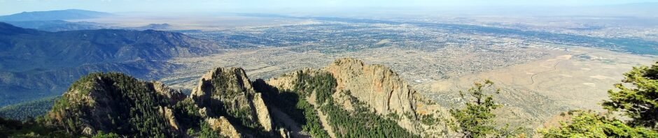
The trailhead is at the south end of the parking area, below to the east of the Crest House. The trail begins with the Crest House Nature Trail, a half mile loop filled with flowers and trees, and with signage that provides truly great descriptions. (I’ve put most of the signs in the Gallery below for my study and your perusing pleasure.) The view across Albuquerque and up and down the Rio Grande valley is stunning (from this sheer cliffside vantage point). In the 11 years that we’ve been in Albuquerque, we’ve been unaware of this true gem; it will be on our list of places to bring visitors, to get a (thorough) glimpse of what New Mexico has to offer.
The western leg of the Nature Trail loop (also Crest Trail #130) runs near the edge of the cliff that forms the top of the Crest (in some sections at the edge). In a couple of places a bit of “scramble” over rocks is required.
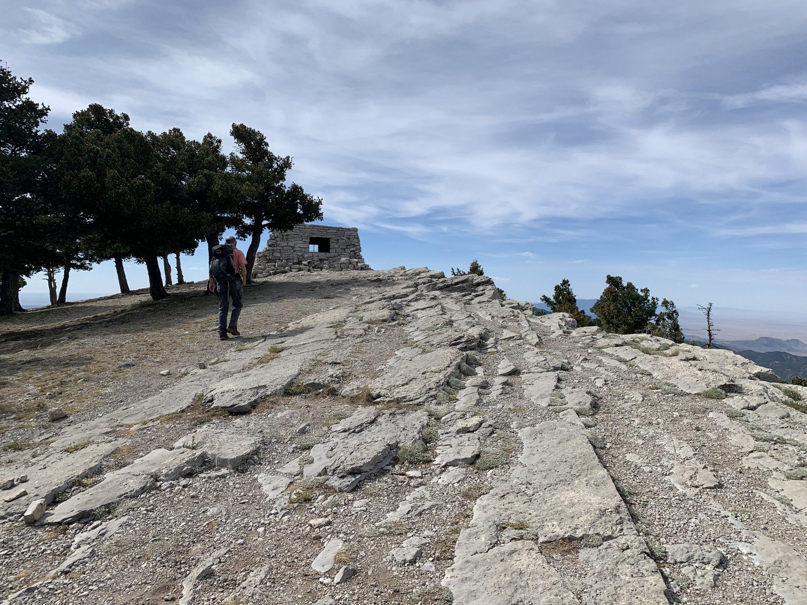
Approaching Kiwanis Cabin.
At the turnback point of the Nature Trail loop, rather than follow the South Crest Trail, we proceeded south along a track that continued to follow the edge of the Crest. This brought us to a large open area at the far end of which was the Kiwanis Cabin. After surveying the Cabin, we headed downhill to rejoin Crest Trail #130 and continue south with occasional diversions up to the edge to take in the view.
Skirting the Upper Tram Terminal and the lifts of the Sandia Peak Ski Area we continued south on the South Crest Trail for another half mile. When the trail began descending, we turned around, content with a good 5 mile hike. On the return we found ourselves on the Gravel Pit Trail (#339) running below but parallel to the South Crest Trail. It is much more a forest trail with a wide variety of plant life. After one significant ascent of some 180 feet, it was an easy hike back to the trailhead.
 Highlight – Lunch at Ten 3
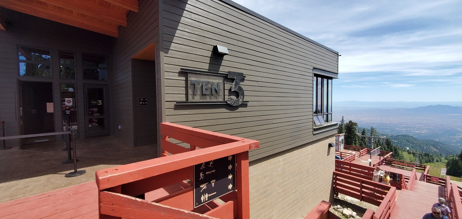
The highlight on this hike was reaching the Top of the Tram and the new Ten 3 restaurant. As we approached, we met Benny Abruzo, one of the owners of Ten 3; in conversation with him we learned that the restaurant would be open at 1100 (with restrictions due to Covid-19), and that we could dine in or take out. 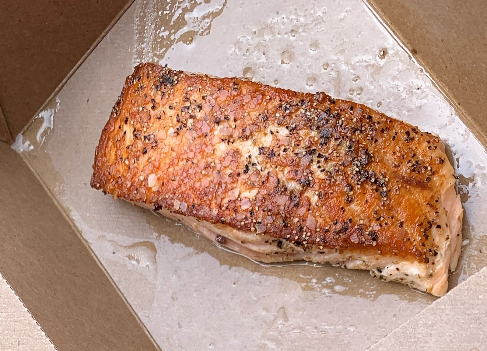 We chose takeout: the “Classic Ahi Tuna Salad” was superb and the desert cupcake was to die for. What an unexpected treat, to be hiking in the woods and enjoy such a delectable lunch; we left our usual Ramen and PB&J/carrots/apple slices in the pack.
Statistics
Total Distance: 4.62 miles
Elevation: start 10,635 ft, maximum 10,648 ft, minimum 10,142 ft
Gross gain: 506 ft. Aggregate ascending 1,311 ft, descending 1,308 ft
Maximum slope: 45% ascending, 42% descending, 8.3% average
Duration: 6:02
| GPS Track Files for Download | |
211 Downloads | |
|---|---|
361 Downloads | |
I urge you to explore our hiking tracks with Google Earth. With the virtual 3-dimensional presentation, achieved by panning and tilting the view, you can get a much better idea of the hikes and terrain than you can get from the 2-dimensional screenshot above. For assistance: Using Google Earth Track Files.
References and Resources
Note: The Crest Trail runs the length of the Sandia Mountains. Some of the references below cover the whole distance.
USDA Forest Service:
Crest Trail 130 – North & South
Sandia Mountain Trails (PDF)
Kiwanis Cabin Interpretive Site
Sandia Peak.com: Sandia Crest Trails and Trailheads (PDF – brochure and great map)
AllTrails:
South Crest Trail
Kiwanis Cabin via South Crest Trail
Kiwanis Cabin via South Crest #130 and Gravel Pit #339 Loop (from Top of the Tram)
SummitPost: Sandia Crest Trail
UNM LoboLife: Kiwanis Cabin
Ten 3: An Elevated Dining Experience
Facebook: Ten 3
Photos
To help envision where the photos were taken, the two Galleries, George’s Photos & Pat’s Photos, are in the order in which we encountered them on the hike.


