I’m posting this report -long- after we made the hike. But I have good memories, so here goes.
The Drive In
Tapia Canyon is way out in the middle of the Rio Puerco valley. From Albuquerque, US 550 to NM 276 (San Louis road), then some 30 miles on generally well maintained dirt/gravel roads. There are two -deep- arroyo crossings with steep entries; these plus the road in general make it unwise to visit Tapia Canyon (or other places along the way) until the roads have dried from rain or snow.
NOTE: Tapia Canyon and Tower Ruin Site are closed for native American traditional activities 4 times each year: Sep 15-Oct 15, Dec 15-Dec 31, Mar 1-Mar 15, and Jun 20-Jun 30.
The Hike
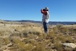
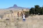
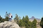
Since we weren’t able to climb from the canyon to the mesa top and Tower Ruins during our earlier hike for this outing our goal was to drive closer and hike to the ruins. We continued on NM 279 for 1.2 miles, then turned right on a two-track. We encountered a locked gate about 1/3 mile on. Although without a clear idea how far, we decided to hike from there hoping to reach Tower Ruins above the canyon. Following the two-track beyond the gate for 1.5 miles or so, we started looking for reference points with which we might determine our progress. In sum, not having a record of our previous track in hand, and and not recognizing our position relative to the canyon, we abandoned our effort and headed back to the car.
From the sceeen-shot above, and looking at the Google Earth track (link below), we can see we were -far- short of the ruins (1.7 miles), and even short of the starting point for our previous hike in the canyon (see the orange track line). We presume since this is a site with regular activity for Native American activities, visits are discouraged with the locked gate.
Statistics
Total Distance: 3.33 miles
Elevation: start 5,922 ft, maximum 6,143 ft, minimum 5,922 ft
Gross gain: 188 ft. Aggregate ascending 438 ft, descending 477 ft
Maximum slope: 35% ascending, 32% descending, 5% average
Duration: 2:38
| GPS Track Files for Download | |
200 Downloads |
|
|---|---|
59 Downloads |
|
I urge you to explore our hiking tracks with Google Earth. With the virtual 3-dimensional presentation, achieved by panning and tilting the view, you can get a much better idea of the hikes and terrain than you can get from the 2-dimensional screenshot above. For assistance: Using Google Earth Track Files.
References
ondafringe: Day Hike: Tapia Canyon and Tower Ruin
CargoVanConversion: Guadalupe Ruin & Tapia Canyon
DougScottArt: Canon Tapia
mjy’s blog: Tapia Canyon, Cabezon Area, New Mexico
For Guadalupe Ruins: BLM: Guadalupe Ruin
Recreation.gov: Guadalupe Ruin, NM
Four Corners Region Geotourism MapGuide: Guadalupe Ruin Chacoan Outlier
Everything Else: Guadalupe Ruins
And .. check other BLOG entries: Tapia Canyon Hike – 05/10/2015 Tapia Canyon & Tower Ruins Hike – 11/19/2016
Last Updated on August 16, 2023 by George Young


I still haven’t managed to get to Tower Ruins. At least I saw it the day you flew us over the Rio Puerco in that light airplane. So Tower Ruins is still on my to-do list.