Returning, this time with Jay, to one of my favorite hiking sites. It is far off the beaten path, some 30 miles from US highway 550, much of that distance on dirt roads. Although the road is well graded, one should not head out this way soon after any precipitation.
The Drive In

Drive-in route from US 550, via CR 279, through San Luis, the -old- village of Guadalupe, past the Guadalupe Mesa ruins, to Tapia Canyon.
The drive in is straightforward: US 550 to CR 279/San Louis Road. Continue through San Louis, stay on 279 as it turns from pavement to a Class 3 road (‘New Mexico pavement’), about 8 miles. Resist turns at 11.5, 16.8, and 21 miles. The road descends into the Rio Puerco valley; along the way it crosses two deep arroyos – the road to the bottom and out is -very- steep .. interesting to drive thorough. At 29 miles from US 550, the road climbs over a sharp saddle, below the Guadalupe Ruins up on the adjacent mesa. From there its .4 mile to the turnoff into Tapia Canyon on a Class 5 road (two-track). Park at the end (there is ample room to turn around).
The Hike
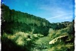
This hike is through the bottom of a wide canyon with walls from 50′ to 150′ high. The surface varies from rocky through sandy to grass covered ground. “Trees” are mostly salt cedar (tamarisk) along the wash that wanders back and forth across the canyon. This is not a good place for summer hiking.
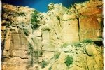
Of great interest are 3 or 4 section of the canyon walls with large collections of petroglyphs, beginning about 2.2 miles or so up the canyon. There are few under an overhang on the left (south) wall (not easy to find), then a large collection 30′ to 40′ or so above the canyon wall on the right (north) wall at 2.3 miles into the hike. One can get close to the petroglypns by climbing some 30′ up on a mound that sits next to the wall (see photos below).
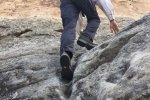
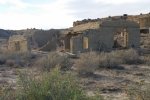
Further up the canyon, there is an arch on the right, an entrance to a slot side-canyon, where we began our return route. Following clues from others who hiked here previously, we found a route to ascend to the south mesa top. Although the wall seemed to have no breaks in it, we found a series of steps cut (or worn) into a 15′ section of rock leading to ‘navigable’ terrain that permitted us to get up on the mesa top. From there we visited the Tower Ruins, then back down into the canyon and returned to the parking spot.
Jay here: Once again, this was a hike where George encouraged me to exceed my comfort level by climbing atop the mesa via ancient “steps” worn into the rock face of the canyon. It was worth getting to the top although I avoided any backward looks as I made my way up. Ironically, the route down would have been easier but lacked the drama.
Statistics
Total Distance: 5.77 miles
Elevation: 5,957 start, 6,167 maximum, 5,929 minimum
Gross gain: 238 ft. Aggregate ascending 928 ft, descending: 928 ft
Maximum slope: 31% ascending, 29% descending, 4% average
Duration: 3:31
| GPS Track Files for Download | |
280 Downloads |
|
|---|---|
356 Downloads |
|
246 Downloads |
|
435 Downloads |
|
If you haven’t explored these hiking tracks with Google Earth, I urge you to try it. With the virtual 3-dimensional presentation, achieved by panning and tilting the view, you can get a much better idea of the hikes and terrain than you can get from the screenshot above. For some ideas, check out Using Google Earth Track Files.
References
ondafringe: Day Hike: Tapia Canyon and Tower Ruin
DougScottArt: Canon Tapia
mjh’s blog: Tapia Canyon, Cabezon Area, New Mexico


You finally found the Tower Ruins! Those “steps” up the canyon wall look like they could get the heart rate up a bit. Love the petroglyphs at the top of the steps.