A friend has been describing some amazing geophysical features in the Rio Puerco valley, north from I-40 and the To’hajillee Indian Reservation. For this trip, we took our shot at finding the area.
The Drive About
To’hajiilee is a reservation of the Cañoncito Band of Navajos that occupies a large area of the Rio Puerco valley north of I-40. Westbound on I-40 from Albuquerque, we took the exit for the Route 66 Casino, and at the traffic circle turned north on Rio Puerco Road.
We continued on Rio Puerco road (also identified on our topo map as Trail 57) for 3.77 miles, then turned left onto Trail 57. This took us to Cañoncito (7.75 miles) where we turned right (north) on Trail 56 for a half mile to an intersection where we opted to bear to the left (Trail 7041) and towards what appeared to be more interesting terrain. A couple of miles further, we bore to the right onto Route 7041, turning left in 3.4 miles onto Rte 7076, climbing up onto La Mesa Quebrada. We continued for another 6.7 miles where the road became a 2-track (at a home site); we opted to turn back at this point, not having found the formations we were looking for.
We returned via the same route to Cañoncito, then chose to continue on the paved Trail 56 (Cañoncito School Road) to I-40 and home.
Highlight
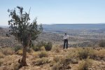
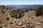
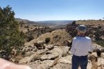
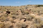
 As always, we enjoy so much getting out into New Mexico’s outback. Trips like this provide the opportunity explore the geography and see the topography in its various shapes and forms. In so many places the views across valleys and canyons, even arroyos, are magnificent. We realized that we had not found the geologic formations. We will return with plans for another route, possibly staying of Rio Puerco Road instead of turning right onto Trail 57.
Statistics (driveabout)
Total Distance: 42 miles (from exit off of I-40)
Elevation: start 5,286 ft, maximum 6,482 ft, minimum 5,286 ft
Duration: 3:15
GPS Tracks
| GPS Track Files for Download | |
140 Downloads |
|
|---|---|
194 Downloads |
|
I urge you to explore our hiking tracks with Google Earth. With the virtual 3-dimensional presentation, achieved by panning and tilting the view, you can get a much better idea of the hikes and terrain than you can get from the 2-dimensional screenshot above. For assistance: Using Google Earth Track Files.
References and Resources
Wikipedia: Tohajiilee Indian Reservation


