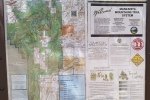
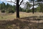
Looking for a trail nearby for a short afternoon hike, we headed south out of Tijeras Canyon, going up Cedro Canyon on NM337, for one of the trails on the east side of the Manzanita Mountains. At the top of the hill, turning right on Raven Road, and staying on it as it winds around a bit, we noted a drive to the right (Mars Court) at the end of which was a sign showing the Manzanita Mountain Trails System.
The Hike
We opted for the loop Turkey Trot, FS Rd 335, and Wild Turkey. The trail starts out through open forest of Ponderosa, Gambel Oak, and other smaller plants; the trail was rocky in a few places but overall an easy surface, and mostly downhill for about 2.5 miles until the intersection the FS Rd 335 (also identified on Google Earth as the Grand Enchantment Trail).
RS Rd 335 is a moderately used two track in open spaces (almost meadow), very easy walking for the next 1.5 miles. We did not find the entrance on to the Wild Turkey trail, but realizing that the trailhead was abreast of our track, we headed to the right, up the east side of the canyon until we came across another well-used trail. This turned out to be the Cajun Turkey trail, which took us to the Wild Turkey trail and back to the parking area.
Statistics
Total Distance: 4.77 miles
Elevation: start 7,611 ft, maximum 7,611 ft, minimum 7,155 ft
Gross gain: 566 ft. Aggregate ascending 755 ft, descending 753 ft
Maximum slope: 27 % ascending, 19% descending, 6% average
Duration: 3:18
| GPS Track Files for Download | |
259 Downloads |
|
|---|---|
255 Downloads |
|
I urge you to explore our hiking tracks with Google Earth. With the virtual 3-dimensional presentation, achieved by panning and tilting the view, you can get a much better idea of the hikes and terrain than you can get from the 2-dimensional screenshot above. For assistance: Using Google Earth Track Files.
References
USFS-Cibola National Forest: Manzanita Mountain Trails System


