Introduction
‘Twas our third approach to Cerro Grande, the tallest mountain in Valles Caldera National Preserve. Our first visit was “exploratory” (we went half way to the top), the 2nd visit two days ago as an appendix to another hike, but today ’twas our plan to go to the top.
The Hike
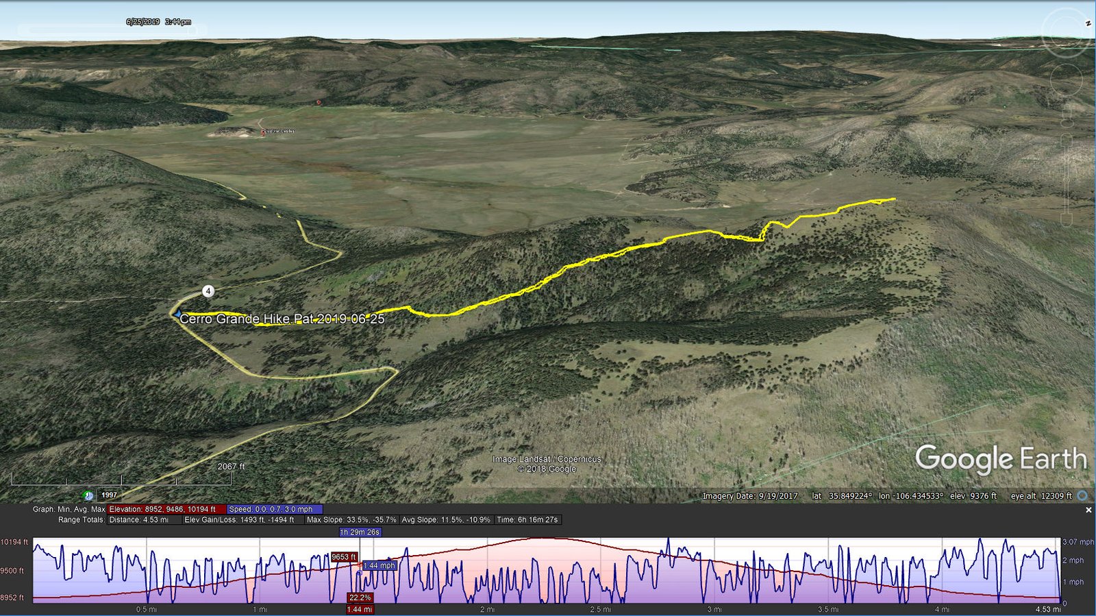
Cerro Grande Hike.Pat.2019-06-25
The trail up to the saddle was much like Our first visit; the grasses are still verdant but the flowers have gone past their prime. We remained on the trail rather than making a beeline for the top of the saddle. We were (pleasantly) surprised that the trail did not attack Cerro Grande directly, not a pleasant prospect because it appeared to be a steep climb and the day was sunny – such a climb would be hot and taxing. Rather, the trail headed to the east/northeast, presenting 1) a fair amount of shade and 2) a trail not so steep, rounding the eastern side of Cerro Grande and with a few switchbacks.
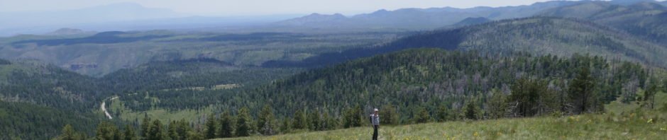
Nearing the top, we left the comfort of shade headed towards the summit which is marked with a large cairn, visible from a distance, and two survey markers (neither of which gave the elevation, but from other sources we understand it to be 10,199 ft; USTopo/GPS on my Galaxy 5 reported 10,194 ft). As expected the view across Valles Grande was “expansive” (?), highlighted by cloud shadows moving across the plain. The air was hazy so the views in other directions weren’t the best, but .. when the air is clear they must be extraordinary.
We retreated from the summit to the edge of the sparsely forested area to find some shade for out mid-hike break/lunch. After enjoying cups of Ramen Soup (a first for us on a hike – these hit the spot) as well as PB&J sandwich, carrots, and a cookie, we headed down, taking time to appreciate the late flowers, green of the grasses, and .. simply being outdoors again in Mother Nature’s garden.
Statistics
Total Distance: 4.53 miles
Elevation: start 8,954 ft, maximum 10,194 ft, minimum 8,952 ft
Gross gain: 1,242 ft. Aggregate ascending 1,493 ft, descending 1,494 ft
Maximum slope: 34% ascending, 36% descending, 11.5% average
Duration: 6:16
| GPS Track Files for Download | |
213 Downloads | |
|---|---|
228 Downloads | |
I urge you to explore our hiking tracks with Google Earth. With the virtual 3-dimensional presentation, achieved by panning and tilting the view, you can get a much better idea of the hikes and terrain than you can get from the 2-dimensional screenshot above. For assistance: Using Google Earth Track Files.
References
National Park Service:
Cerro Grande Trail
Valles Caldera Map
Natural Atlas: Cerro Grande Trail, a very nice interactive map – pan, zoom etc.
AllTrails: Cerro Grande Trail
American Southwest: Cerro Grande Trail, Bandelier National Monument
Wikipedia:
Cerro Grande Fire
Valles Caldera
VallesCalderaRim: Cerro Grande Showshoe (Official Cerro Grande Route).


