Our 2nd day of a 4 day visit to Valles Caldera. We brought our bikes to learn if we’re ready for biking on back country roads. A friend’s description of the roads in the Valle encouraged us to give it a go; he judged the roads’ surface to be fair and elevation changes would be minimal within the Valle.
The Drive In
After consulting with the Ranger at the Visitors Center and getting our entrance permit, we drove to the Horse Barn; driving further was not permitted because of the culvert washout presently undergoing repair. Leaving our bikes at the top of the hill/driveway to the Barn and parking the truck at the Barn, we started riding north on VC02. This was our first time on any uneven, rocky surface and we quickly determined that we needed some practice to become safe. Shortly we came to a steep descent that would be on a surface that was even more rocky. At that point we chose to stash our bike away from the road and make this a hike.
The Hike
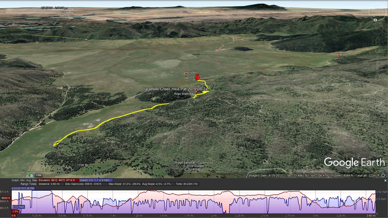
Jaramillo Creek Hike.Pat.2019-06-24
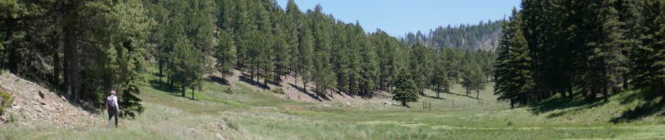
We walked down the hill, saw the work being done to repair the road (we remained clear of the construction area per instructions from the Ranger) and proceed up Jaramillo Creek. We followed an ad hoc trail, an old two-track that runs parallel to Jaramillo Creek (the only recent activity evident on the two-track were bicycles). Lush grasses covered the ground all around and the forest of douglas fir, spruce, and ponderosa pine trees covered the sides of Cerro Piño on our right and Redondo on our left, with burned areas on the ridge tops ahead.
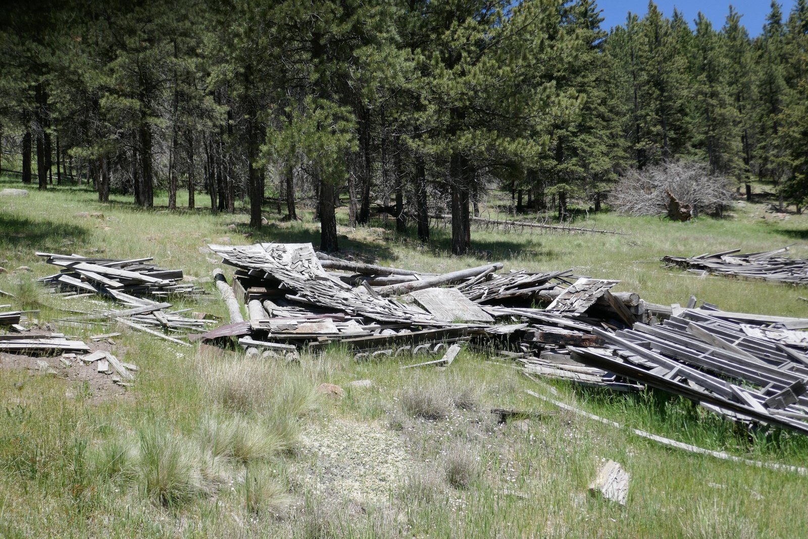
The remains of a cabin, built partially into the slope of Redondo, looking down upon Jaramillo Creek.
As we proceeded north along Jaramillo Creek the views were spectacular – to the northwest across Valle Jaramillo ahead of us and behind us the huge Valle Grande. The space of this place is hard to grasp – one can see unobstructed by -any- disturbance one mile (Valle Jaramillo) or 5 miles (Valle Grande). And through the pristine clear air, distant objects seem to be much closer (until one measures the distance on a map or starts walking towards some destination and learns .. it is much farther than perceived).
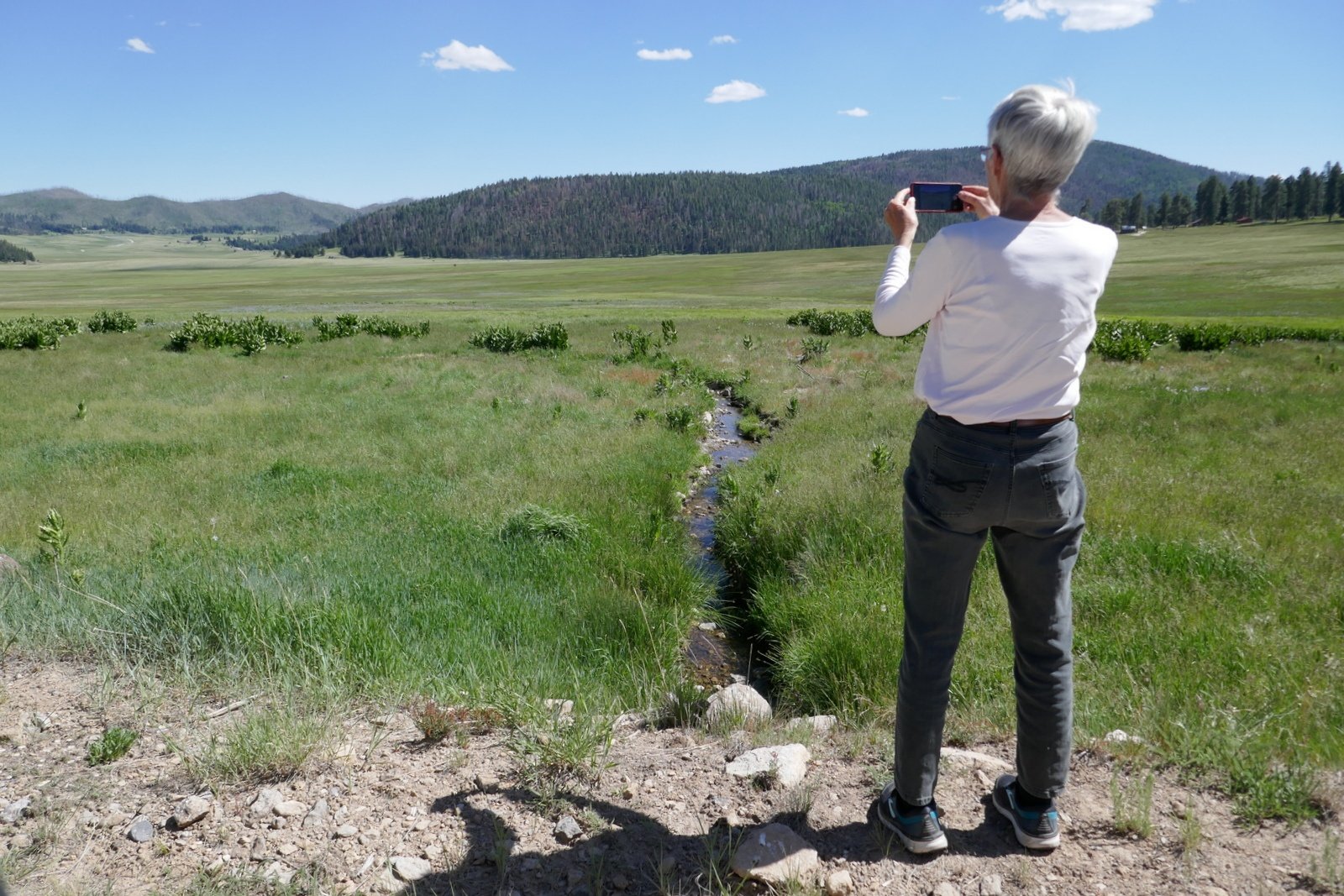
Driving from Valles Caldera back to the Campground, we stopped to take in the view from a stream that feeds the East Fork Jemez River.
Planning about a 4 mile hike, when we reached two miles we found some shade to have our mid-hike break (I might better describe it as lunch, since Pat brings more for us than the granola bars Jay & I bring). After enjoying the PB&J sandwich and sliced carrots & apples, it seemed only proper to lay back and rest a bit (.. for me, a half hour nap). Looking further north, we could see more beautiful scenery – the open (huge) meadow of Valle Jaramillo, and … what might lay beyond? But we turned back towards the bikes, road them down to the Barn, and headed back to the campground having enjoyed another wonderful day in this amazingly beautiful place.
Statistics
Total Distance: 3.60 miles
Elevation: start 8,655 ft, maximum 8,714 ft, minimum 8,612 ft
Gross gain: 102 ft. Aggregate ascending 556 ft, descending 516 ft
Maximum slope: 31% ascending, 29% descending, 4.7% average
Duration: 3:23
| GPS Track Files for Download | |
262 Downloads | |
|---|---|
196 Downloads | |
I urge you to explore our hiking tracks with Google Earth. With the virtual 3-dimensional presentation, achieved by panning and tilting the view, you can get a much better idea of the hikes and terrain than you can get from the 2-dimensional screenshot above. For assistance: Using Google Earth Track Files.
References
National Park Service:
Valles Caldera National Preserve
Maps
AllTrails: Interactive Map of Valles Caldera
(zoom in to see trails, our hike is not shown)
Wikipedia: Valles Caldera
NM Museum of Natural History and Science: Valles Caldera, Jemez Volcanic Field
GeoTimes: A Secret Garden: New Mexico’s Valles Caldera
Facebook: Valles Caldera National Preserve
National Parks Traveler: Exploring the Parks: Valles Caldera National Preserve
BikePacking: Valles Caldera Supervolcano Explorer, New Mexico
(a superb photo gallery)


