Pat and I returned to the Jemez Mountains for a 4-night stay at the Jemez Falls Campground in our R-Pod, planning to explore further in and around Valles Caldera. For our first hike, we visited Obsidian Valley in the Valles Caldera.
The Drive In
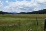
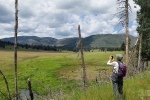
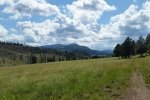
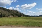
After a relaxing morning on our first full day, we stopped by the Visitors Center to get the entrance pass, then headed out into the Caldera. With the prospect of thunderstorms, we drove only 6 miles into the Caldera, then parked at the entrance to Obsidian Valley for the day’s hike.  The whole of Valles Caldera is plush with grasses, many shades of green, nearly waist high in some places; it is such a contrast with other parts of New Mexico. Flowers are abundant – many colors, sizes, styles. And the ever-present New Mexico sky, the brightest of blue and this time of year, the monsoon season, brings clouds to accentuate the sky and skyline. That is the case until afternoon, when … the convective activity heats up producing thunderclouds with lightning and rain, sometimes a deluge. This makes it advisable to hike in the first half ofthe day (and still, bring a raincover of some kind).
The Hike
 The ‘trails’ in Valles Caldera are typically two-tracks, now off limits to any wheeled vehicle (autos, ATVs, etc.), which makes for easy hiking. The two-track, VC05, proceeds up Obisidian Valley, a gentle slope until approaching Puerto de Abrigo, a saddle between Cerros de Abrigo on the left and Cerro del Medio on the right. It’s not much of a climb, 100 feet, to crest the saddle and descend into a side-valley at the upper reach of Valle Toledo. We continued for another half mile to check out a spring that is shown on the topo maps. And a spring we found – a large area of open water and marsh, judging by the tracks in the mud a favorite place for elk and deer.
 Highlights
The views throughout our visits to Valles Caldera are stunning, huge open valleys with mountains all around. Some of the mountains are lush with forest, others recovering from fires from past years. But even the burned areas have their own appeal as we see grass, oak, and other plants bringing the mountainsides back to life. And everywhere we go other colors stand out against the green grasses, the many flowering plants in white, yellow, blue, and red. This -is- such a beautiful place.
Statistics
Total Distance: 4.05 miles
Elevation: start 8,711 ft, maximum 8,947 ft, minimum 8,711 ft
Gross gain: 236 ft, Aggregate ascending 584 ft, descending 584 ft
Maximum slope: 27% ascending, 23% descending, 4.6% average
Duration: 3:10
| GPS Track Files for Download | |
308 Downloads | |
|---|---|
130 Downloads | |
I urge you to explore our hiking tracks with Google Earth. With the virtual 3-dimensional presentation, achieved by panning and tilting the view, you can get a much better idea of the hikes and terrain than you can get from the 2-dimensional screenshot above. For assistance: Using Google Earth Track Files.
References and Resources
Wanderlusting the Jemez: Obsidian’R’Us
Los Angles Times: In Valles Caldera’s wild heart
Valles Caldera Trust: La Ventana en los Valles (PDF)
Eas-on Down The Road: Valles Caldera National Preserve
Earthwatch: Encountering the Prehistoric People of New Mexico 2013 (PDF)
And check other posts for Valles Caldera


