The first trip to the mountains and hiking on this year’s visit to Oaxaca. While Pat attended a cooking class in Oaxaca City, I joined a group from the Oaxaca Lending Library (OLL) for an excursion to visit prehistoric caves near Mitla. From information provided by our guides and subsequent research, the caves we visited along with others in the vicinity provide a fascinating story of -very ancient- times, as long as 10,000 years ago.
The Drive In
Trips from the OLL begin at their location on the outskirts of Oaxaca City’s historic central district. Boarding a 16 passenger van, we drove southeast into the Tlacolula Valley to the village of Mitla (formally San Pablo Villa de Mitla), 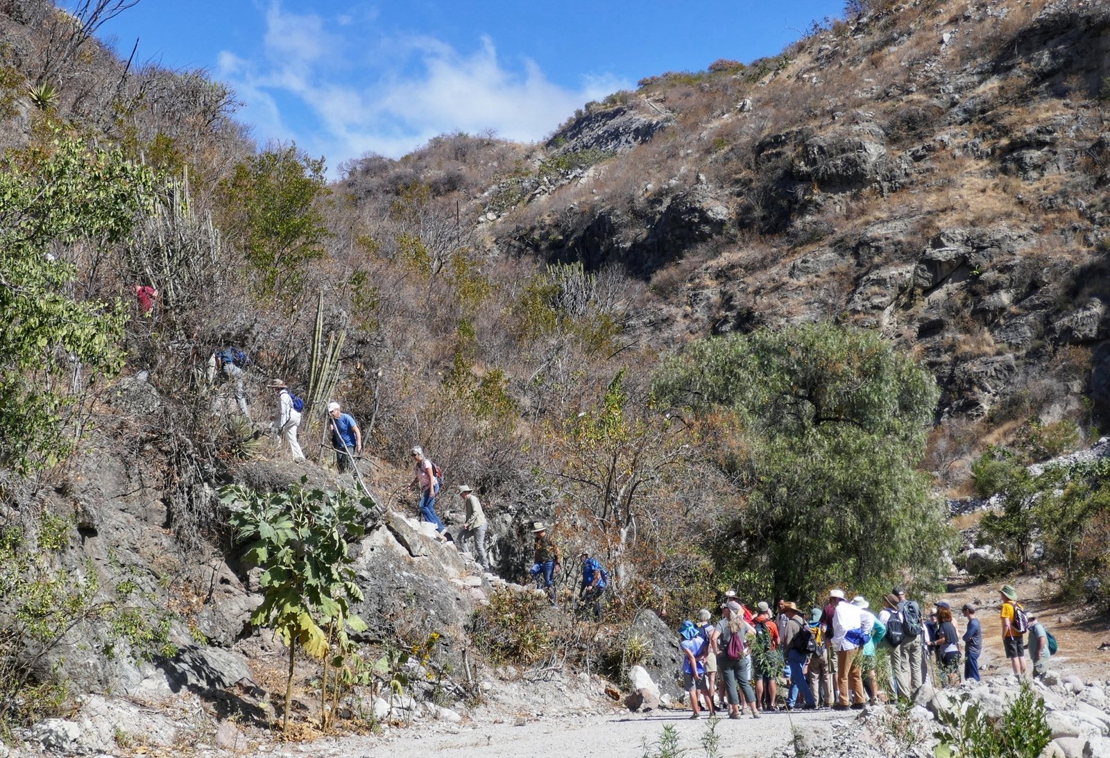 about 25 miles. From there we passed through the village and another three miles through arid sandy/rocky terrain towards the foothills of the Sierra Norte.
The Hike
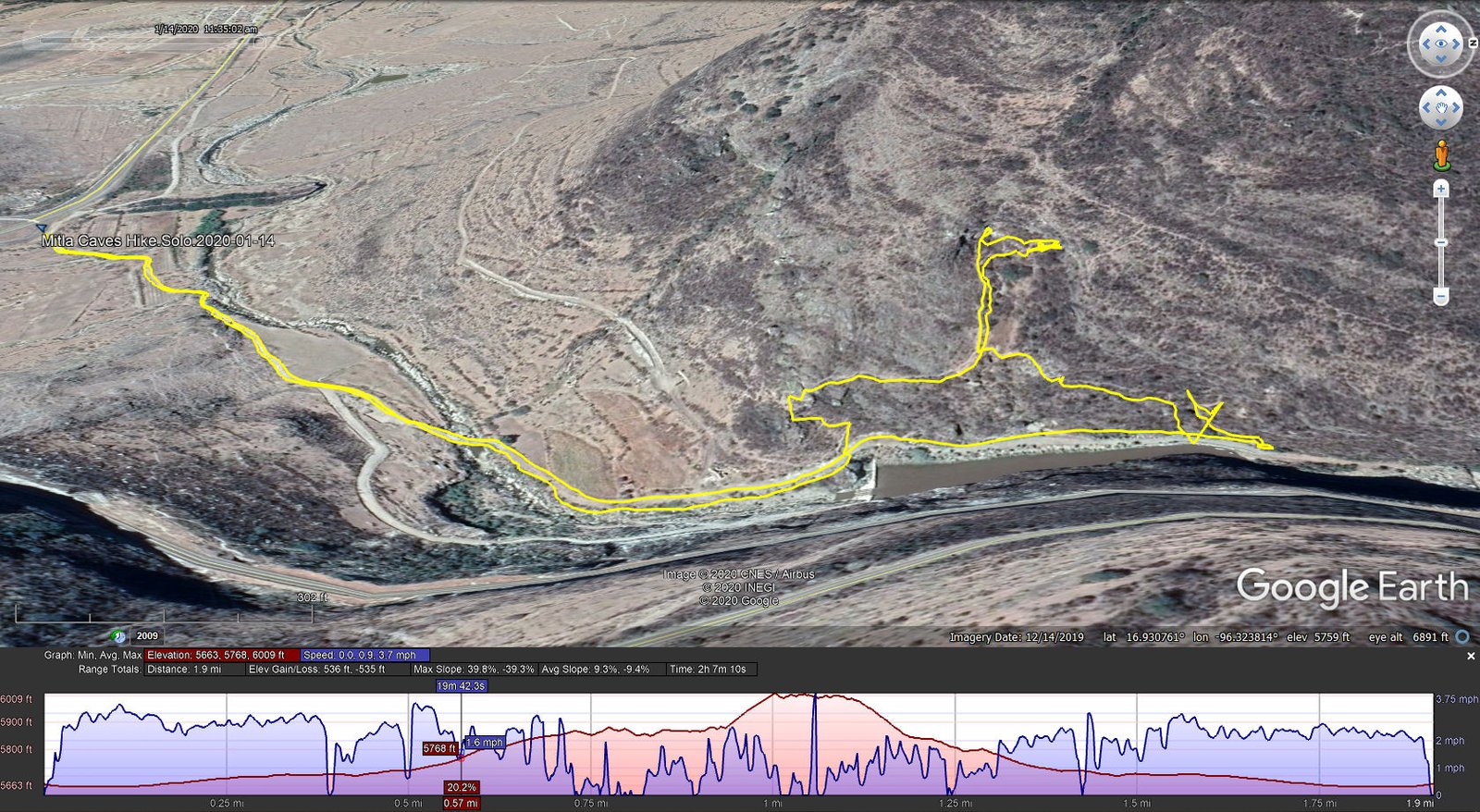
Mitla Caves Hike.Solo.2020-01-14
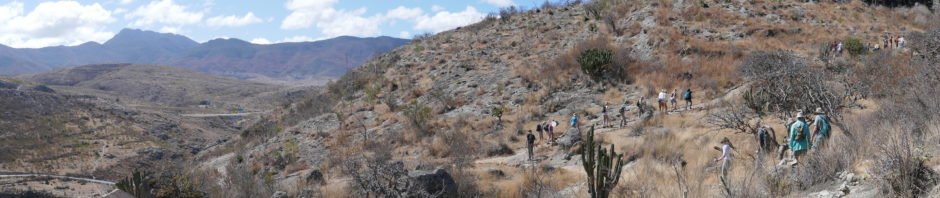
Parking just off the highway, we were met by local Zapotec guides and began the hike on a quite rocky two-track that followed a dry wash towards the first hill, the edge of the Sierra Norte. Some .7 miles along, we were directed up the side of this hill following a steep tho’ well established trail (with stairs in some places).
 In less that 100 yards, we were introduced to the first two of the four caves to be visited that day. The geology of the area is entirely of volcanic origin, so the caves would seem to be voids in the lava flow, opening in the nearly vertical side the deep arroyo. In this cave the guide told us there is evidence of habitation from 10,000 years ago. Among other seeds, an ancient type of corn was found in these caves. The tiny ears, which aren’t found to exist today, were subjected to carbon dating to determine their date. (Other reference sources, some listed below, substantiate the claim. When asked about further scientific or archeological studies in these caves, the guides told us no serious work has yet been done.)
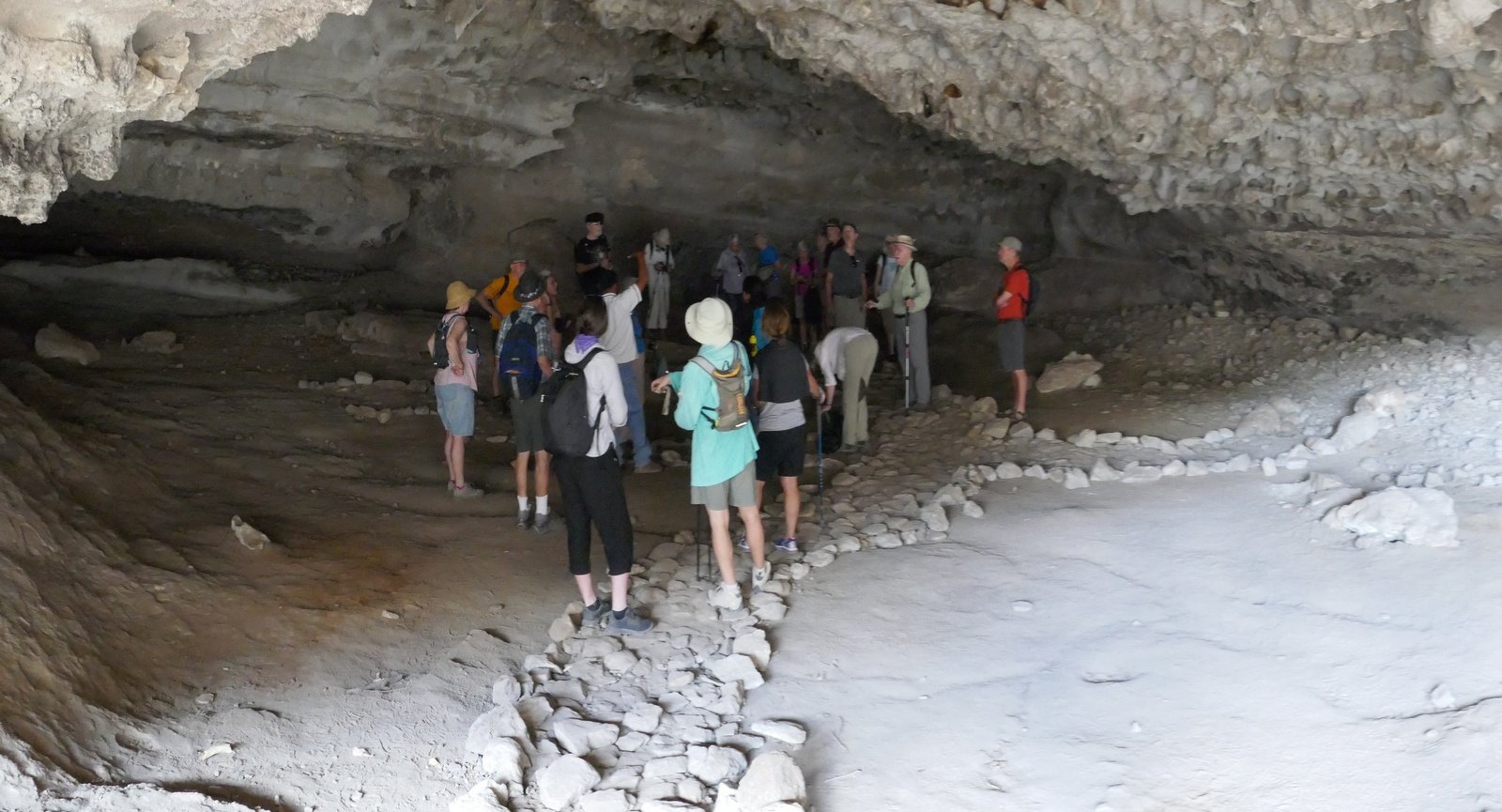
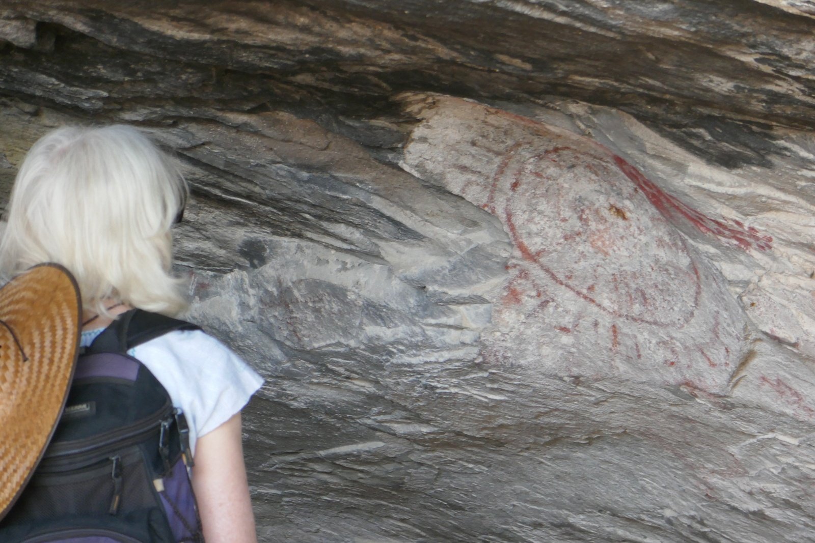 Continuing on upward, we visited the 3rd cave which had a few symbols painted in red on the walls; we were told to expect more paintings in the 4th cave. And we were not disappointed – the walls of this 4th cave were lined with numerous paintings. The group had great fun (with the help of the guides) trying to interpret the images, to imagine what they might have meant to the people who made them.
Being careful on the steep, rocky, sometimes slippery trail, we returned to the van and to Oaxaca City.
Statistics
Total Distance: 2.26 miles
Elevation: start 5,631 ft, maximum 5,964 ft, minimum 5,631 ft
Gross gain: 333 ft. Aggregate ascending 1,255 ft, descending 1,261 ft
Maximum slope: 40% ascending, 39% descending, 9.3% average
Duration: 2:07
| GPS Track Files for Download | |
221 Downloads | |
|---|---|
197 Downloads | |
I urge you to explore our hiking tracks with Google Earth. With the virtual 3-dimensional presentation, achieved by panning and tilting the view, you can get a much better idea of the hikes and terrain than you can get from the 2-dimensional screenshot above. For assistance: Using Google Earth Track Files.
References and Resources
UNESCO: Prehistoric Caves of yagul and Mitla in the Central Valley of Oaxaca
Yagul and Mitla in the Central Valley of Oaxaca (Mexico) (PDF)
Latin America & Caribbean Geographic: Prehistoric Caves of Yagul and Mitla …
Andrew Lawler: The Oldest Ritual


