The Hike
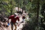
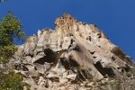
A beautiful day for a hike, then coffee, with family from North Carolina. First time on the East Fork Jemez River Trail, from Battleship Rock.
Statistics
Total Distance: 1.16 miles
Elevation: start 6,787 ft, maximum 7,148 ft, minimum 6,787 ft
Gross gain: 361 ft. Aggregate ascending 472 ft, descending 472 ft
Maximum slope: 54% ascending, 46% descending, 14% average
Duration: 1:13
| GPS Track Files for Download | |
287 Downloads |
|
|---|---|
126 Downloads |
|


