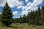
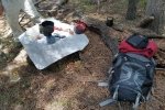
Seeking trails new to us, we came upon ASCHG’s Barley Canyon hike. The Jemez Mountains are better this time of year, a higher elevation than around Albuquerque and generally nicely wooded forest. ‘Tis a bit distant from Albuquerque (90+ miles to La Cueva), but we find it worth the drive. On this day, instead of having breakfast in Bernalillo, we opted to eat at Highway 4 Coffee in Jemez Springs. And the scenery going up NM 4, through Canon de San Diego, through which flows the Jemez River, is stunning.
The Drive In
To get to Barley Canyon, at La Cueva turn left off of NM 4 onto NM 126. Continue past Fenton Lake; .4 mi beyond the lake turn right on a two track, FR 378. Continue up the road as far as you’re comfortable with your vehicle; we went about a mile. On weekends particularly, you can expect to pass 3, 4, or more occupied campsites. Once you decide you’ve gone far enough, park and continue up FR 378. The adventurous could continue some 3 miles further to the intersection with NM 144 which can take one back to NM 126.
The Hike
We chose to hike up this two-track, which had some serious rock obstacles. Reaching the aforementioned intersection, and orienting ourselves with the aid of the GPS, rather than retrace our steps as did the ASCHG folks, we chose to head back via an adjacent canyon. We did not have tracks to follow from another hike, but we saw on the GPS Topo map that this canyon eventually descended back into Barley Canyon, not far from our parking spot. (Thanks to the US Topo app on the Android tablet to give us this picture.)
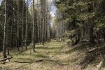
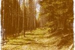
This adjacent canyon, shall I name it Barley Canyoncito?, was similar to Oat and Hay Canyons from our hike two weeks prior: an open meadow-like bottom with mainly ponderosa pine with smaller plants (shrubs) on the sides of the canyon; it was easy walking and at times we were able to follow what we believe was an animal trail, deer, cattle, maybe elk. The descent into Barley Canyon was quite easy, no rock falls to overcome.
Jay here: Another two track hike for the first half and once again the scenery made up for the lack of challenge. Not really sure how some of the campers we passed got their vehicles up the rough two track road but they got to enjoy some great weather in a secluded area of the Jemez. Returning via an adjacent canyon gave us the opportunity to do some of the overland hiking that is more typical of our hikes.
Statistics
Total Distance: 5.77 miles
Elevation: start 7,992 ft, maximum 8,805 ft, minimum 7,992 ft
Gross gain: 813 ft. Aggregate ascending 1,320 ft, descending 1,317 ft
Maximum slope: 27% ascending, 35% descending, 7% average
Duration: 3:18
| GPS Track Files for Download | |
184 Downloads |
|
|---|---|
109 Downloads |
|
I urge you to explore our hiking tracks with Google Earth. With the virtual 3-dimensional presentation, achieved by panning and tilting the view, you can get a much better idea of the hikes and terrain than you can get from the 2-dimensional screenshot above. For assistance: Using Google Earth Track Files.
References
ASCHG: Barley Canyon Hike
ASCHG: Barley Ridge to Fenton lake Overlook Hike
AroundGuides: Barley Canyon (great interactive map of area features)


