Introduction
This is one of the first forays back to hiking on forest trails. After a year-long layoff for medical reasons and a month walking mostly on the Bosque Trails along the Rio Grande, the body is coming back. And the progress has been to gradually take longer walks and now get back on trails. I look forward to continuing hikes, with Pat and with Jay, like we did in the past.
The Drive In
The drive to the trailhead: from downtown Santa Fe, head out on Hyde Park Road (NM 475), 9 miles from the Santa Fe Plaza (by way of Washington Ave/Bishops Lodge Road, right/east on Artist Road, then continue onto Hyde Park Road). The trailhead will be on the left just beyond Hyde National State Park.
The Hike
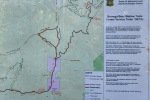
Notes about the Google Earth screenshot: the graph at the bottom shows elevation of the track (pink area) and speed (the blue line).
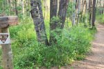
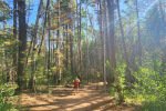
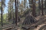
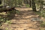
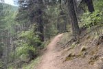
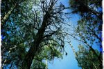
This is a downhill-uphill-downhill (and reverse returning) out-and-back hike. The trail is wide and smooth (some areas of exposed roots and rocks) … easy ambulating. It proceeds through mature forest (many pine trees and aspen too). It is truly like the proverbial park, the New Mexico kind of parks. We chose to turn back where it crosses Teseque Creek (at first we thought crossing the creek would require rock/log hopping, but .. there is a bridge that was just out of sight from where we decided to stop).
Highlight
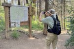
For me … to be back on a forest trail. And to be hiking again with Jay.
Jay here: Was great to be back in the woods….about 5 years since we were on this trail. Had to hustle at the end to beat a thunder shower.
Statistics
Total Distance: 3.4 miles
Elevation: start 8,880 ft, maximum 8,892 ft, minimum 8,490 ft
Gross gain: 402 ft. Aggregate ascending 1,054 ft, descending 1,056 ft
Maximum slope: 40% ascending, 36% descending, 10% average
Duration: 2:26, Average Speed: 1.4 mph
| GPS Track Files for Download | |
79 Downloads |
|
|---|---|
55 Downloads |
|
| Link to GAIA GPS: “Borrrego Trail Hike” | |
| If you haven’t explored these hiking tracks with Google Earth, give it a try. With the virtual 3-dimensional presentation, achieved by panning and tilting the view, you can get good idea of the hike and the terrain. For some ideas, check out Using Google Earth Track Files. | |
Related Posts
Bear Wallow-Winsor-Borrega Trails Hike – 06/02/2019
Borrego-Winsor-Bear Wallow Hike – 7/29/2018
Posts for Trails on Hyde Park Road
References and Resources
AllTrails: Borrego Trail
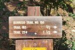
Borrego (150), Windsor (254) and Bear Wallow (182) Trail Loop
Hiking Project: Borrego Trail
Santa Fe New Mexican: Happy Trails: Borrego Trail offers a mixture of history, rough-edged beauty
Photos
Views to date: 137 views.


