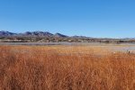
‘Tis our first visit to Bosque del Apache, heading south as colder temperatures conspire against hiking north of Albuquerque or in the mountains.
The Drive In
Drive south on I-25, through Socorro, exit for San Antonio (Exit 139). Continue east through “downtown” San Antonio, turn right, south on old US Hwy 85. The Visitors Center for Bosque del Apachie is 8 miles down the road (closed when visited due to Covid-19). The entrance is a quarter of a mile further south from the visitors center.
The Hike
We started with a drive through the north half of the Preserve. The roadway is very wide, clearly to make the driving tour comfortable while one takes in the views. There are a few stopping places with viewing stands offering a good vantage point to look for wildlife. we stopped at a couple of the viewing stands to look out across the marshes. Each time we heard the sounds of sandhill cranes as they come and go in large v-shaped  formations to feeding grounds (as far north as Albuquerque). Often we were unable to locate them in the large blue sky above because of the etheral sound of their call.
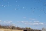
When we got to the northwest corner of the preserve we came across a very large flock of snow geese sitting out in the grain field. We stopped to watch their activity – each 15-20 minutes while we were there the whole flock took flight, circled around the area, and returned to land in a new location – quite a scene.
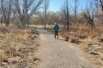
To get in a bit of hiking. we set out on the Rio Viejo Trail.  This trail, well groomed with gravel end-to-end, passed through open bosque. Finishing the hike,
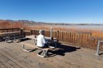
  we returned to one of the overlooks of the marsh to have lunch.
Statistics (of the hike)
Total Distance: 1.76 miles
Elevation: start 4,512 ft, maximum 4,512 ft, minimum 4,503 ft
Gross gain: 9 ft. Aggregate ascending 10 ft, descending 10 ft
Maximum slope: 2% ascending, 1% descending, 0.2 % average
Duration: 0:51
| GPS Track Files for Download | |
122 Downloads |
|
|---|---|
345 Downloads |
|
197 Downloads |
|
305 Downloads |
|
I urge you to explore our hiking tracks with Google Earth. With the virtual 3-dimensional presentation, achieved by panning and tilting the view, you can get a much better idea of the hikes and terrain than you can get from the 2-dimensional screenshot above. For assistance: Using Google Earth Track Files.
References and Resources
US Fish & Wildlife Service: Bosque del Apache
New Mexico True: Bosque del Apache national Wildlife Refuge
AllTrails: Rio Viejo Trail
Friends of Bosque del Apache National Wildlife Refuge
DesertUSA: Bosque del Apache
Wikipedia: Bosque del Apache national Wildlife Refuge
Facebook: Bosque del Apache National Wildlife Refuge


