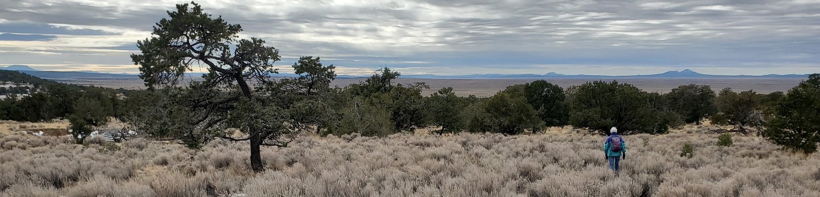
This time of year, we avoid going north, into the Jemez, Sangre de Cristo, or other mountains – it is winter – cold, likely snowy, etc. Going west is better ‘tho it can be cold because places thereabouts are at a higher elevation. I had read about this hike some months ago (see References below) and thought it would be a good destination for our hike this week.
The Drive In
From Albuquerque, west on I-40 (68 miles), then south on NM 117 along the east edge of the Malpais. You will pass La Ventana (10 miles from I-40) then drive through the Narrows (there is a nice trail here, the Narrows Rim Trail that starts at the south end of the Narrows and goes north to a nice overlook of La Ventana). Continue on NM 117 for 16 miles, turn left onto Pie Town Road (also identified as Rd 41), a Class 3 road (New Mexico Pavement – graded and sanded). Another 3 miles, turn left onto Armijo Canyon Road, a Class 4 road. Park at the gate 1.5 miles from Pie Town Road, the boundary of the El Malpais National Conservation Area (NCA),.
The Hike
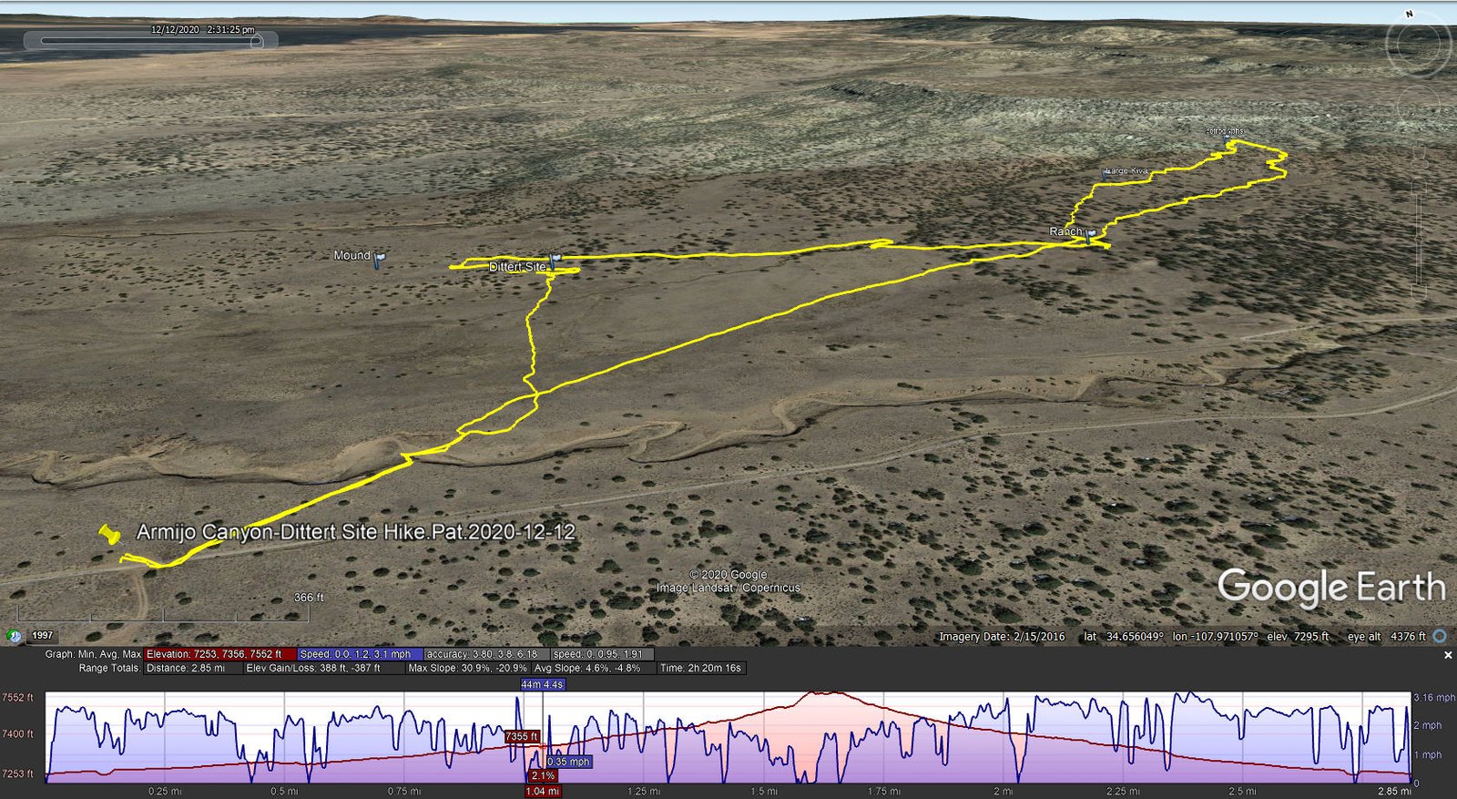
Armijo Canyon-Dittert Site Hike.Pat.2020-12-12
The Armijo Canyon Trail proceeds from the gate up the bottom of Armijo Canyon. We left the gate on a well-used trail, heading northeast on a well used trail; 125 yards on we were faced with a deep arroyo with the typical vertical sides. But from this trail we could enter the arroyo and … climb out the other side. Back on level ground, the trail we anticipated was nowhere to be found. But … I had downloaded the track from ASCHG to USTopo on my phone/GPS, so off we went towards the features of our interest.
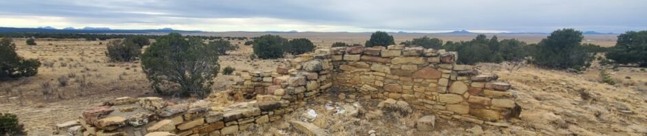
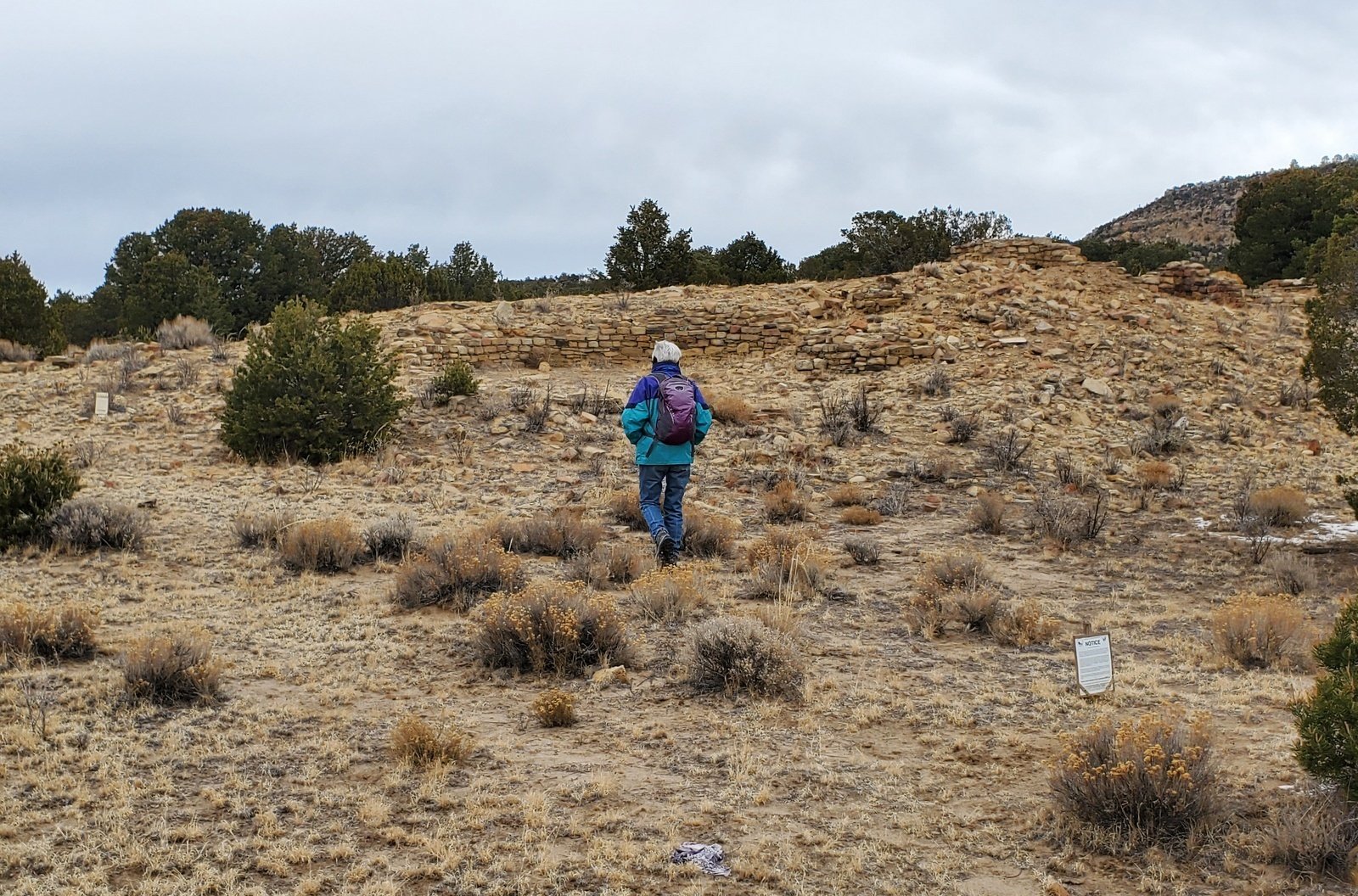 The surface was a bit challenging – tufts/mounds of grass interspersed with soft soil – a trail would be nice to have. Our first point of interest was the Dittert Site, ruins dating from the 1000-1200 era. Situated on a mound, well constructed rock walls have been excavated including a circular enclosure, presumably a kiva.
 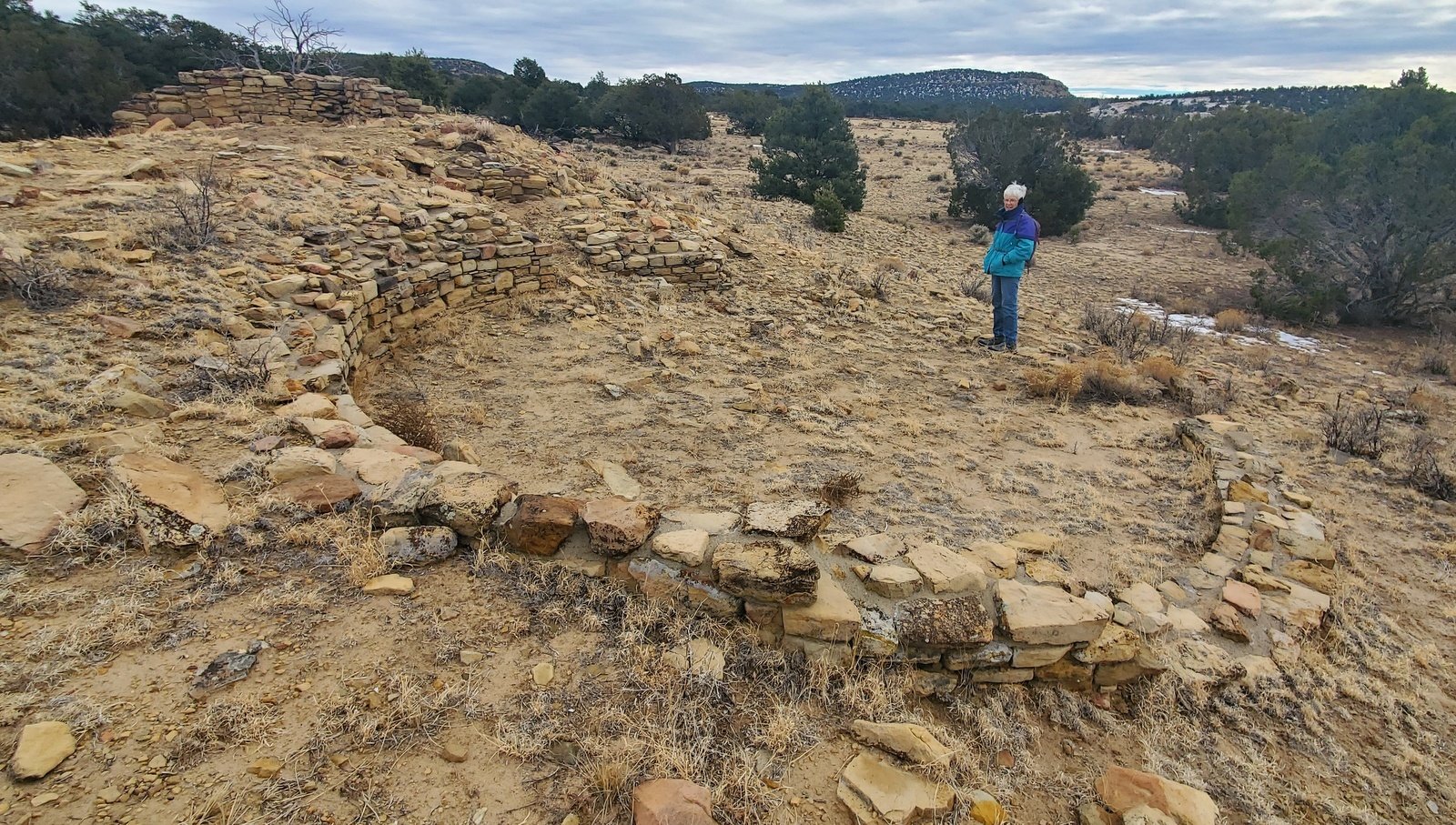 To the north of the exposed walls was more mound suggesting that only a small part of the ruins have been exposed. A few yards further to the northwest is another mound which would appear to be another ruins site.
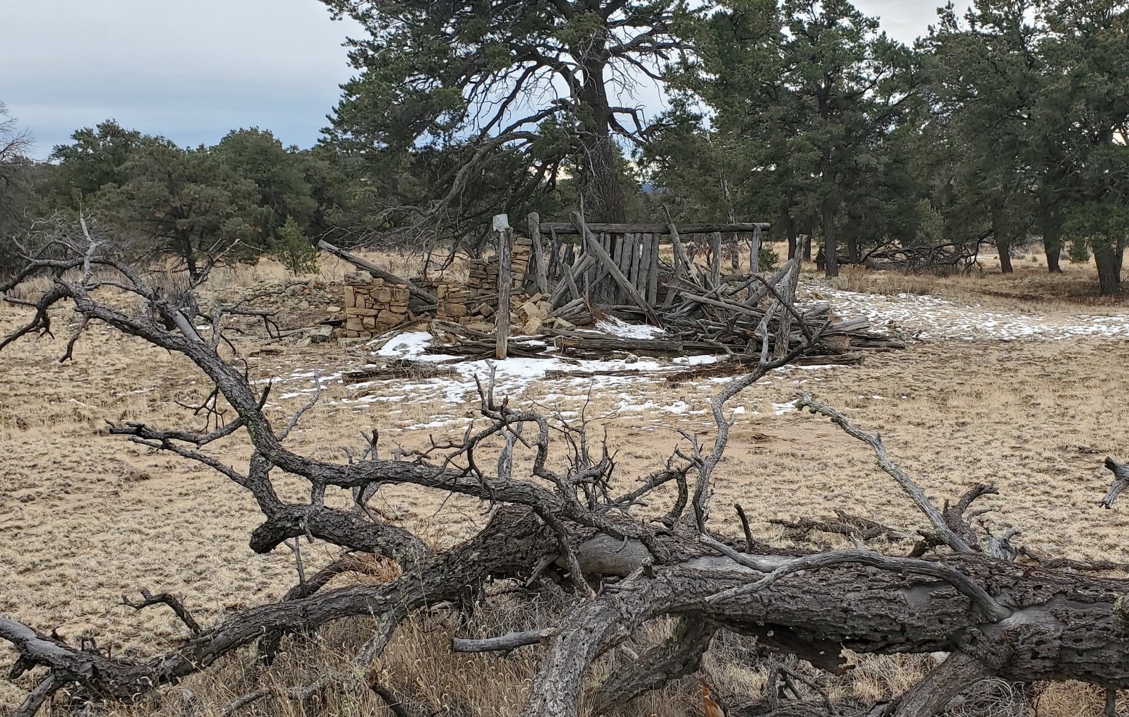 From there we set out on a heading of 95° for the remnants of a ranchstead. About 2/3 of the way there, we encountered another of those deep, steep sided arroyos. In this case, we found a cattle (or game) trail, an easy down and back up onto the other side. Soon we came upon signs of occupancy nearby – pieces of rusted metal, even a tin can. A short distance further along was a collapsed structure of poles (juniper tree trunks) and a rock walled room – it must be a building of the ranchstead along with what appeared to be a fireplace (notice
 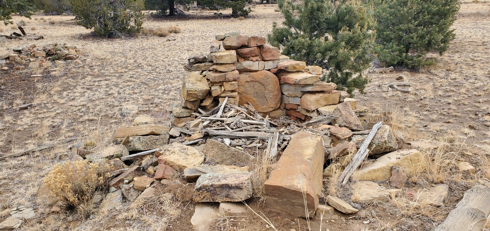 the large rock behind what must have been the hearth). Also interesting – there was a prominent mound adjacent to the building, suggesting that this might be another site of ancient ruins.
From the ranchstead, we struck out for “Igor”, a name given to the site of petroglyphs. From this point we had a gradual climb for the half mile to the rock outcrops identified on the ASCHG track as the site of Igor. About half way along, we paused to look at the large kiva, a depression in the terrain some 30 feet in diameter.
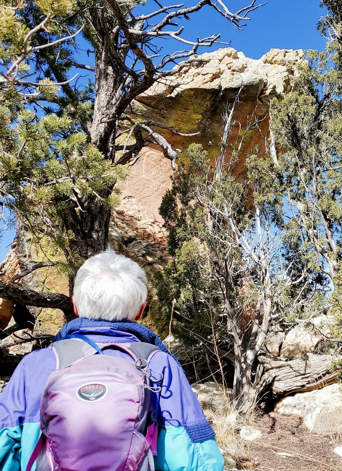
Approaching a rock outcrop that forms the end of a ridge, we started looking for signs of Igor. From the base of a steep, rocky incline, our first take was an image that looked like a face. On further inspection, it was … only lichen on the rock face. Continuing to work our way around the rocks, we spotted .. Igor.
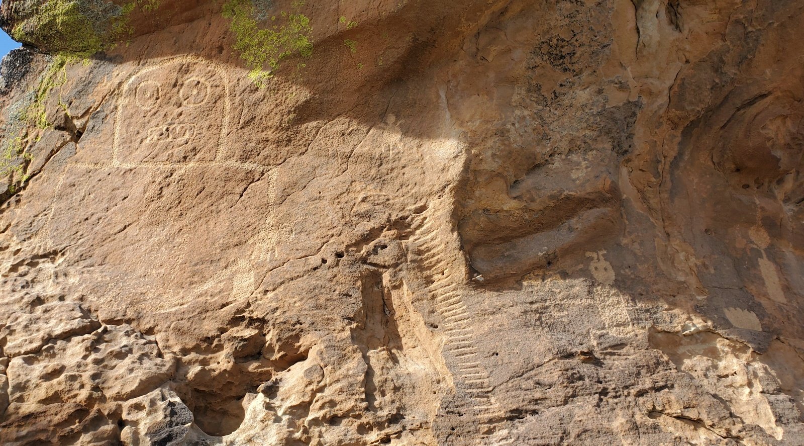 Climbing closer to the rock we found that there are other petroglyphs, some quite clear, others a bit washed out.
The weather, tho’ sunny, was a bit chilly with a light breeze blowing. Failing to find a spot out of the breeze and in sunshine for a warm spot to have our lunch, we headed back to the truck where we enjoyed hot drinks and our PB&J lunch.
Heading home, as we reached the intersection with Pie Town Road we decided .. let’s take the longer way home – to Pie Town, then to Socorro and I-25 ( and avoid the heavy truck traffic on I-40). Pie Town Road is a Class 3 (in some places 3.5 – it would be soft when wet) and passes through 3 or 4 ranches and 2 or 3 residential developments. The latter are very remote from anything, a different place to live.
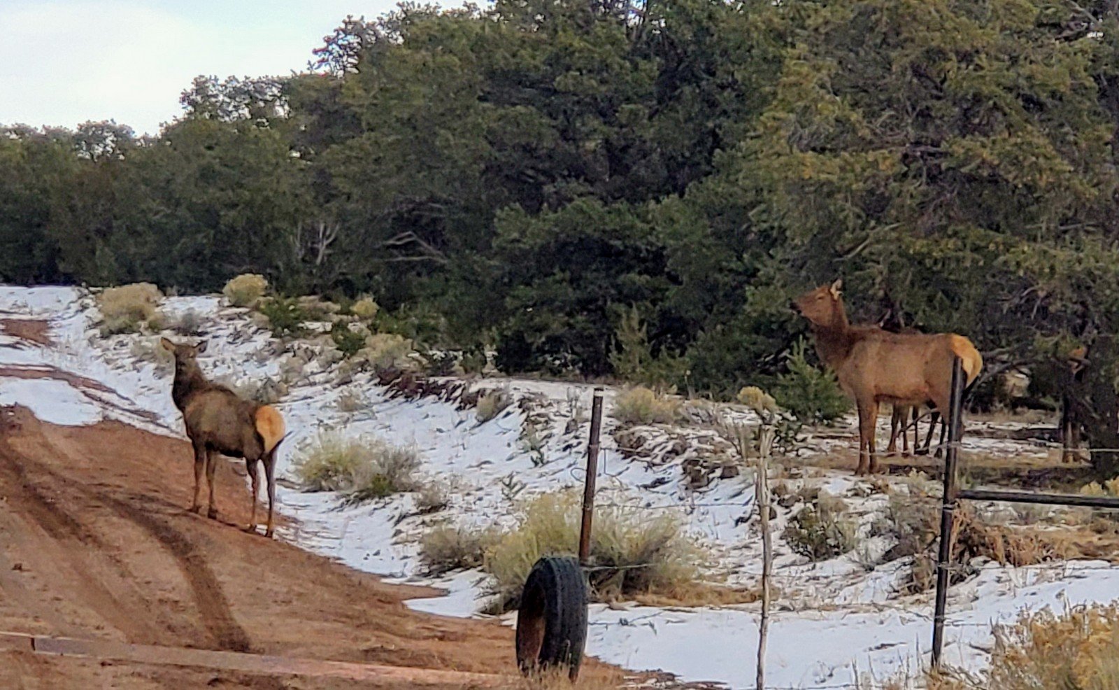
As we approached US 60, we encountered a small heard of elk – the first we’ve seen up close as they crossed the road in front of us. A great treat to end our visit to these parts. Then it was eastbound on US 60, through Pie Town (didn’t stop for a pie), across the Plains of San Agustin and the VLA (Very Large Array).
Statistics
Total Distance: 2.85 miles
Elevation: start 7,257 ft, maximum 7,552 ft, minimum 7,253 ft
Gross gain: 299 ft. Aggregate ascending 388 ft, descending 387 ft
Maximum slope: 31% ascending, 21% descending, 4.7% average
Duration: 2:20
| GPS Track Files for Download | |
355 Downloads | |
|---|---|
267 Downloads | |
349 Downloads | |
236 Downloads | |
I urge you to explore our hiking tracks with Google Earth. With the virtual 3-dimensional presentation, achieved by panning and tilting the view, you can get a much better idea of the hikes and terrain than you can get from the 2-dimensional screenshot above. For assistance: Using Google Earth Track Files.
References and Resources
ASCHG: Armijo Canyon – El Malpais Hike
Cargo Van Conversions: Dittert Site
BLM: National Conservation Area
The Dittert Site (PDF)
National Geographic Four Corners Region: The Dittert Archaeological Site:
Archaeology Southwest: Dittert Site
Previous Hikes
El Malpais – Narrows Rim Hike – 03/26/2014


Thank you for the map. We really enjoyed the hike.