
This was our first chance to hike on our trip through Colorado. On our way from Arvada to Central City, we drove to Boulder, then Nederland, then north to Ward and Brainard Lake, looking for high elevation (cool) and maybe some wildlife. We parked in the lot adjacent to the Pawnee Campground, then set out going first down the road around Brainard Lake.
The Hike
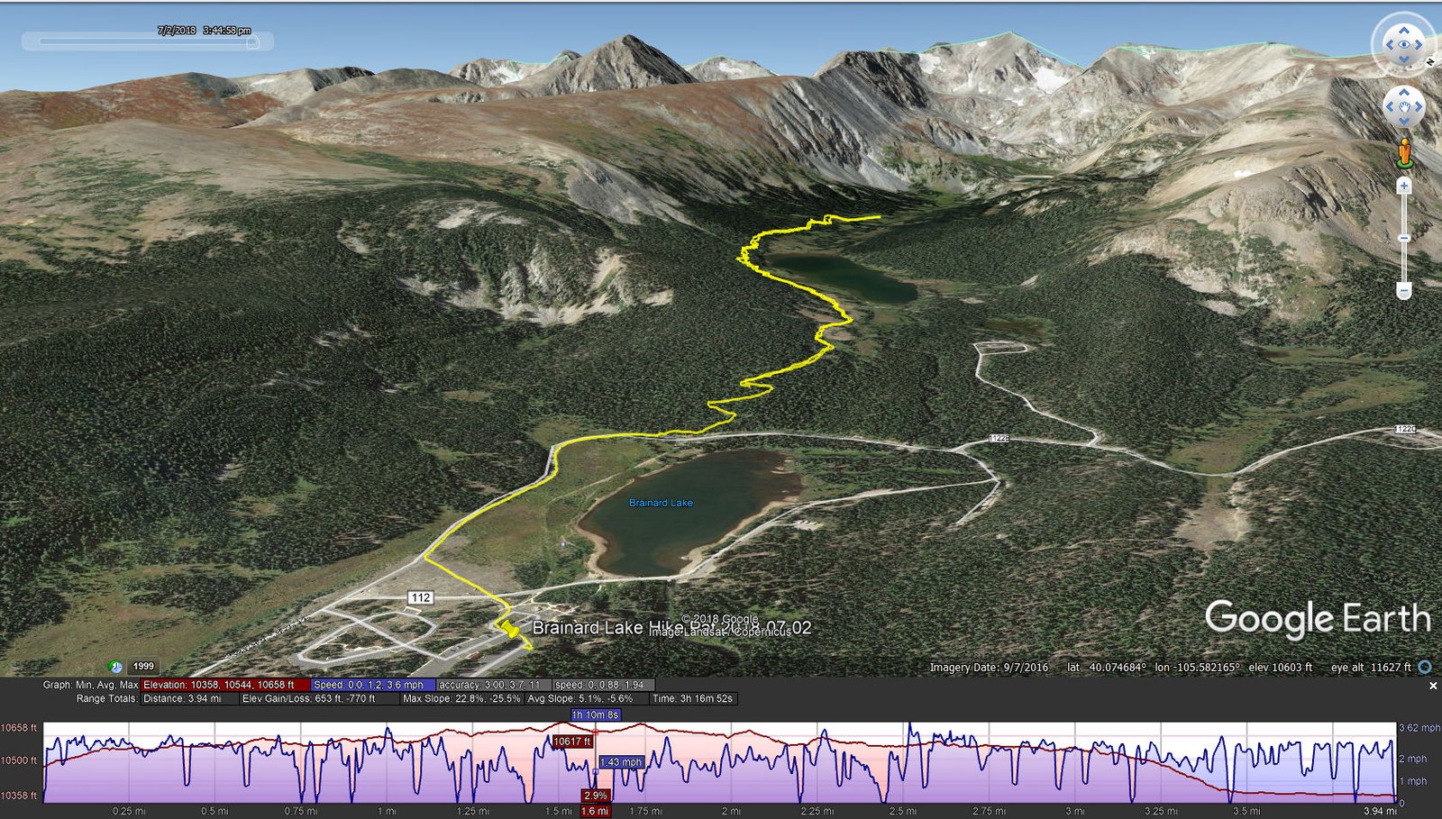
Brainard Lake Hike.Pat.2018-07-02
From there, we hit the Niwot Cutoff Trail #907.2, proceeding on the Jean Lenning Trail #807.1 that passes along the south shore of Long Lake. We hoped to make a loop, returning on Pawnee Pass Trail #907, but crossing St Vrain Creek required going through a very marshy area. So we returned by the same route. The trails are well used, easy to hike on, and provided great views of Long Lake and the surrounding mountains including Apache Peak at 13,442 feet.
Statistics
Total Distance: 4.63 miles (started GPS tracking .69 miles late)
Elevation: start 10,358 ft, maximum 10,658 ft, minimum 10,358 ft
Gross gain: 300 ft. Aggregate ascending 653 ft, descending 770 ft
Maximum slope: 23% ascending, 26% descending, 5% average
Duration: 3:39 (3:17 from GPS track plus 22 min before GPS track was started)
| GPS Track Files for Download | |
305 Downloads | |
|---|---|
149 Downloads | |
I urge you to explore our hiking tracks with Google Earth. With the virtual 3-dimensional presentation, achieved by panning and tilting the view, you can get a much better idea of the hikes and terrain than you can get from the 2-dimensional screenshot above. For assistance: Using Google Earth Track Files.
References
USDA Forest Service: Brainard Lake Recreation Area
AllTrails: Isabelle Glacier Trail (up to a point abreast Long Lake)
Rocky Mountain Hiking Trails: Long Lake Loop (Jean Lunning Loop)