‘Tis summer, and the Jemez Mountains offer temperatures that are not so high as elsewhere near Albuquerque. So we’ve returned again to the area of other recent hikes, Oat-Hay Canyon and Barley Canyon, to another of the numerous canyons above Fenton Lake and the Fish Hatchery.
The Drive In
To get there, continue on NM 126 past the Hatchery about a mile, park on the right where Calaveras Canyon goes northeast; large rocks now block access to a 2-track that goes up the canyon.
The Hike
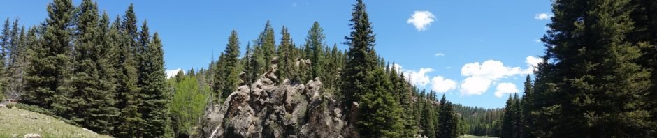
Calaveras Canyon.Jay.2017-05-28
A bit tight at the beginning, the canyon opens up to a wide bottom, mostly like a meadow. About a quarter of a mile up the canyon we found numerous sampling holes and other instrumentation which we presume is used to assess conditions arising from a spring; there was some water flowing which appears to be captured in a pipe near the road. Check SmugMug in the references below for more great photos of features and findings in Calaveras Canyon.
Our hike continued up the canyon with a nice wide, grass covered bottom with steep rock wall on the left and a steep slope to the ridge on the right. About 1.7 miles up the canyon we chose to take a side canyon to the left to see what was up there – it was much like the the main canyon ‘tho a bit narrower. Now 2.3 miles into the hike we stopped for our mid-hike break.
We returned to the main canyon, and thinking we might find circumstances that would permit a loop, we proceeded further up the main canyon looking for a place where we could make reasonable ascent up the left wall. We didn’t find anything promising enough to -plan- a revisit, but on GoogleEarth this area does hold promise for exploring further on our own, i.e. without reference to others who have posted their hikes (thanks ASCHG for getting us this far).
Jay here: I’m not sure if it says something about me or it’s just fate, but on many such hikes as this I run into detritus of the dead kind. In this instance it appeared to be the skull and jaw of perhaps a young calf. There was also a spine (not pictured) that would seem to fit with our supposition.
Statistics
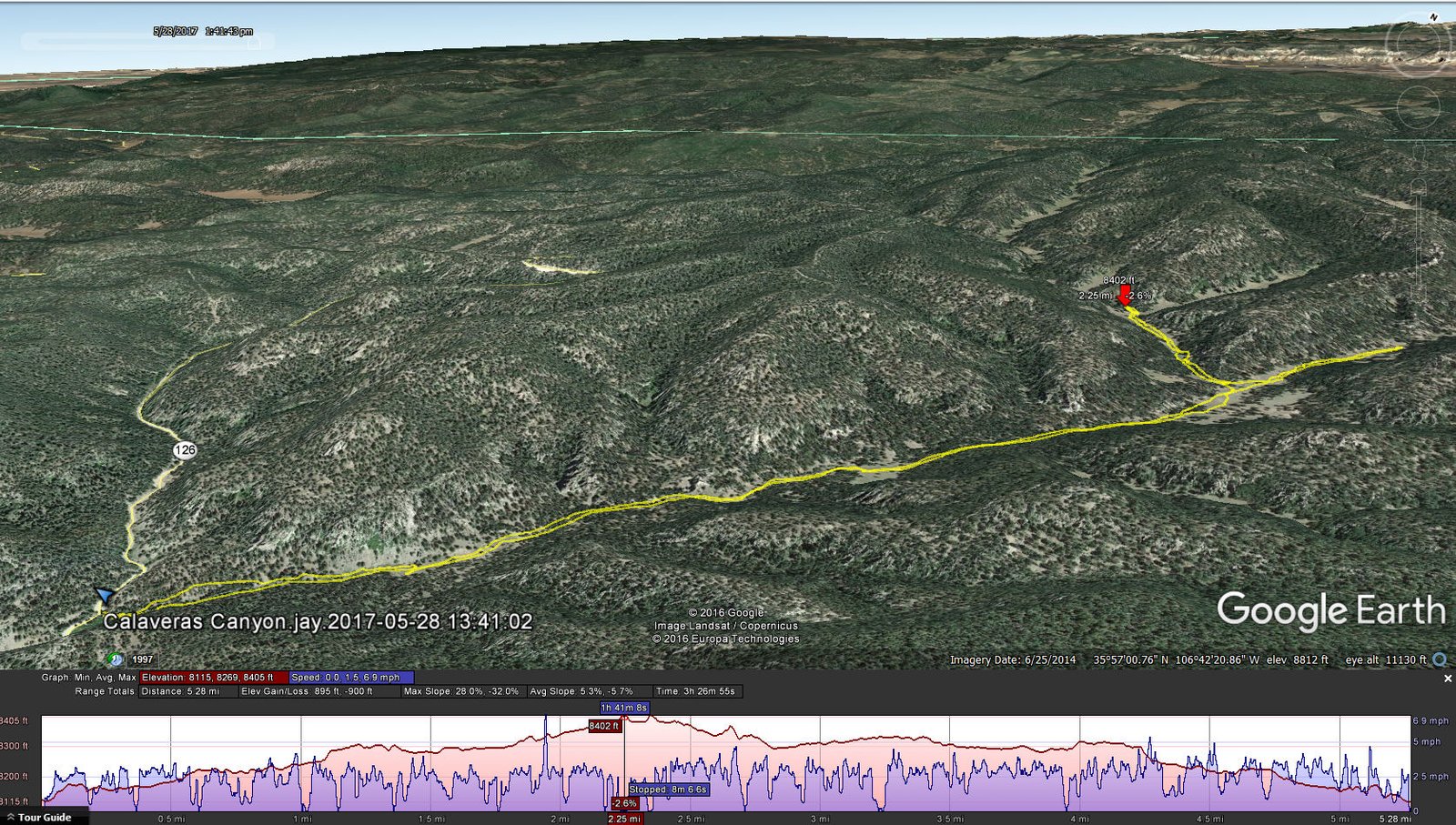
Total Distance: 5.28 miles
Elevation: start 8,115 ft, maximum 8,405 ft, minimum 8,115ft
Gross gain: 390 ft. Aggregate ascending 895 ft, descending 900 ft
Maximum slope: 28% ascending, 32% descending, 5% average
Duration: 3:27
| GPS Track Files for Download | |
349 Downloads | |
|---|---|
217 Downloads | |
I urge you to explore our hiking tracks with Google Earth. With the virtual 3-dimensional presentation, achieved by panning and tilting the view, you can get a much better idea of the hikes and terrain than you can get from the 2-dimensional screenshot above. For assistance: Using Google Earth Track Files.
References
ASCHG: Calaveras Canyon – Big Side Canyon Hike
Dog of the Desert: Calaveras Canyon in the Jemez Mountains
SmugMug: Jemez Mtns: Calaveras Canyon Hike
AroundGuides: Calaveras Canyon (great interactive map of area features)


