In all the years that we’ve been hiking, we never checked out trails from the Doc Long and Cienega Canyon picnic areas near the base of the road to Sandia Crest. We’ve discovered them, and will be returning – to this trail and the others thereabouts.
The Drive In
As though you are going to Sandia Crest – from the turn off of NM 14 onto Sandia Crest Road, in 1.7 miles turn left into the entrance to Doc Long & Cienega Canyon Picnic Grounds. Turn left immediately on Cienega Canyon Picnic Ground road; park at the end. (Names courtesy GAIA.)
The Hike
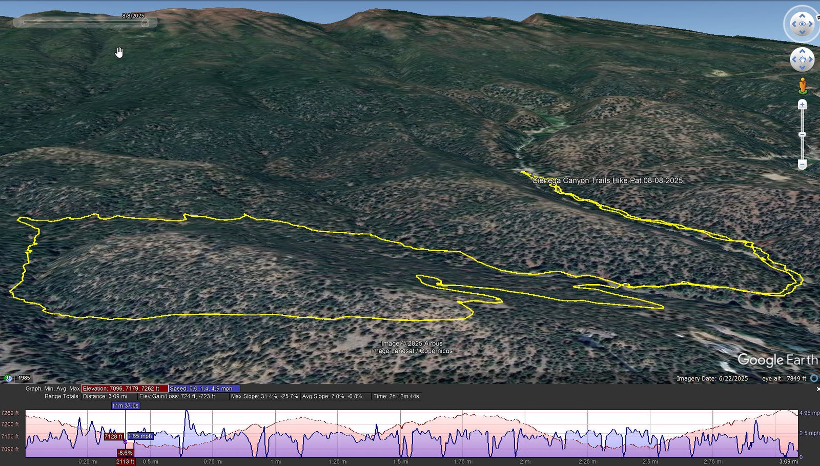
Cienega Canyon Trails Hike.Pat.08-08-2025
Notes about the Google Earth screenshot: the graph at the bottom shows elevation of the track (pink area) and speed (the blue line).
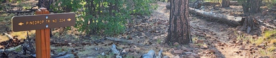
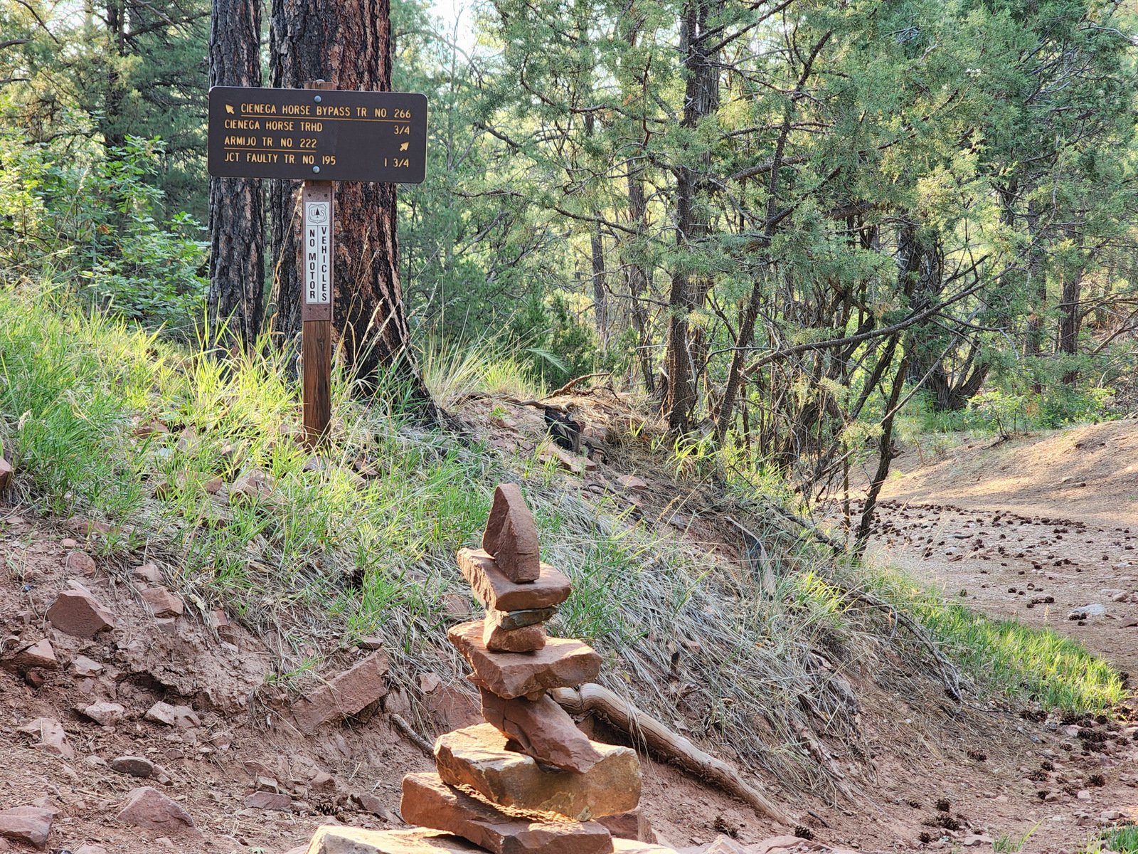
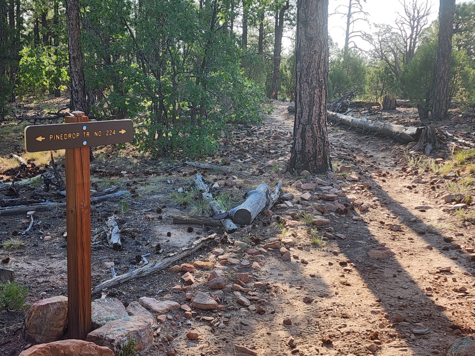
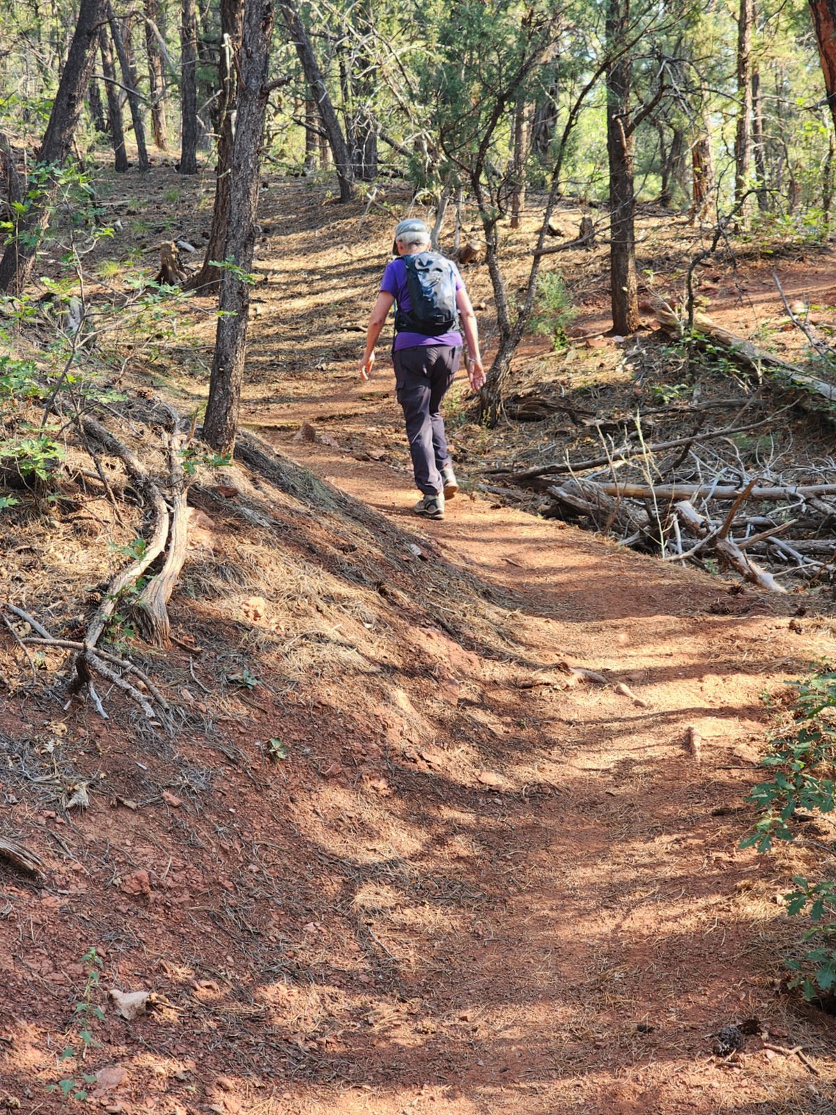
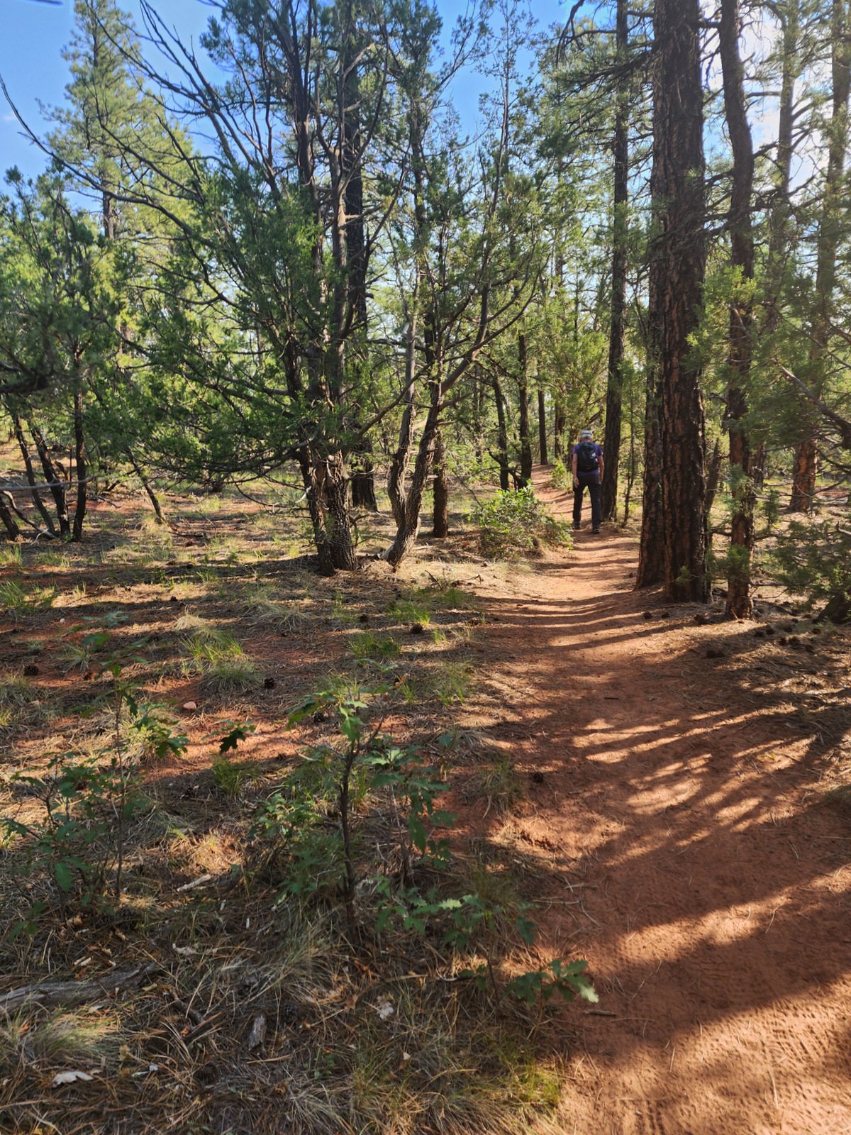
 A very nice, easy set of trails through a juniper/ponderosa forest (with a few oaks, too). The first trail, Acequia Trail (227), runs parallel to the left of a closed road (Armijo Trail Access Road) for half a mile, to a turnabout. From there we hiked for a quarter mile on the Armijo Trail (222), then turned left onto the Valle Trail. Next, .3 miles later, we turned left again onto the Pine Drop Trail (224). It was then 3/4 mile to the point where Pine Drop Tee’d at the Armijo Trail (222). Turning right on Armijo, it was then 1.6 miles back to the Acequia Trail and half a mile to the trailhead. (All trail identification courtesy GAIA. Use this link to the hike in GAIA.)
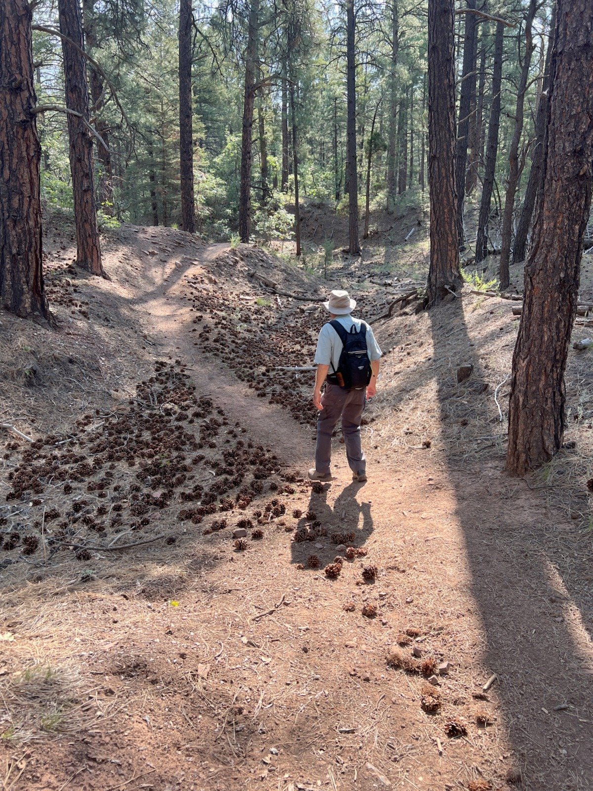
The trail is well used (hike, bike, horseback) and in very good condition – wide and mostly smooth (a few area a bit rocky). Elevation changes are small and gradual. The trail is in open shade except on top of the hill, the middle half of Pine Drop.
Highlight
This hike is part of a set of trails that offer great opportunities to alternatives, including loops rather than out-and-back hikes. We had set out to do a loop around the Un Poquito Trail (241), starting at the end of the Armijo Trail Access Road . But we found upon arrival that the Road is closed so the Acequia Trail was added to the hike. . around the Un Poquito Trail (241) – we did not realize we couldn’t drive to the end of the Armijo Trail Access Road and Acequia became part of our hike. But there were trails that cut across the ‘loop’; in fact we opted to not continue onto Un Poquito Trail (241) as planned, but continued on Pine Drop to Armijo.
Statistics
Total Distance: 3.09 miles
Elevation: start 7,239 ft, maximum 7,262 ft, minimum 7,096 ft
Gross gain: 166 ft. Aggregate ascending 724 ft, descending 723 ft
Maximum slope: 31% ascending, 26% descending, 6.9% average
Duration: 2:13, Average Speed: 1.4 mph, Shade: 90%
| GPS Track Files for Download | |
136 Downloads | |
|---|---|
111 Downloads | |
| Link to GAIA GPS: “Cienega Canyon Trails Hike” | |
| If you haven’t explored these hiking tracks with Google Earth, give it a try. With the virtual 3-dimensional presentation, achieved by panning and tilting the view, you can get good idea of the hike and the terrain. For some ideas, check out Using Google Earth Track Files. | |
Related Posts
Our first hike hereabouts.
References and Resources
AllTrails: Cienega Trail #148
. Sulphur and Cienega Canyon Loop
Dog of the Desert: Loop Hikes of the Doc Long-SulphurCanyon-CIenega Canyon Area
. Armijo Trail Loop in the Sandia Mountains
Forest Service: Cibola National Forest and National Grasslands Trails
Southern New Mexico Explorer: Sandia Mountains Wilderness Loop Hike
Photos
Views to date: 181 views.