With beautiful August weather, ‘tho hot in Albuquerque, we retreated to the Jemez Falls Campground for a couple of days to go hiking. We got the R-Pod set up in the early afternoon, leaving time to make a short hike on the Las Conchas Trail, more of a stroll in a beautiful setting (only .86 miles; see the Related Posts below for details of previous hikes on Las Conchas).
El Cajete has been on our ‘target list’ for some time, but the trails we’d found were longer than we wanted to tackle. Last week I came upon an article suggesting another, shorter path to get into El Cajete (‘bowl’ in Spanish).
The Drive In
For the Las Conchas “walkabout”, drive east on NM 4 from the entrance to the Jemez Falls Campground for 4.5 miles to the Las Conchas Trailhead. There is limited parking on the north side of the road – full when we arrived.
For the El Cajete hike, drive east on NM 4 from the entrance to the Jemez Falls Campground for .3 miles. At the bottom of the hill, where the East Fork Jemez River crosses NM 4, park alongside the road. (In spite of the No Parking signs, there are almost always cars parked here, some to collect obsidian just uphill, or to hike along the East Fork.)
The Hike
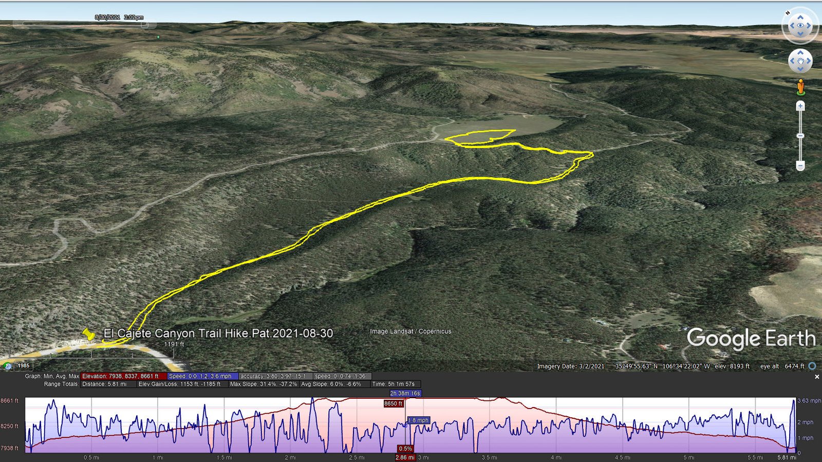
El Cajete Canyon Trail Hike.Pat.2021-08-30
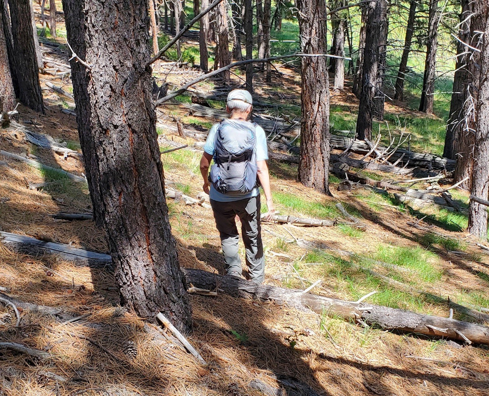
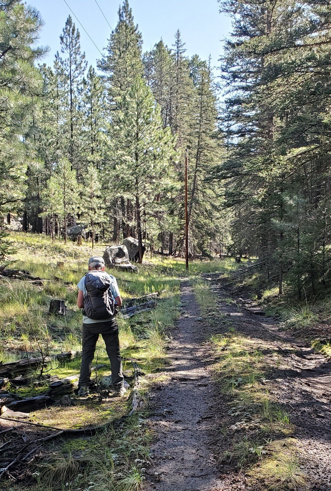 Crossing the road from where we parked, we found a driveway descending very steeply from the north side of the road into a small parking area – interesting we thought, maybe for a trail that proceeded up the East Fork Jemez River. But information we for this hike directed us up onto the ridge to the left of this driveway. We saw a two-track heading up through a barbed wire gate. So, up we went, finding ourselves on a nice, -old- two track. For some distance, the track was a bit rocky and steep, but soon changed to a gently sloping smooth two-track, overgrown with grass (courtesy, we suspect, of the this year’s recent and regular monsoon rains).
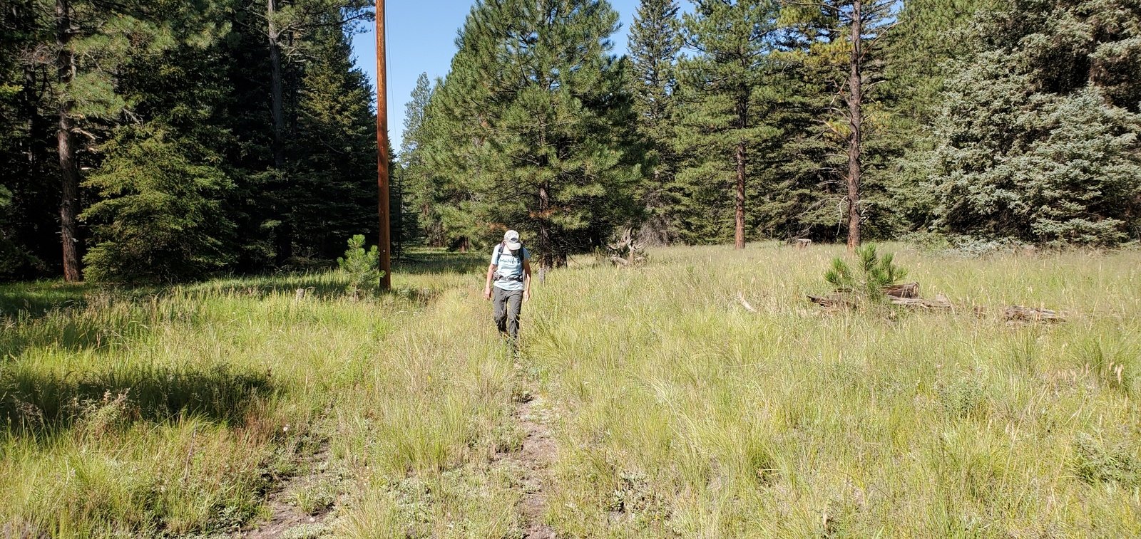 The trail proceeded up El Cajete Canyon on the old two-track which remained grass covered, into and out of forested areas. With the USTopo, following a sketch track I had created from the map that I found in El Cajete Three Ways, and indications on topo charts, we were on the lookout for that two-track. It proved easy to identify at 1.9 miles into the hike.
 From there it was a bit of a climb to get up on the ridge that overlooks El Cajete – 8,450 to 8,650 in half a mile. Up on the ridge the large flat meadow of El Cajete came into view. Rather than follow the two-track around, descending to the meadow itself, we “bushwhacked” down a moderately steep slope to the edge of the meadow.
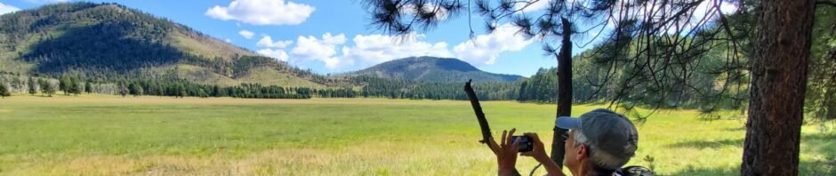
 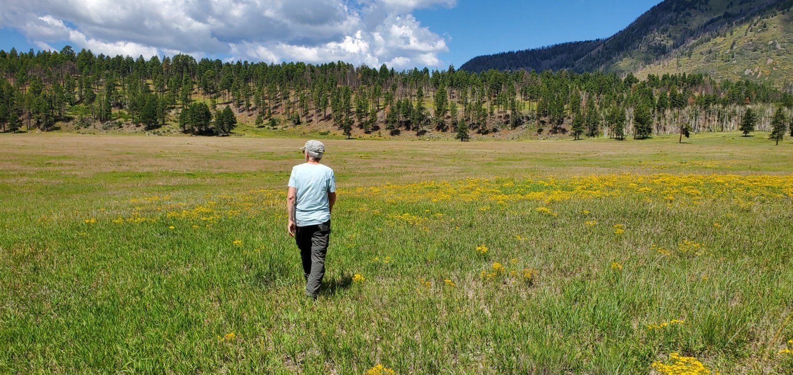 There we had a snack, then wandered out into El Cajete, enjoying the open space with green grasses with areas of yellow, flowering plants in their last days before dropping their seeds. And in the est end of El Cajete was a pond (‘tank’ in these parts) left over from years before the Preserve when huge herds of cattle grazed throughout Valles Caldera.
El Cajete measured up to what we anticipated – a beautiful, quiet, open space with mountains and forest all around. And the hike in, and out, was the pleasant. We’re looking forward to returning, maybe by way of one of the other approaches (there are 4 by my count: from the east via VC02, from the west across Banco Bonito, or from the west from Redondo Meadow, plus this one – El Cajete Canyon).
Statistics
Total Distance: 5.81 miles
Elevation: start 7,981 ft, maximum 8,666 ft, minimum 7,938 ft
Gross gain: 728 ft. Aggregate ascending 1,153 ft, descending 1,185 ft
Maximum slope: 31% ascending, 37% descending, 6.3% average
Duration: 5:02
| GPS Track Files for Download | |
174 Downloads | |
|---|---|
266 Downloads | |
167 Downloads | |
167 Downloads | |
If you haven’t explored these hiking tracks with Google Earth, I urge you to try it. With the virtual 3-dimensional presentation, achieved by panning and tilting the view, you can get a much better idea of the hikes and terrain than you can get from the screenshot above. For some ideas, check out Using Google Earth Track Files.
Las Conchas Trail Hike – 09/23/2020
Las Conchas Trail Hike – 07/27/2019
References and Resources
Prime Passages: El Cajete Three Ways
NPS Valles Caldera: Moderate Hikes – El Cajete
El Cajete Loop
AllTrails: El Cajete
Wanderlusting the Jemez: Wanderlusting El Cajete
Dog of the Desert: El Cajete via Redondo Meadows


