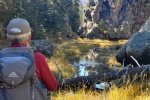
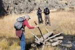
 This was our 2nd hike on a 3-night camping trip to Jemez Falls Campground. This hike is a favorite of ours in Valles Caldera. It is an easy hike in a wonderful setting, ideal for introducing people to the Caldera without having to drive a half hour or more to get into the Preserve’s back country.
The Drive In
The trailhead for this hike is halfway down the road from the entrance to the Valles Grande National Preserve. From the Jemez Falls Campground, drive east on NM 4 for 7.5 miles. Turn into the Preserve, drive .6 miles, park near the two-track on the left which has a cable across it.
The Hike
 The trail begins as a two-track up the hill. Cresting the hill, the Missing Cabin comes into view. The cabin was built for Ron Howard’s movie “The Missing” in 2003 (re: FineArtAmerica); it adds a nice touch to the beautiful vista view across the Caldera. (While atop this hill, we scanned the Caldera for a herd of elk which frequent the area. We didn’t see any at the start of our hike, but did pick out a dark area indicating a herd way out in the middle, some two miles away.)
Abreast of the Cabin, the trail heads off to the left (westerly) through knee-high grass. Descending into the East Fork River valley, 300 yards ahead the trail rounds a rock outcrop. In another 300 yards the trail comes abreast of the river and follows it for the remainder of the trail. In another 600 yards the trail crosses to the north side and continues .8 mile to a point where, to go further, one would need to wade between rock walls that go right up to the edge of the river.
On the way back out, the view out of the canyon, across the Caldera, is breath taking (the featured image above).
Highlight
 In a nutshell: The Views. Views of the Caldera, the forest, the cliff sides on both left and right, the burbling stream, the varied colors and textures of grasses and the autumn remains of summer flowers.
Statistics
Total Distance: 3.97 miles
Elevation: start 8,545 ft, maximum 8,592 ft, minimum 8,464 ft
Gross gain: 128 ft. Aggregate ascending 925 ft, descending 927 ft
Maximum slope: 44% ascending, 40% descending, 6.1% average
Duration: 3:02
| GPS Track Files for Download | |
131 Downloads |
|
|---|---|
157 Downloads |
|
If you haven’t explored these hiking tracks with Google Earth, I urge you to try it. With the virtual 3-dimensional presentation, achieved by panning and tilting the view, you can get a much better idea of the hikes and terrain than you can get from the screenshot above. For some ideas, check out Using Google Earth Track Files.
Related Posts
Hidden Valley Trail Hike – 10/14/2020
References and Resources
USDA National Park Service: Missing Cabin Trail
National Parks Traveler: … Setting Foot in Valles Caldera National Preserve
FineArtAmerica: … The Missing Cabin … (Description in notes)


